Charlton, Massachusetts
Top Spots in and near Charlton
-
Randolph, Massachusetts
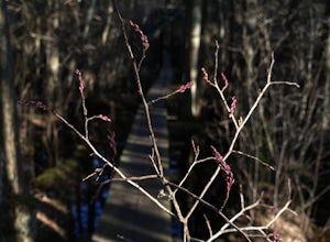
Hike the Ponkapoag Pond Trail
4.03.82 mi / 173 ft gainPark at the end of Ponkapoag Trail Road to access the trail. Dog friendly, open year round.Read more -
Milton, Massachusetts
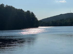
Houghton's Pond Recreation Area
1.2 mi / 79 ft gainHoughton's Pond Recreation Area is a loop trail that takes you by the lake located near Milton, Massachusetts.Read more -
Glastonbury, Connecticut
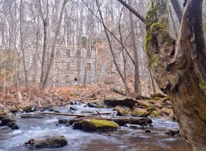
Hike the Cotton Hollow Nature Preserve
5.03 miThere are two parking locations for Cotton Hollow, the location tagged in the directions is the shortest hike to the old gun powder mill. Suggestions when it comes to exploring the preserve are to stay on the trails, know your limits, and enjoy! There are swimming holes along the river, but swim ...Read more -
Boston, Massachusetts
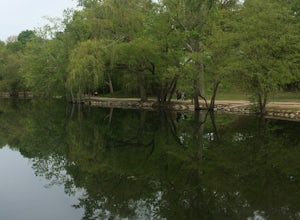
Run the Jamaica Pond and Victorian Jamaica Plain Loop
5.01.5 mi / 95 ft gainPark in the Jamaica Pond parking area. You can go either direction on this loop trail, which is highly trafficked and dog-friendly. Keep a lookout for (and a respectful distance from) the wildlife that live here. The loop around Jamaica Pond itself is 1.5 miles. The best part about running in thi...Read more -
North Stonington, Connecticut
Hike Narragansett Trail
4.010.7 mi / 1 ft gainNarragansett Trail is a 10.7 mile point-to-point hike that takes you by a lake located near North Stonington, Connecticut.Read more -
Simsbury, Connecticut
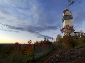
Hike to the Heublein Tower on Talcott Mountain
4.32.54 mi / 404 ft gainThe Heublien Tower Trail, located just inside the Talcott Mountain State Park entrance off of Route 185 in Simsbury CT, is a short 1.25 miles. While the hike isn't long, the first 1/3 of a mile is a steep incline that will get your heart pumping. The trail itself it very well kept, and although ...Read more -
Granby, Connecticut
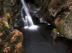
Hiking Enders Falls
4.0Enders State Forest sprawls over approximately 2000 acres, and is found within the towns of Granby and Barkhamsted in Connecticut. Enders has a good sized parking lot directly on Route 219. From the junction of Route 219 and Route 20, visitors will proceed west on Route 219 for 1.2 miles and tu...Read more -
Cambridge, Massachusetts
Bike or Run on the Charles River Path
5.010 miThe Charles River Path becomes a center of activity in Boston, especially during the summer, and you can run (or bike) it! It is a paved pathway that travels along both sides of the Charles River from the North End of the city to Allston and beyond. There are several bridges along the way with pe...Read more -
Medford, Massachusetts
Hike Southern Middlesex Fells Loop
4.73.5 mi / 756 ft gainPark in the parking area near Bellevue Pond. There are multiple entrances to the reservation (some closer to the reservoir itself than others). I have spent days in there hiking around and never seeing the water and there are days when I just hiked right in to the water and sat and enjoyed it. Th...Read more -
Quincy, Massachusetts
Hike The Skyline Trail at Blue Hills
4.012.7 mi / 2542 ft gainPark in the lot across from Batterymarch Rd off of Willard St. Access the Skyline trail from here, it is marked blue. Follow the signs. The trails in Blue Hills are perfect for training for backpacking because they are so steep and rocky. I would fill up a big pack and take the skyline trail up t...Read more -
Jaffrey, New Hampshire
Hike MT Monadnock via White Arrow Trail
4.3 mi / 1485 ft gainArriving at the Old Toll Road/Halfway House Trail head you will have $5 entrance fee. Starting on the Old Toll road you'll find yourself walking on a gradual incline into the beautiful New Hampshire wilderness. Everything you see and smell is fresh and vibrant. Following the road for 1.1 miles yo...Read more -
East Haddam, Connecticut
Explore Chapman Falls in Devil's Hopyard SP
4.0If you map to Chapman Falls in East Haddam, CT, you will be brought to a parking lot opposite from the waterfall in Devil's Hopyard, a beautiful Connecticut state park. Once there, it's only a few minute walk down a very clear trail to the base of the 60 foot falls. There's plenty of room to set ...Read more -
Boston, Massachusetts
Freedom Trail
4.72.9 mi / 121 ft gainPark along the trail and then hop on. The Freedom Trail allows you to not only see the most beautiful parts of Boston (which is an absolutely gorgeous city) but you can learn some history too! Head off the trail a bit to explore the Charles River, the waterfront near the aquarium and picturesque ...Read more -
Jaffrey, New Hampshire
Mount Monadnock via White Dot & White Cross Loop
4.53.7 mi / 1686 ft gainThe White Dot Trail is the shortest, steepest ascent to the summit, while White Cross has a slightly easier grade down with very little difference in distance. Therefore, per the park's rangers, the best way to conquer this loop is White Dot up, White Cross down.The White Dot Trail begins at Mon...Read more -
Jaffrey, New Hampshire
Mount Monadnock via White Dot Trail
4.43.46 mi / 1699 ft gainMonadnock State Park is located in and around the 3,165-ft. Mount Monadnock. Mount Monadnock is crisscrossed by many miles of well-maintained hiking trails. The popular White Dot Trail (2.2 miles) is the shortest but steepest ascent to the summit, accessible from the Monadnock State Park headquar...Read more -
Temple, New Hampshire
Hike the North & South Peaks of Pack Monadnock
5.08.3 mi / 2290 ft gainThis route will take you to both peaks and on most of the trails in this section of the park! Take the Wapack Trail (1.4 miles, rocky, challenging) to the summit of South Pack (2290') and climb the fire tower for some incredible views! On a clear day, you can see the Boston skyline. Then continue...Read more

