Sheffield, Massachusetts
Looking for the best hiking in Sheffield? We've got you covered with the top trails, trips, hiking, backpacking, camping and more around Sheffield. The detailed guides, photos, and reviews are all submitted by the Outbound community.
Top Hiking Spots in and near Sheffield
-
Elka Park, New York
Backpack the Eastern Half of Devil's Path in the Catskill Mountains
5.014 mi / 3900 ft gainThe Eastern half of Devil's Path has four major summits: Indian Head, Twin, Sugarloaf and Plateau. Each summit is a straight climb up and down, then back up to as much as 3,900 ft. There are some sparse sections of level ground, but most is a steep descent uphill or steep slide downhill. Your ...Read more -
Elka Park, New York
Backpack Devil's Path in the Catskills
24.2 mi / 9000 ft gainDevil's Path is roughly more than 24 miles long, althought it feels like an eternity of milage. Going thru the summits of Indian head, Twin, Sugarloaf, Plateau, Hunter, and Westkill Mountains.Its brutal. Its painful, Its unique. Be prepared for anything and everything. You will encounter wild lif...Read more -
Savoy, Massachusetts
Tannery Falls Loop
0.54 mi / 135 ft gainThe hike to Tannery Falls may be a little confusing, I'll clear it up for you before you even go there! To get to The falls you will travel down a dirt road that isn't very well maintained during the winter. As you keep driving down the dirt road you will notice a pond , which means you are almos...Read more -
Elka Park, New York
Camp at Sugarloaf Mountain in the Catskills
4.06 mi / 1500 ft gainBegin by parking at the end of Mink Road in Elka Park (GPS:N42 08.593, W74 09.479). It will be a .7 mile hike to camp. Follow the rocky woods road to the junction where there is a SPRING sign. Continuing straight will take you to the water source. If you do not need water, turn left when you see ...Read more -
Southington, Connecticut
Hike the Crescent Lake & Metacomet Trail Loop
4.02.4 mi / 269 ft gainThe hike to view Crescent Lake is peaceful. You can either walk through the woods where you will be blessed with natures finest birds and wildlife or you can take the trail along the lake edge. Both are similar distances and lead to the same hill at the end! Once you get to the top take a left on...Read more -
Woodstock, New York
Sugarloaf Mountain via Blue Trail
6.54 mi / 2297 ft gainSugarloaf Mountain, is one the 35 highest peaks in New York's Catskills at 3806 ft. There are many ways to approach this peak, and this is an out-and-back hike via Mink Hollow. The parking area is located at the end of Milk Hollow Rd (42.10405386879072, -74.17148500019927). From here, get on the...Read more -
New Fairfield, Connecticut
Hike Squantz Pond Trail
2.2 mi / 321 ft gainThe hike is rated as moderate and is accessible all year round. While it’s accessible during all seasons, the sights of the leaves changing colors in the autumn makes it an exceptionally beautiful time to do this hike. You’ll definitely want to snap some photos along the way of the foliage reflec...Read more -
Berlin, Connecticut
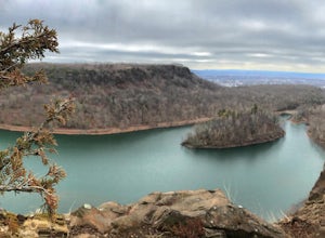
Hike the Ragged Mountain Memorial Preserve
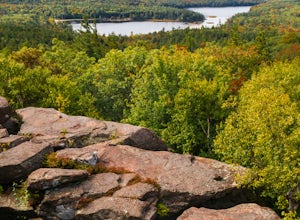
4.55.5 mi / 560 ft gainRagged Mountain main loop is approximately 5.5 miles long, and is known for its expansive bare-rock vistas, vertical cliff faces, and scenic views overlooking cliff-side reservoirs and ponds. The trail is rated moderate, with some flat stretches among the trees, mixed with some uneven rocky foot...Read more -
Windham, New York
Backpack the Catskill's Escarpment Trail
32.4 mi / 8000 ft gainThe Escarpment Trail runs the length of the Catskill Escarpment. The Escarpment rises steeply from the valley below forming the northeast corner of the Catskill Mountains. It offers great views toward the Adirondack Mountains to the north and the great Hudson River to the east. The trail is moder...Read more -
High Falls, New York
Scramble Bonticou Crag and Table Rocks
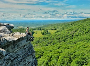
4.5This is not a hike for the inexperienced. There is a very steep rock scramble that has some dangerous section if you are not aware of your footing and positioning. For those up to the challenge, it is extremely rewarding at the top.To start, each person has to pay $12 to access the Monhonk Preser...Read more -
Deerfield, Massachusetts
South Sugarloaf Trail
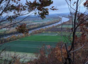
1.48 mi / 404 ft gainSouth Sugarloaf Trail is a loop trail that takes you by a river located near South Deerfield, Massachusetts.Read more -
High Falls, New York
Mohonk Mountain House Labyrinth and Lemon Squeeze Hike
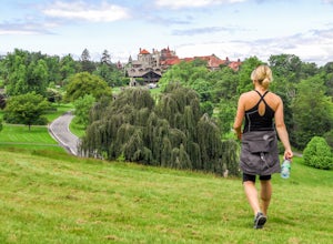
4.5Mohonk Mountain House is a historic resort located just outside the Catskills in the Hudson Valley just 90 miles north of New York City. With 85 miles of winding trails throughout the Mohonk Preserve, you'll have endless hiking options upon your arrival.Parking at the Gatehouse is limited, so be ...Read more -
New Paltz, New York
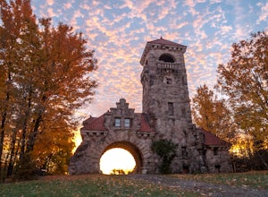
Hike Mohonk Preserve's Gatehouse to Skytop Tower
5.09 mi / 1268 ft gainBegin at the intersection of Gatehouse Rd and Mohonk Private Rd. There is a small shoulder to park on here. Begin hiking into the preserve along the gatehouse road. There will be signs stating you need a membership or pass to enter. Don't worry about these, there will be a place on the trail ...Read more -
Voorheesville, New York
Hike the Keleher Preserve Loop
2.03 mi / 1636 ft gainThe historic preserve is operated by the Mohawk Hudson Land Conservancy, so trails are clearly marked and extremely well maintained. There are features of the original farm that the land was used for from the 18th Century, including hand-thrown stone walls and an old logging road that cuts throug...Read more -
Meriden, Connecticut
Hike the Metacomet, Blue, and Yellow Loop
5.04.5 mi / 976 ft gainStart from the Castle Craig road entrance. Walk until you're greeted by a beautiful reservoir. You'll notice the strange but beautiful Mine Island in the middle of all this. You'll also notice markers for White Trails and Yellow Trails. The White Trail is an easier/wider trail. The Yellow Trail C...Read more -
Cropseyville, New York
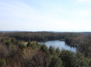
Hike Dickinson Hill Fire Tower
4.53 mi / 200 ft gainOnce you drive onto N. Long Pond Road you will follow it appproximately 1.5 miles to the end. From the parking you can take the short walk back on the road to the start of the trail. The trail is actually a rough Fire Tower Road. You will follow this for about 1.3 miles. Here you will see a se...Read more

