Michigan
Top Spots in and near Michigan
-
Munising, Michigan
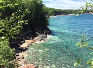
Grand Island Loop
20.63 mi / 1309 ft gainLocated in Munising, MI, Grand Island National Recreation Area is a part of the Hiawatha National Forest. While this section of the Upper Peninsula is known for Pictured Rocks National Park, many people fail to see or check out Grand Island. Secluded by ferry access, the island features 12 backpa...Read more -
Island Lake Pathway, Michigan
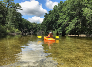
Paddle the Huron River in the Island Lake Recreation Area
Park at the Island Lake Picnic Grounds, also known as the Kent Lake parking lot. Look for a spot on the west end of the parking lot and carry your kayak down to the river – but don’t worry, they have installed a nice little kayak slide to assist you as you walk down the river bank! Simply, plac...Read more -
Honor, Michigan
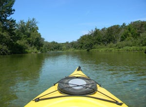
Paddle the Platte River
2.0Starting at Riverside Canoe Rentals (located near the intersection of M-22 and Lake Michigan Rd), or the small park across the river, this trip will take you roughly 3 hours to float, but shorter if you are paddling. But beware, starting here will require you to cross a small lake - not very dif...Read more -
Ann Arbor, Michigan
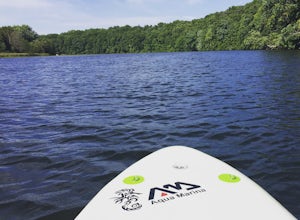
Paddle Argo Pond
You can launch from many points along Argo Pond (which is the name of this dammed portion of the Huron River), but the most abundant parking is located at Argo Park, Bandemer Park, or Huron Bridge Park. This is a popular place for paddleboarders, kayakers, canoers, and rafters during the summer. ...Read more -
Shingleton, Michigan
Mosquito Falls
2.15 mi / 184 ft gainWhen you want to pack the backpack for a short day hike in the Pictured Rocks, look no further than hiking to Mosquito Falls! Start at the Chapel Basin parking lot at the far northwest corner (if you see signs for Chapel Rock, you picked the wrong trail!), and you will be gifted with a great hi...Read more -
Seney, Michigan
Sable Falls
5.00.4 mi / -100 ft gainLocated off of H-58, Sable Falls can be found about a mile north of the eastern terminus of Pictured Rocks and the Grand Sable Visitors Center. There is a large parking lot area for the falls, along with an entrance onto the North Country Trail, which runs along the falls. The hike is short, with...Read more -
Shingleton, Michigan
Chapel Falls & Mosquito Beach Loop Trail
9.67 mi / 1211 ft gainThe trip begins at the parking lot or trailhead 3 miles inland from Chapel Rock. The first three miles of the trail are pretty much flat and is a very easy hike. At the two-mile mark, you will see scenic overviews of Chapel Lake and Chapel Falls providing great photo opportunities. About 1/4 mile...Read more -
Bruce Crossing, Michigan
Hike to O Kun de Kun Falls
2.6 mi / -100 ft gainLocated roughly 8 miles north of Bruce Crossing on Highway 45, the O Kun de Kun Trailhead is a small turnoff located on the right side of the highway. The trailhead offers limited parking, but the trail is rarely busy. At the beginning the trail, hikers can see the blue blazes of the North Countr...Read more -
Shingleton, Michigan
Mosquito Beach Loop
4.54 mi / 413 ft gainStart at the Chapel Basin parking lot at the far northwest corner (if you see signs for Chapel Rock, you picked the wrong trail!), and you will be gifted with a great hike downhill at first. The trail will split and you will have to choose to go the falls route or the direct route. I would sugges...Read more -
Houghton Township, Michigan
Backpack Rock Harbor to Lane Cove
7 mi / 500 ft gainIf coming from Michigan, take the ferry to Isle Royale from Copper Harbor. After a three-hour journey you will arrive at the park via the dock in Rock Harbor around lunchtime. After registering at the park office you can set off on a great 7-mile hike to Lane Cove, which is well marked. This hike...Read more -
Munising, Michigan
Tannery Falls
0.37 mi / 112 ft gainLocated right off of County Highway 58 across from Sand Point Road, Tannery Falls doesn't see the larger advertising that many other falls see in the area, but is a hidden gem within the town. At the start of the hike, you'll need to find a parking spot off of the highway, you might run into tick...Read more -
Eagle Harbor Township, Michigan
Backpack Windigo to South Lake Desor, Isle Royale NP
11.3 mi / 1400 ft gainThis guide assumes that hikers have already made their journey by either float plane or charter ship to the Windigo Port on the West end of the island of Isle Royale National Park.As mentioned above, this section hike of the Greenstone Ridge Trail partitions off one of the NUMEROUS options one ca...Read more -
Leland Township, Michigan
Paddle Board Lake Michigan from Leland Harbor
5.0For a day on the water, off the shores of Lake Michigan head to Leland. Park in the marina and load onto your paddle boards from the boat ramp. You'll quickly find your way out of the marina, in which you can head right, left or to open water. Either way you'll find accessible beaches and clear s...Read more -
Traverse City, Michigan
Hike Old Mission Peninsula Park
6 mi / 183 ft gainAt the end of the Old Mission peninsula sits Mission Point Lighthouse. The lighthouse is surrounded by 5 acres of wooded township and many acres of state land! Upon arriving you can explore the shores just below the lighthouse - there can intriguing iceberg islands forming at the edge of the wate...Read more -
Ironwood, Michigan
Hike to Superior Falls
4.00.5 mi / -100 ft gainSuperior Falls sits right next to the Superior River, near the northern terminus of the Montreal River. The parking area for the falls is rather large, and there are porta-potties directly next to the parking area. To see the lower region of the falls, you can hike down to the base of the river,...Read more -
Marquette, Michigan
Hike to Morgan Creek Falls
5.03 miBegin your hike at the Noquemenon South Trailhead and follow the markings for the Morgan Creek Falls loop. You will immediately have to cross Hwy 553 to get to the main trail. From there, you have two options to reach the falls. The first and more scenic is the marked Noquemenon trail (look for b...Read more

