Zephyr Cove, Nevada
Top Spots in and near Zephyr Cove
-
South Lake Tahoe, California
Meiss and Round Lake via Tahoe Rim Trail
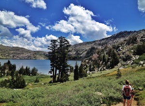
10.5 mi / 1257 ft gainMeiss and Round Lake via Tahoe Rim Trail is an out-and-back trail that takes you by a lake located near Kirkwood, California.Read more -
Alpine County, California
Hike to Round Top Peak
5.09 mi / 1821 ft gainThis hike begins at Carson Pass which is accessible from Highway 88. The trail leaves from the parking lot (parking requires a fee of $5) and is easy to follow. After about a mile, you'll pass Frog Lake on the left, which is a nice place to stop for a quick snack.Continue along the trail and stay...Read more -
Markleeville, California
Caples Lake to Emigrant Lake
5.08.71 mi / 971 ft gainThis is an awesome out-and-back hike for the weekend warrior. The trail begins at the western-most point of Caples Lake, and takes you to Emigrant Lake. The first 2/3 of the trail is rather flat and appropriate for all skill levels. The last mile up to the lake schleps up the hill, and has some ...Read more -
Alpine County, California
Hike Round Top Summit and Winnemucca Lake Loop
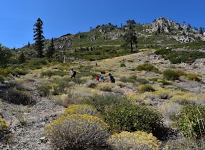
6.6 mi / 1272 ft gainThis hike begins near the Woods Lake campground. Start off by hiking towards Winnemucca Lake. You will begin your journey going through the forest beside a crystal-clear stream. Soon the trail opens up to become more open, full of all colours of wild flowers. You follow this breathtaking trail up...Read more -
Markleeville, California
Snowmobile at Hope Valley Sno-Park
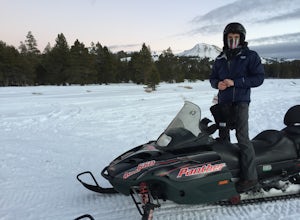
Book a snowmobile trip through a local adventure center (we love Lake Tahoe Adventures) or bring your own gear. Don't forget to grab permits ahead of time if you come on your own (more info here.) Drive (from anywhere) to Highway 88 and the snow park entrance is on the south side of the highway. ...Read more -
Alpine County, California
Hike The Sisters in the Mokelumnee Wilderness
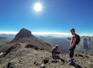
8 mi / 2500 ft gainThe Sisters offer a great day hike with fun scrambling and beautiful views of the Northern Sierra, Lake Tahoe, the Mokelumnee Wilderness, and the Carson River Canyon.The trail to The Sisters begins at Woods Lake (38.6855° N, 120.0095° W), at the end of Woods Lake Road off Highway 88, 1.5 miles we...Read more -
Olympic Valley, California
Hike the Thunder Mountain Trail
5.03.2 mi / 2000 ft gainThe Thunder Mountain Trail is the perfect hike to explore the Squaw Valley Alpine Meadows. Squaw may be famed for its mountain ski runs in the winter, but when the snow melts in the summer, beautiful alpine meadows line the mountain and the ski runs turn into hiking trails! The Thunder Mountain T...Read more -
Washoe County, Nevada
Sledding Fun for the Whole Family
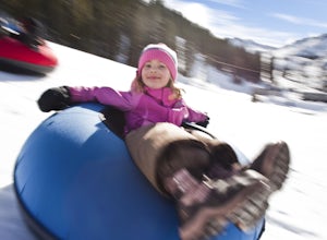
5.0You can't miss this spot in the open snowfields of Tahoe Meadows. This area is not privately owned or maintained, which is perfect. It is a short drive up the Mt. Rose Highway from Reno and Sparks and there is plenty of free parking (except on super-busy days) right next to the sledding slopes an...Read more -
Amador County, California
Hike to Thunder Mountain at Carson Pass
7 miThe trailhead begins on Rt 88 just past Kirkwood Resort or Silver Lake - depending on which way you are headed. There is plenty of parking but no other amenities. The trail begins at 7,900 ft and climbs steadily up Two Sentinels then along the ridge to Martins Point, ending at the 9,408ft summit ...Read more -
New Washoe City, Nevada
Chicadee Ridge
5.01.69 mi / 289 ft gainChicadee Ridge is an out-and-back trail where you may see beautiful wildflowers located near Incline Village-Crystal Bay, Nevada.Read more -
Olympic Valley, California
Hike the Shirley Canyon Cascades Trail
3.6 mi / 2109 ft gainThis trail has lots of elevation over a short distance, be warned! The Shirley Canyon Cascades Trail is close to Olympic Valley in the North Lake Tahoe region. Dogs are allowed on this trail if kept on leash.Read more -
Kyburz, California
Hike to Bassi Falls
4.61.22 mi / 194 ft gain109' tall Bassi Falls is located in the Crystal Basin area of the El Dorado National Forest. These gorgeous falls at peak Springtime flow crash over enormous boulders and the water sheets over huge, flat slabs of granite. It is located off a rural, pot-holed dirt road (high clearance vehicles re...Read more -
Reno, Nevada
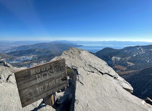
Mt. Rose Summit Loop
5.010.74 mi / 2392 ft gainThis challenging hike offers great views of the greater Tahoe area. The first part of the hike to the waterfall is relatively easy, but once you pass that, you'll be doing a decent climb to the summit. During the summer months, you'll want to get an early start as there can be a decent crowd head...Read more -
Truckee, California
The Five Lakes Hike
4.0The Five Lakes Trail is located in the Granite Chief Wilderness in between Alpine Meadows and Squaw Valley ski resorts and is easily accessible at the intersection of Alpine Meadows and Deer Park roads. The 5-mile moderate trail ascends approximately 900-1000 ft. along granite canyons and pine f...Read more -
Truckee, California
Ski Outer Outer Limits at Alpine Meadows
Starting off of Lakeview chair at Alpine Meadows, head to the far right towards the sign for Outer Limits run. Traverse across the run and past the Ski Area Boundary signs on the far side. Continue through the trees where you will find a series of clearings generally full of untracked powder. The...Read more -
New Washoe City, Nevada
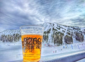
Ski or Snowboard Mt. Rose
5.0The Resort is located about 30 miles (50 km) south of Reno in the Carson Range. Mt. Rose is Tahoe's highest base elevation at about 8,260 ft (2,520 m) and the summit is 9,700 ft (3,000 m). The resort area is 1,200 acres (4.9 km2), and is located in the Toiyabe National Forest.See the resort map h...Read more

