Burnsville, North Carolina
Looking for the best hiking in Burnsville? We've got you covered with the top trails, trips, hiking, backpacking, camping and more around Burnsville. The detailed guides, photos, and reviews are all submitted by the Outbound community.
Top Hiking Spots in and near Burnsville
-
Old Fort, North Carolina
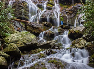
Catawba Falls
4.82.19 mi / 394 ft gainPlease note, Catawba Falls is temporarily closed. You can learn more about updates at www.fs.usda.gov. This quick and relatively easy hike is located close to Asheville, NC. If you're looking to have the trail to yourself, it can be a little tough. It's best to get there as early as possible or ...Read more -
Unicoi, Tennessee
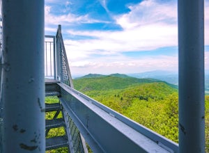
Pinnacle Mountain Fire Tower via Fire Tower Road
5.03.47 mi / 663 ft gainPinnacle Mountain hosts one of the nicest fire towers on the East Coast of the United States. The fire tower is relatively new, sturdy, and has a large 360 degree viewing area at the top. The tower overlooks the Downtown Johnson City area, Elizabethton, Erwin, and the rest of the Buffalo Mountain...Read more -
Newland, North Carolina
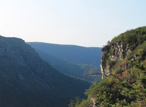
Hike the Conley Cove Trail into Linville Gorge
5.02.6 mi / 1200 ft gainFollow the gravel old 105 to the parking lot at the Rock Jock Trailhead. Follow this trail a short distance until it splits to the left for Conley Cove. The Conley Cove trail descends over 1,200 ft. into the Linville Gorge, providing a glimpse into the dense and wild Pisgah National Forest. Shor...Read more -
Marion, North Carolina
Hike the Rock Jock Trail
6 mi / 700 ft gainOne of the first things I noticed when researching this hike was the conflicting information regarding finding the trail head, length of the hike, and the hike's correct route. Hopefully, as of September 2017, this report will contain the most up-to-date information currently available. To find t...Read more -
Morganton, North Carolina
Little Table Rock Trail
5.02.73 mi / 1148 ft gainLittle Table Rock Trail is an out-and-back trail where you may see beautiful wildflowers located near Morganton, North Carolina.Read more -
Morganton, North Carolina
Camp at the Chimneys in the Linville Wilderness
5.01 mi / 138 ft gainThe Chimneys area is a lesser-known camping destination within the Linville Wilderness. The Chimneys are a series of rock formations that rise above Linville Gorge and provide unobstructed panoramic views of the gorge and surrounding mountains. These rocks sit adjacent to Table Rock which hosts w...Read more -
Morganton, North Carolina
Hike to the Summit of Table Rock Mountain
4.62.2 mi / 572 ft gainOff of Highway 181, the trailhead is very clearly marked with a large parking lot. Although the trail is fairly short, make sure you have your footing, because the trail does switch back and forth in addition to gaining elevation -- it's pretty steep in some places! It's all worth it when you get...Read more -
Morganton, North Carolina
Hawksbill Mountain Trail
4.91.87 mi / 633 ft gainHidden far above the beautiful Linville Gorge stands Hawksbill Mountain, among many other fantastic hikes. The roughly 1.7 mile hike from the dusty gravel parking lot is steep but worth every step. It took me about an hour to conquer with a few water bottle-guzzling stops. At the top, you are al...Read more -
Morganton, North Carolina
Photograph Hawksbill Mountain at Sunrise or Sunset
5.01.5 mi / 860 ft gainThe trail to the summit of Hawksbill begins on an unpaved road for the Pigsah National Forest. In about a half a mile the trail turns left just before reaching the Jonas Ridge Trail. This turn is an clearly marked turn with a sign for "Hawksbill Summit". The trail then becomes steeper and rocki...Read more -
Linville, North Carolina
Shortoff Mountain Summit
4.84.64 mi / 1178 ft gainStart your hike from the Shortoff Mountain Trail off of Wolf Pit Road at the base of Lake James. From the summit there is a small grassy area off a side trail that provided awesome cliff side views of the Gorge and Linville River! You can setup after making the hour and a half trek (maybe just in...Read more -
Marshall, Tennessee
Appalachian Trail: Jones Meadow to Jerry Cabin Shelter
7.58 mi / 909 ft gainAppalachian Trail: Jones Meadow to Jerry Cabin Shelter is an out-and-back trail that provides a good opportunity to view wildlife located near Greeneville, Tennessee.Read more -
Johnson City, Tennessee
Lone Oak to Tip Top Trail
3.25 mi / 1253 ft gainLone Oak to Tip Top Trail is an out-and-back trail where you may see beautiful wildflowers located near Johnson City, Tennessee.Read more -
Morganton, North Carolina
Camp on Shortoff Mountain in the Linville Gorge
5.0The Linville Gorge Wilderness Area, also known as the Grand Canyon of the East, is one of the wildest, most rugged gorges in the eastern United States. It's also an outdoor paradise for hikers and backpackers. Camping here is always a treat and you are sure to enjoy your time spent in the gorge.D...Read more -
Appalachian Trail, Tennessee
Jones Falls via Appalachian Trail
5.010.65 mi / 2484 ft gainStarting at the Appalachian Trail (AT) trailhead at US 19E, follow the AT north for 3.1 miles until you reach the intersection of the trail with Buck Mountain Rd. This section of the AT has an elevation gain of almost 1000 ft, and large sections of trail with significant meadows offering magnific...Read more -
Johnson City, Tennessee
Sunset Point
5.00.65 mi / 223 ft gainSunset Point is an overlook located in Buffalo Mountain State Park. The trail is a short hike up along the White Rock loop trail then a short walk off the trail to get to the overlook. There is a clearing with a few benches that has wide open views to the west. The short hike up to the point shou...Read more -
Johnson City, Tennessee
White Rock Loop
5.04.94 mi / 1457 ft gainWhite Rock Loop is a loop trail where you may see beautiful wildflowers located near Johnson City, Tennessee.Read more

