Burnsville, North Carolina
Looking for the best hiking in Burnsville? We've got you covered with the top trails, trips, hiking, backpacking, camping and more around Burnsville. The detailed guides, photos, and reviews are all submitted by the Outbound community.
Top Hiking Spots in and near Burnsville
-
Johnson City, Tennessee
Fork Knob, White Rock and The Noggin Loop
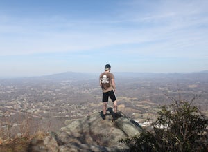
5.03.12 mi / 1220 ft gainThe Fork Knob and White Rock Loop in Johnson City, Tennessee, is a moderately challenging hiking trail that spans approximately 3.12 miles. The trail is marked by a variety of natural features, including a prominent rock formation known as White Rock, which offers panoramic views of the surroundi...Read more -
Johnson City, Tennessee
Hike to Tip Top on Buffalo Mountain
4.05.4 mi / 1388 ft gainTip Top rests on one of the highest points of Buffalo Mountain. The overlook features tree coverage perfect for hammocking and benches while providing views of Downtown Johnson City as well as the other side of the mountain range. The hike from the trailhead to Tip Top is moderately steep. The tr...Read more -
Johnson City, Tennessee
White Rock Overlook
5.02.85 mi / 876 ft gainThe White Rock trailhead is less than a 10 minute drive from downtown Johnson City. When pulling up Highbridge Road, take a left at the fork. You will shortly encounter a vehicle gate where you will park to the side of the road (do not block the yellow vehicle gate). You have the option to walk ...Read more -
Morganton, North Carolina
Hike to Hawksbill Mountain
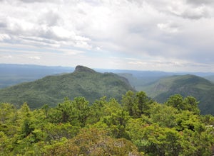
5.02.1 mi / 660 ft gainStarting at the Hawksbill Mountain Trailhead, which is clearly marked start hiking up! The trail starts out with some easy uphill switchbacks and leads you to the first lookout point. Enjoy sometime at the lookout point, but you'll want to keep going for a more incredible view. Keep hiking uphill...Read more -
Nebo, North Carolina
Explore Lake James State Park
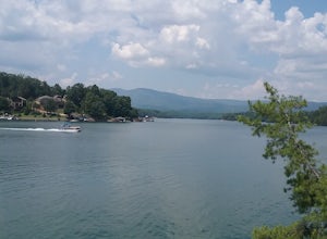
The park has about 15 miles of trails with different levels of difficulties . Hiked the Lake Channel Trail along the lake with good views of the lake and the Blue Ridge Mountains. Hiked the Mill's creek trail which is nicely shaded and offers good views of the lake and the Linville Gorge area. ...Read more -
Greeneville, Tennessee
Hike to Margarette Falls
5.02.7 mi / 715 ft gainTo reach the trail head, take exit number 39 to Erwin/Jonesborough and turn onto State Route 81/107 west and stay on this for 6.5 miles. Then you will turn left to stay on Route 107 and continue on for 16 more miles. Then you will take a left on Route 351 and drive 4.5 miles. Then you will take a...Read more -
Hampton, Tennessee
Laurel Falls via Appalachian Trail
5.02.43 mi / 449 ft gainLaurel Falls via Appalachian Trail is an out-and-back trail that takes you by a waterfall located near Hampton, Tennessee.Read more -
Hampton, Tennessee
Appalachian Trail: Dennis Cove to US 19E
21.27 mi / 4843 ft gainAppalachian Trail: Dennis Cove to US 19E is a point-to-point trail that takes you through a nice forest located near Roan Mountain, Tennessee.Read more -
Hampton, Tennessee
Appalachian Trail: Dennis Cove to Watauga Lake
8.08 mi / 1955 ft gainAppalachian Trail: Dennis Cove to Watauga Lake is a point-to-point trail that takes you by a waterfall located near Hampton, Tennessee.Read more -
Hampton, Tennessee
Hike to Laurel Fork Falls
4.62.6 mi / 600 ft gainFrom Hampton, Tennessee, take US-321S for about 3.5 miles. Turn right onto Dennis Cove Road and travel for 4 miles on this steep and very curvy mountain road. The trailhead is where the Appalachian Trail (AT) crosses the road at a small gravel lot on the left. Take the AT north on the trail lea...Read more -
Hampton, Tennessee
Hike and Traverse the Cables to Dennis Cove Falls
5.03.2 mi / 300 ft gainThe Hike to Dennis Cove Falls includes three water crossings and passes several small waterfalls. Sturdy cables spanning the width of the water crossings provide a fun way of traversing the creek without wading. It is completely possible to wade through the creek while holding onto the cables for...Read more -
Linville, North Carolina
Hike the Flat Rock Trail (NC)
5.00.6 miFlat Rock Trail is located off the Blue Ridge Parkway at milepost 308. There is a pull-off from the Parkway with a sign designating the location. There are several picnic tables around the pull-off, but I would recommend taking your lunch up to Flat Rock. The wide, clear trail is practically flat...Read more -
Elk Park, North Carolina
Elk River Falls
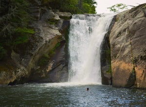
4.60.35 mi / 62 ft gainThe coordinates for the parking area are 36.198288, -81.970137. You'll see a parking area that's dirt/gravel on the right side of the road. At the far end of the parking lot is a sign that says Elk River Falls with an arrow pointing up the hill. From this point its about a .2 mile long walk to th...Read more -
Collettsville, North Carolina
South Harper Creek Falls
5.03.46 mi / 564 ft gainSouth Harper Creek Falls is an out-and-back trail that takes you by a waterfall located near Collettsville, North Carolina.Read more -
Linville, North Carolina
Rough Ridge via the Tanawha Trail from Beacon Heights
5.07.49 mi / 1280 ft gainIf you're feeling frisky, set your alarm for the early am and park at the Beacon Heights Parking area about 30 minutes before dawn. Put on your head lamp and hike the short trip to Beacon Heights, bask in the glory of the warm morning sun, then head back down and connect with the Tanawha Trail. A...Read more -
Newland, North Carolina
Beacon Heights Overlook
5.00.71 mi / 105 ft gainBeacon Heights is the perfect hike when you're on the Blue Ridge Parkway near Linville and Grandfather Mountain, Milepost 305.2. The trail is a steady climb uphill for less than a half mile. The last section being fairly steep and rocky. Once at the top, there are several rock outcroppings, but...Read more

