Marble, North Carolina
Looking for the best hiking in Marble? We've got you covered with the top trails, trips, hiking, backpacking, camping and more around Marble. The detailed guides, photos, and reviews are all submitted by the Outbound community.
Top Hiking Spots in and near Marble
-
Tallassee, Tennessee
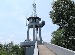
Hike to Look Rock Tower
5.01 mi / 300 ft gainLook Rock tower has spectacular views and is a great hike to enjoy year round. The tower is an old fire tower used for spotting smoke in the valley. Because of this the tower is placed on the highest ridge around making for some amazing views. The only way to get to the tower is along the Foothil...Read more -
Helen, Georgia
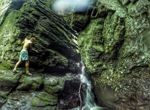
Raven Cliff Falls
4.64.78 mi / 584 ft gainThe hike to Raven Cliff Falls round-trip is about 5 miles. The scenery is amazing the whole way through with beautiful cascading waterfalls and running streams filled with wildlife everywhere you look. Along the way, there are a few campsites where during the warm months you'll see many tents set...Read more -
Helen, Georgia
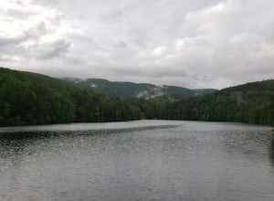
Hike the Unicoi Lake Trail
1.9 miUnicoi State Park is a pleasant, refreshing park just outside of Helen, GA. There is a hiking trail, kayaking/canoeing launch, paddle boat rentals, camping area, and even a 3 segment zipline course (all three were fantastic)! Fishing is allowed, and when we went last there were a few kayakers fis...Read more -
Helen, Georgia
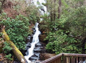
Hike to Dukes Creek Falls
4.21.9 mi / 300 ft gainStarting with a scenic overlook of Yonah mountain and ending with three waterfalls, Dukes Creek falls is the perfect hike on any occasion. This easy 1 mile trail has spectacular views and is great for dogs and families. The trail is gravel and boardwalk the whole way and great for any age. The pa...Read more -
Bryson City, North Carolina
Hike to Alarka Falls
5.01 mi / 100 ft gainTo visit the falls, take US-74 west from Bryson City to exit 64 . Take a left at the exit and drive on Alarka Road for about 10 miles. Follow the road all the way to the end where you will find a turnaround. Don't make the mistake of following the forest service road (it is gated), as it is not ...Read more -
Cleveland, Georgia
Hike the Appalachian Trail to Preachers Rock
5.02.1 mi / 425 ft gainThe Appalachian Trail is arguably the most famous thru-hike in the world. Along its 2,181-mile journey, there are many beautiful mountain views, and Preachers Rock is definitely one of them. A large granite slab near the summit of Big Cedar Mountain reveals mountain views that are truly the epi...Read more -
Clayton, Georgia
Hike the James E. Edmond trail to Lookoff Mountain Overlook
4.07.5 mi / 2378 ft gainBlack Rock Mountain State Park is Georgia's highest elevation State Park. It is adorned with several waterfalls, sweeping overlooks, blooming Rhododendron's, and plenty of miles of trail. The James E. Edmond trail is the longest and by far most challenging hike in the park. Its medium-long dis...Read more -
Bryson City, North Carolina
Hike to Lonesome Pine Overlook
5.07 mi / 2300 ft gainTo start the hike to Lonesome Pine Overlook begin from the Noland Divide Trailhead in Deep Creek. The trail is a steady climb with an average gain of 700 ft. every mile. Approaching the top you'll walk along a rocky ridge line where you are able to see the overlook. As you continue, be sure to lo...Read more -
Upper Tremont Road, Tennessee
Hike to Indian Flat Falls via Middle Prong Trail
4.57.21 mi / 1140 ft gainOne of the best trails in the Smokies is the Middle Prong Trail. The trail passes three major waterfalls, in addition to numerous smaller falls, cataracts and cascades. Once you've parked, you'll start at the trail head and immediately see your first cascade. From the trailhead hikers will cro...Read more -
Bryson City, North Carolina
Hike Three Waterfalls Loop
5.02.4 mi / 450 ft gainStart the loop by hiking the Juney Whank Falls Trail to Juney Whank Falls. The footbridge across the creek makes an excellent place to rest and take in the falls. Follow the trail across the bridge and up the bank. After about 300 feet take a right and follow Deep Creek Horse Trail towards Deep C...Read more -
Bryson City, North Carolina
Hike the Juney Whank Falls Loop
4.00.65 mi / 150 ft gainStarting at the Deep Creek Trailhead, take a short walk until the trail meets up with Juney Whank Falls Trail. From here, hang a left and head onto the Juney Whank Falls Trail. Once you've reached the falls, continue the loop to get back to the trailhead. The falls are said to be named after Mr...Read more -
Bryson City, North Carolina
Deep Creek Loop
5.05.01 mi / 892 ft gainAfter parking in the Deep Creek Campground parking lot follow the signs for the Deep Creek Trailhead. The Tom Branch waterfall is just .3 miles on the right side. Hike another .5 miles, at the next intersection stay right, and you will approach Indian Creek Falls. After viewing the falls you ca...Read more -
Bryson City, North Carolina
Tom Branch and Indian Creek Falls
4.51.76 miFrom the Deep Creek Trailhead, you can hike to both waterfalls heading up the Deep Creek Trail. You will come across Tom Branch Falls quickly, after 0.2 miles. Once you've had your fill of Tom Branch, head further along the Deep Creek Trail for another 0.5 miles. Turn right on the Indian Creek Tr...Read more -
Bryson City, North Carolina
Deep Creek to Clingmans Dome Loop
32.82 mi / 7400 ft gainThis is a ~36 mile loop that goes up Clingman's Dome (the tallest point in Tennessee). Pretty challenging, not for the novice backpacker. Park at Deep Creek campground in Bryson City, NC. We did it as a 3-day, 2-night camping at sites 53 and 61. As it is a loop it could easily be done in reverse....Read more -
Sylva, North Carolina
Hike to Cowee Bald Fire Tower
4.4 mi / 400 ft gainThe Cowee Bald Fire Tower is located in the Nantahala National Forest near Bryson City North Carolina. To get there you can either drive almost all the way to the top about .2 miles from the top but to get there you will need to have a 4WD or a higher clearance vehicle to cross a small stream. Ho...Read more -
Townsend, Tennessee
Spruce Flats Falls
4.81.64 mi / 495 ft gainTo get to Spruce Flats Falls, you will want to drive down 2.2 miles down the scenic Tremont Road to the Great Smoky Mountains Institute and park in the visitor center parking area. You will then want to ascend up the gravel road past the sign that says restricted to unrestricted traffic (meaning ...Read more

