Tuckasegee, North Carolina
Looking for the best hiking in Tuckasegee? We've got you covered with the top trails, trips, hiking, backpacking, camping and more around Tuckasegee. The detailed guides, photos, and reviews are all submitted by the Outbound community.
Top Hiking Spots in and near Tuckasegee
-
Joyce Kilmer-Slickrock Wilderness, North Carolina
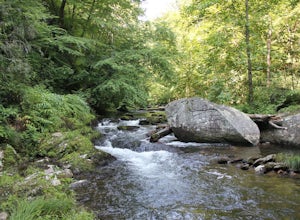
Backpack Slickrock Creek Trail #42
30 mi / 3700 ft gain8:30 a.m. and we’re winding our way down Highway 129 near Robbinsville, NC. The fog is still thick over the Little Tennessee River as we slow down crossing the bridge into Graham County. “I think we missed it,” I say as we continue onward. Within minutes the Tapoco Lodge comes into view. My pre-h...Read more -
Toccoa, Georgia
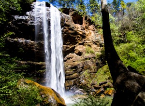
Explore Toccoa Falls
3.60.2 miPark at the welcome center of Toccoa College.The trailhead is behind the welcome center, starting at the gates to the right of the center. The trail takes you along a creek on a gravel trail. After a short distance, you will reach Toccoa Falls, where the water pours off the rocks from over 180 fe...Read more -
Robbinsville, North Carolina
Hike the Big Fat Gap Trail
12 mi / 3000 ft gainThere are many trailheads leading into the wilderness on either the Tennessee or North Carolina side. My favorite is the Big Fat Gap trail on the North Carolina side at an elevation of 3,060'. To see the best of what this area has to offer take the Hangover Lead South Trail to the 5,180' Hangover...Read more -
Lake Santeetlah, North Carolina
Huckleberry Knob
4.81.77 mi / 295 ft gainHuckleberry Knob is the highest point in the Cheoah Ranger District at 5,560 feet, and it offers expansive views of the surrounding Cherokee and Natahala National Forest. The hike is 2.4 miles roundtrip and begins at the parking lot between mile 8 and 9 up an old dirt road. You will go up the di...Read more -
Hendersonville, North Carolina
Hike along The World's Edge
0.7 mi / 40 ft gainPark at the end of The World's Edge Road, but be aware that parking is very limited. There is a private residence up to the right so do not block their driveway/gate. Begin your hike by going through the leftmost gate, and continue straight until you reach the first view less than half a mile in....Read more -
Greenville, South Carolina
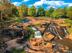
Hike Swamp Rabbit Trail to Reedy River Falls
4.53 mi / 100 ft gainSwamp Rabbit Trail is a 21 mile-long paved walkway that closely follows the Reedy River in Downtown Greenville. Over a half-a-million people visit the trail each year, but few ever walk the whole thing. What most people don’t know, is that it begins on a different river: the Enoree river and wind...Read more -
Robbinsville, North Carolina
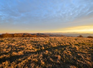
Hike Hooper Bald
1 mi / 250 ft gainHooper bald is one of the highest points in Graham County so the views from the top can be spectacular year round. The trail-head starts at mile marker 8 on the Cherohala Skyway. From the trail-head you start your accent on a semi-paved trail and walk about a half-mile before reaching the edge o...Read more -
Blairsville, Georgia
Hike to Horsetrough Falls
5.00.4 mi / 10 ft gainTo get to the trail head you will follow Wilks road five miles to Upper Chattahoochee River Campground. The five miles down the gravel road should be doable for a majority of cars as the gravel road is in good condition. Pretty much if you feel comfortable driving your car on a regular gravel roa...Read more

