Clackamas County, Oregon
Looking for the best running in Clackamas County? We've got you covered with the top trails, trips, hiking, backpacking, camping and more around Clackamas County. The detailed guides, photos, and reviews are all submitted by the Outbound community.
Top Running Spots in and near Clackamas County
-
Camas, Washington
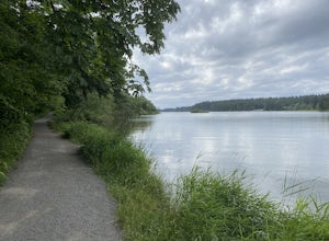
Hike Lacamas Heritage Trail
5.03.5 mi / 139 ft gainUsed often for cross country practice, the Lacamas Heritage Trail is a popular gem in Camas, Washington for all citizens. It is family and dog friendly and comes with endless scenic views of the beautiful Lacamas Lake. Parking is free and there are bathrooms at the entrance.Read more -
Portland, Oregon
Run Springwater Corridor Trail
4.07 mi / 50 ft gainSpringwater Corridor is a 40-mile paved trail that stretches from downtown Portland all the way to Boring. This trail is wide, virtually flat, and yes, paved - but there is a clear manmade path on the dirt shoulders that's friendlier to knees. Any given day, you'll see dozens of cyclists and pede...Read more -
Sisters, Oregon
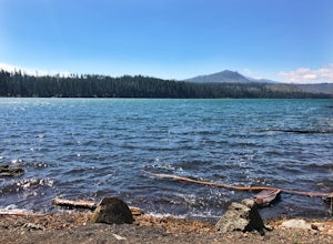
Suttle Lake Loop
5.03.66 mi / 128 ft gainBeginning at the Suttle Lake Lodge just off Highway 20, the Suttle Lake Loop follows a wide dirt path that circumnavigates the entire lake. Hug the lake whenever the trail opens up to camping areas or pavement - it's nearly impossible to become lost on this track. Pass campsites, kayakers, and r...Read more -
Portland, Oregon
Mount Tabor Park
4.3Sitting 400 feet above the city with views of Mt. Hood and Portland doesn't sound to bad right?? Mount Tabor is located in Southeast Portland and is a once active volcano. There are 196 acres of park for you to explore. In order to photograph the best pictures of Mt. Hood I highly suggest gettin...Read more -
Portland, Oregon
Tryon Creek Outer Loop
4.55.12 mi / 554 ft gainTryon Creek State Park has a fantastic, well-maintained trail system that’s a great alternative to Portland’s downtown Washington Park and Forest Park. It’s a super family-friendly area with a Nature Center that hosts kid’s events year-round. This entire area is relatively small and therefore eas...Read more -
Portland, Oregon
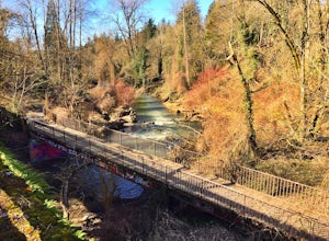
Tryon Creek Triple Bridge Loop
3.35 mi / 479 ft gainTryon Creek Triple Bridge Loop is a scenic approximately 3.5-mile loop with bridge crossings near downtown Portland. This trail is a great way to get outside, stretch your legs, and feel like you're away from the hustle and bustle of the city. This trail is dog-friendly on-leash. If you're look...Read more -
Stevenson, Washington
Three Corner Rock
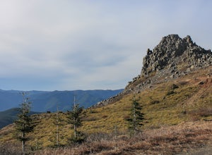
4.03.86 mi / 1093 ft gainFrom the Rock Creek Pass Trailhead, begin the short hike to Three Corner Rock by heading south on the Pacific Crest Trail from its crossing of Road CG 2090. After a steady 1.5-mile climb of roughly 600 feet, look for a large fallen sign marking the junction to Three Corner Rock. Shortly after, an...Read more -
White Salmon, Washington
Coyote Wall Loop
3.56.29 mi / 1962 ft gainCoyote Wall is a relatively uncrowded trail system in the Columbia River Gorge that provides outstanding views of the Columbia River. The trail system is made up primarily of user-created mountain biking trails, allowing hikers a choose-your-own-adventure approach to exploring the area. Start o...Read more -
Portland, Oregon
Waterfront Park
4.52.68 mi / 79 ft gainLooking for a quick run along the water in the heart of Portland? Look no further. This relatively flat 2.6 mile loop runs right along the Willamette and features great views of the city’s bridges, river, the downtown skyline, and all of the fun people enjoying this urban park. From the Salmon S...Read more -
Foster, Oregon
Iron Mountain
4.71.79 mi / 610 ft gainGetting There There are a couple of different routes to the summit of Iron Mountain. This adventure article focuses on the shorter but more strenuous hike to the summit of Iron Mountain. To get there, drive to the upper trailhead (Trail # 3389) via Highway 20. Take Forest Service Road (FSR) 035 ...Read more

