White City, Oregon
Top Spots in and near White City
-
Jackson County, Oregon
Backpack to Devil's Peak and the Seven Lakes Basin
3.013.7 mi / 3050 ft gainStarting at at elevation of 5250 feet, the trail climbs steadily from the trailhead for approximately 3.3 miles to pass at 6900 feet. From here you will come to a junction where going right will lead to Devils Peak and the PCT and going left (straight) will take down into the basin. If you starte...Read more -
Ashland, Oregon
Summit Mt. Ashland
5.05 mi / 1550 ft gainSituated in Southern Oregon right near the California border lies the Siskiyou Mountain Range's tallest peak, Mount Ashland. Mount Ashland is a very popular area for many recreational activities, one of the most popular activities is skiing. The ski area was opened up in 1963 and has changed hand...Read more -
Prospect, Oregon
Mill Creek Falls & Barr Creek Falls
5.01.54 mi / 315 ft gainMill Creek Falls is a lesser-known gem in Southern Oregon. At 173 ft it is one of the tallest in the area, and Barr Creek Falls, plunging 240 ft, is less than a quarter mile further down the trail. The viewpoints can be accessed year-round though flows often fluctuate and spring/winter may best f...Read more -
Prospect, Oregon
Explore Pearsony Falls
0.5 miPearsony falls, located in the Oregon State Park known as Prospect State Scenic Viewpoint, is about 15 feet tall and cascades picturesquely in two sections underneath a green canopy and between mossy rocks. The falls flow year round, though water levels vary with the season. A trip to Pearsony Fa...Read more -
Klamath Falls, Oregon
Hike to the Summit of Mt. McLoughlin
5.09 mi / 3900 ft gainThis is not an easy hike, but every step is more than worth it. Unlike Mount Thielsen to the north, this summit requires no scrambling/climbing; it's just a long, steep hike. Mount McLoughlin (named for John McLoughlin of Hudson's Bay Company and Oregon Trail fame) is a lava cone on top of a comp...Read more -
Ashland, Oregon
Hike to Hobart Bluff
2.5 mi / 200 ft gainHobart Bluff is part of the Western Cascades, a range of weathered volcanic mountains that are much older than the High Cascades that most people think of today, the range of Shasta, Rainier, and Hood. These mountains are shorter as a result of the work of time and usually have summits wrapped in...Read more -
Ashland, Oregon
Hike and Climb Pilot Rock
8 mi / 1000 ft gainPilot Rock is one of the most prominent features in the Cascade-Siskiyou National Monument and is visible from over 40 miles away in the Shasta Valley of northern California and the Rogue Valley of Southern Oregon.Similar to Devil’s Tower in Wyoming, though much smaller in stature, Pilot Rock is ...Read more -
Prospect, Oregon
Explore the Rogue River Gorge
5.0This 500 ft. long gorge carved out of an old lava tube sits right along highway 62 near Crater Lake. The original road that brought travelers to the National Park passed right next to the gorge but it now remains hidden from view of the current highway. The area isn't large but has a nice parking...Read more -
Josephine County, Oregon
Raft or Kayak the Wild & Scenic Rogue River
4.8The Wild and Scenic Section of the Rogue River is a hidden secret in the Pacific Northwest. This virtually untouched 34-mile section boasts some of the most pristine and secluded scenery in Oregon. Bald eagles, osprey, and black bears are frequently (if not always) spotted along the way. This bea...Read more -
Tiller, Oregon
South Umpqua Falls
If you are early enough, you can park at the designated day use parking area, which is where the bathroom is. There are picnic benches there along with a path to the top of the falls. If you want to be where the real action is, take the dirt trail down to the bottom of the falls which is less tha...Read more -
CRATER LAKE, Oregon
Hike Union Peak
11 mi / 1600 ft gainThe trailhead is located across Highway 62, on the opposite side of the highway from the Crater Lake National Park entrance at Mazama Village. Look for a road sign indicating parking for the Pacific Crest Trail (PCT).Start on the PCT: Highway 140 to Highway 138 (near Cascade Crest), hiking severa...Read more -
CRATER LAKE, Oregon
Visit the Lady of the Woods at Crater Lake
0.3 mi / 100 ft gainStart your adventure behind the Steel Visitor Center, halfway between the Mazama Village entrance of Crater Lake National Park and the lake itself. It won't take long before you stumble upon the mystery that is the Lady of the Woods: a dazzling, intricate sculpted rock that experts are unsure whe...Read more -
Klamath County, Oregon
The Rim at Crater Lake NP
4.330.99 mi / 4124 ft gainWhy Go? Avoid the crowds in summer and have the entire 33 mile long rim and 21 square miles of beautiful Crater Lake to yourself. Sunrises and sunsets that will take your breath away; stars and a milky way you can get lost in for days. Expect solitude and beautiful scenery, nothing less. The 360 ...Read more -
CRATER LAKE, Oregon
Photograph Crater Lake
4.9Crater is a short 20min drive up Highway 62 off of the 97. We were chasing sunset and caught the last glimmers of twilight. Just driving around the west rim is amazing. Pictures did absolutely no justice to this place, you have to see it with your own eyes...it's MASSIVE!!! Every small pull-off/p...Read more -
CRATER LAKE, Oregon
Watch the Sunrise at Crater Lake
4.8Drive to the overlook at Crater Lake well before sunrise. Actually, you should probably just sleep in your car for a bit to make sure you're not late for this incredible sight. Witness the changing colors and light as the sun creeps over the east side of the lake, throwing shadows and reflections...Read more -
CRATER LAKE, Oregon
Bike around Crater Lake
5.0I forgot how large Crater Lake was. Wikipedia said it was only 6 miles in diameter, multiply X 3.14 or C = πd and boom its only 18.84 miles around, that's cake, or pie. Imaging a NASCAR track with a pond in the middle.WRONG, hindsight being 20/20, dramatic landscape rarely equates to flat, cycle ...Read more
Top Activities
Camping and Lodging in White City
Trail, Oregon
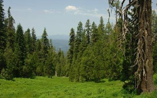
Butler Butte Cabin
Overview
This facility is closed.
Recreation
Facilities
Natural FeaturesNearby Attractions
.
Butte Falls, Oregon
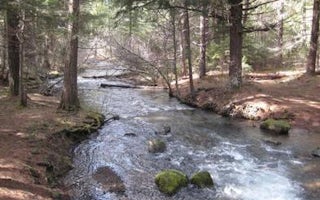
Whiskey Springs Campground
Overview
The campground is a large bisected loop in a dense stand of Douglas fir, cedar and other conifers next to Whiskey Springs Pond. ...
Butte Falls, Oregon
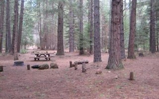
Fourbit Ford Campground
Overview
Fourbit Ford campground and campsites are located along Fourbit Creek in the City of Medford, OR, watershed. This remote and pic...
Eagle Point, Oregon
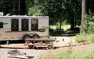
Willow Prairie Horsecamp
Overview
Willow Prairie Horse Camp is nestled in tall timber at an elevation of 4,400 feet just southwest of Mt. Mc Loughlin, near a beau...
Jacksonville, Oregon
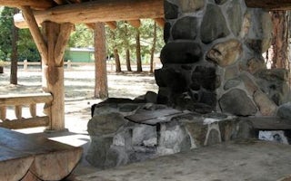
Mckee Bridge Community Kitchen
Overview
Situated along the rocky banks of the Applegate River, the McKee Bridge Community Kitchen is a fantastic day-use picnic shelter ...
Eagle Point, Oregon
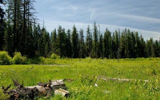
Willow Prairie Cabin
Overview
Willow Prairie Cabin is located in the southwest portion of the magnificent volcanic Cascade Mountain Range at the foot of Mt. M...


