Cocke County, Tennessee
Looking for the best photography in Cocke County? We've got you covered with the top trails, trips, hiking, backpacking, camping and more around Cocke County. The detailed guides, photos, and reviews are all submitted by the Outbound community.
Top Photography Spots in and near Cocke County
-
Bryson City, North Carolina
Hike Three Waterfalls Loop
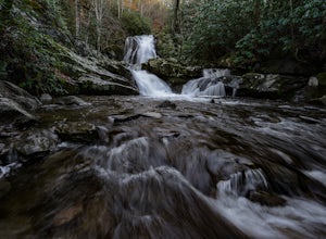
5.02.4 mi / 450 ft gainStart the loop by hiking the Juney Whank Falls Trail to Juney Whank Falls. The footbridge across the creek makes an excellent place to rest and take in the falls. Follow the trail across the bridge and up the bank. After about 300 feet take a right and follow Deep Creek Horse Trail towards Deep C...Read more -
Bryson City, North Carolina
Hike to Lonesome Pine Overlook
5.07 mi / 2300 ft gainTo start the hike to Lonesome Pine Overlook begin from the Noland Divide Trailhead in Deep Creek. The trail is a steady climb with an average gain of 700 ft. every mile. Approaching the top you'll walk along a rocky ridge line where you are able to see the overlook. As you continue, be sure to lo...Read more -
Upper Tremont Road, Tennessee
Hike to Indian Flat Falls via Middle Prong Trail
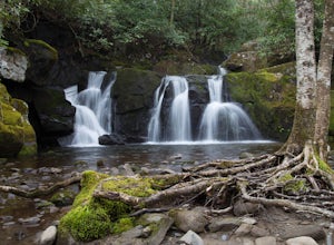
4.57.21 mi / 1140 ft gainOne of the best trails in the Smokies is the Middle Prong Trail. The trail passes three major waterfalls, in addition to numerous smaller falls, cataracts and cascades. Once you've parked, you'll start at the trail head and immediately see your first cascade. From the trailhead hikers will cro...Read more -
Townsend, Tennessee
Spruce Flats Falls
4.81.64 mi / 495 ft gainTo get to Spruce Flats Falls, you will want to drive down 2.2 miles down the scenic Tremont Road to the Great Smoky Mountains Institute and park in the visitor center parking area. You will then want to ascend up the gravel road past the sign that says restricted to unrestricted traffic (meaning ...Read more -
Bryson City, North Carolina
Explore Old 288 and the Lands Creek Bridge
2.51 miNC 288 was constructed in the 1920's, but did not last long with the construction of the Fontana Dam as the resulting lake covered the highway. The U.S. government entered an agreement in which they would provide a replacement road, but to this day it has not been completed and is know by locals ...Read more -
Knoxville, Tennessee
Forks of the River Wildlife Management Area
This park is located in south Knoxville. The wildlife management area is very popular in the sunflower season. This area offers many activities including biking, hiking and photography. There are several trails that run through the area but some of them are closed in hunting season so make sure t...Read more -
Asheville, North Carolina
Explore Lake Powhatan
Lake Powhatan is located just minutes away from Asheville, NC and offers a number of fun activities for you, your friends, and your family. In the warm summer months, the Lake is a popular spot for swimming. The small stretch of beach along the lake is a nice place to lay out and soak in the sun....Read more -
Knoxville, Tennessee
Mead's Quarry Park
3.0This quarry is located near the Ijams Nature Center in South Knoxville. The quarry is right off of Island Home rd and has a large parking lot. The parking lot has about 30 spaces and about 50 spaces in overflow parking. There is a lot activities to do at the quarry. In the summer there is kayak a...Read more -
Asheville, North Carolina
Photograph Haw Creek Valley Overlook
The Haw Creek Valley Overlook is only 8 miles from downtown Asheville. If you're in the downtown area, it's a rather easy place to zip on over to if you're in need of some time away from urban life. This overlook is a hot spot for sunset watching and picture taking. If you plan on seeing what th...Read more -
Knoxville, Tennessee
River Boardwalk Trail
1.5 mi / 200 ft gainThis trail is located at the Ijams Nature Center. Ijams Nature Center is only 10 minutes from downtown Knoxville and is a great place to escape city life and enjoy the outdoors. The parking lot here is quite large and in the busy season it has an overflow lot too. Ijams Nature Center has many hik...Read more -
Walland, Tennessee
Drive the Foothills Parkway National Scenic Byway
5.0The foothills parkway runs parallel to the Great Smoky Mountains. It is 38.6 miles in total with the longest section at 33.0 miles. There are a few different places to get on to the parkway. There is one entrance near Fontana, Walland, Wears Valley, and Cosby. However Cosby is a smaller section a...Read more -
Canton, North Carolina
Climb Fryingpan Mountain Lookout Tower
4.51.5 miThis is an extremely easy trail with a minimal incline. The tower, built in 1941, standing 70 feet above the summit, can be nerve wracking, even for those who aren't scared of heights. However, most feel it's worth the view. Expect to see fellow hikers. On pretty days there can be a few people w...Read more -
Knoxville, Tennessee
Will Skelton Greenway
7 mi / 300 ft gainThis greenway starts at the Island Home Park and goes through Ijams Nature Center and the Forks of the River Wildlife Management Area. The trail is almost 4 miles one way so it makes for a great half day trip. From start to finish it is 8 miles long. The trail is mostly paved with only a small bi...Read more -
Arden, North Carolina
Photograph the French Broad Overlook
5.0The French Broad Overlook is one of several overlook spots along the Blue Ridge Parkway. It's not known to be the most breathtakingly scenic spot of the batch, but it's still a nice viewpoint that will offer you sights of the French Broad River, one of the few north flowing rivers in the US. Yo...Read more -
Canton, North Carolina
Shining Rock via Shining Creek Trail
4.38.69 mi / 2569 ft gainThere are several ways to access the Shining Rock Wilderness Area, but go for the main trail head off of Hwy 276. The trail is split by the Pigeon River, providing a seemingly infinite combinations of trails and routes, keeping in mind that this area intersects often with the well known Art Lobe ...Read more -
Townsend, Tennessee
Backpack to Spence Field
13.8 mi / 3100 ft gainStart your hike at Anthony Creek Trailhead (elevation 1,800 ft), in the Cade’s Cove area. The trailhead is located at the far end of the day-use picnic area near Cade’s Cove campground. There are a few parking spots right at the trailhead, but note that the picnic area closes at dusk (a gate clos...Read more


