Great Smoky Mountains National Park, Tennessee
Looking for the best hiking in Great Smoky Mountains National Park? We've got you covered with the top trails, trips, hiking, backpacking, camping and more around Great Smoky Mountains National Park. The detailed guides, photos, and reviews are all submitted by the Outbound community.
Top Hiking Spots in and near Great Smoky Mountains National Park
-
Bryson City, North Carolina
Hike to Alarka Falls
5.01 mi / 100 ft gainTo visit the falls, take US-74 west from Bryson City to exit 64 . Take a left at the exit and drive on Alarka Road for about 10 miles. Follow the road all the way to the end where you will find a turnaround. Don't make the mistake of following the forest service road (it is gated), as it is not ...Read more -
Townsend, Tennessee
Gregory Bald via Gregory Ridge Trail
5.011.3 mi / 3020 ft gainThe Gregory Bald summit is indisputably picturesque – the 10-acre meadow at the top hosts magnificent azalea blooms in June, wild blueberries in August, and views of Cades Cove, Rich Mountain, Fontana Lake, Thunderhead Mountain, and Clingmans Dome, year-round. Start this hike at the Gregory Ridg...Read more -
Tallassee, Tennessee
Abrams Falls Trail
4.84.96 mi / 625 ft gainOne of the biggest perks of hiking Abrams Falls is the drive to get there. The trailhead is located approximately 5 miles into the scenic Cades Cove Loop. Cades Cove is an adventure in itself. Keep your eye out for black bears, deer and wild turkey. If you are taking the self guided auto tour, Ab...Read more -
Fontana Dam, North Carolina
Shuckstack Fire Tower
5.08.84 mi / 2605 ft gainYour Shuckstack adventure starts at the Fontana Dam outside of Bryson City, NC. As the highest dam East of the Rocky Mountains, it's a sight on its own. This will be your last chance to fill up water bottles and use the restroom so take advantage. You can leave on foot from the dam and continue ...Read more -
Sylva, North Carolina
Pinnacle in Pinnacle Park
5.05.98 mi / 2142 ft gainHeading out from the parking area, head north on this challenging hike. For the majority of the hike, you'll have a pretty steady uphill charge. There are some flat parts between climbs, so be sure to catch your breath and get some water in during these times. Once you reach the fork, where you'...Read more -
Sylva, North Carolina
Hike to Cowee Bald Fire Tower
4.4 mi / 400 ft gainThe Cowee Bald Fire Tower is located in the Nantahala National Forest near Bryson City North Carolina. To get there you can either drive almost all the way to the top about .2 miles from the top but to get there you will need to have a 4WD or a higher clearance vehicle to cross a small stream. Ho...Read more -
Sevierville, Tennessee
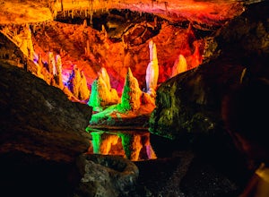
Spelunking in Forbidden Caverns
5.0When exploring all that Tennessee has to offer, it’s hard to ignore the fact it is home to more caves than any other state in America. So when picking one, of more than 10,000, to explore it is hard to go wrong. Forbidden Caverns happens to be one of the most popular spots and is only a few minut...Read more -
Sylva, North Carolina
Abandoned Cessna 414A at Waterrock Knob
3.71.72 mi / 430 ft gainThis is an AWESOME day hike for anyone looking to get outside for a few hours and see some special views of the blue ridges, as well as check out the abandoned plane crash of a Cessna 414A that happened back in 1983. The remains of the plane are still scattered along the hillside making it a supe...Read more -
Sylva, North Carolina
Waterrock Knob Trail
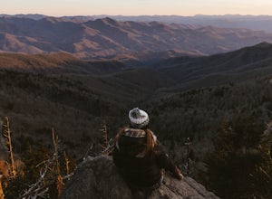
5.01 mi / 407 ft gainThe trail begins paved and quickly climbs up into a heavily forested area. Once at a 1/4 of a mile in, you will come to a nice overlook that will give you your first real good view of the surrounding mountains. The trail then continues on, though now unpaved, with great views off to your left as ...Read more -
Newport, North Carolina
Hike to Mouse Creek Falls
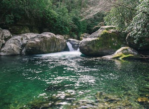
5.04.2 mi / 605 ft gainFollow Big Creek Trail on a moderate climb to this 45-foot waterfall. Around 1.3 miles in, you will begin to hike alongside Big Creek, and shortly afterwards you will pass Midnight Hole, a particularly deep pool. There are a number of other small falls en route. In spring you should see a number ...Read more -
Newport, North Carolina
Hike to Mt. Sterling's Fire Tower
4.012 mi / 4200 ft gainOn your way in, stop at the ranger station parking lot to use the outhouses and grab a map for $1. Once at the Baxter Creek trailhead you have two options: 1. The Out and Back (12.2 miles) 2. The Loop (17 miles)Out and Back: Start on the Baxter Creek Trail and continue up for 6.1 miles until you...Read more -
Robbinsville, North Carolina
Gregory Bald via Twentymile
4.015.42 mi / 3694 ft gainGregory Bald via Twentymile is a loop trail where you may see beautiful wildflowers located near Robbinsville, North Carolina.Read more -
Franklin, North Carolina
Wesser Bald Fire Tower
4.72.36 mi / 807 ft gainThe road leading to the trailhead is rough the last mile, but doable in any car. Just make sure to take it easy going up and be careful, especially if there has been any rain or snow. You will have reached the parking area for the hike once you see a large green Appalachian trail sign and a few...Read more -
Bryson City, North Carolina
Hike Ledbetter Creek
5.0Leaving the Nantahala Outdoor Center, drive upriver for 6.5 miles until you see a pull off on the right. Walk past the picnic tables, cross the railroad tracks, then follow the trail to arrive at the creek. Once you're there, it's up to you on what to do next.One of the most popular activities he...Read more -
Tallassee, Tennessee
Hike to Look Rock Tower
5.01 mi / 300 ft gainLook Rock tower has spectacular views and is a great hike to enjoy year round. The tower is an old fire tower used for spotting smoke in the valley. Because of this the tower is placed on the highest ridge around making for some amazing views. The only way to get to the tower is along the Foothil...Read more -
Kodak, Tennessee
Bobwhite Trail
2 mi / 100 ft gainThis is a great and easy hike through the Seven Islands Birding State Park. This park is located in east Knoxville and is one only 20 minutes from downtown Knoxville. The trail starts at the Seven Islands Birding Park parking lot that has a beautiful garden with lots of wildflowers. The trail is ...Read more


