Sequatchie, Tennessee
Looking for the best hiking in Sequatchie? We've got you covered with the top trails, trips, hiking, backpacking, camping and more around Sequatchie. The detailed guides, photos, and reviews are all submitted by the Outbound community.
Top Hiking Spots in and near Sequatchie
-
Rising Fawn, Georgia
Cloudland Rim Loop via East Rim Campground
4.66 mi / 873 ft gainCloudland Rim Loop via East Rim Campground is a loop trail in Cloudland Canyon State park, which offers up stunning vistas and several waterfalls. This trail is located near Rising Fawn, Georgia.Read more -
Rising Fawn, Georgia
Camp at Cloudland Canyon State Park
4.8If you're looking to camp somewhere with exceptional hiking and beautiful waterfalls, Southeastern Tennessee locals know not to look further than Lookout Mountain. Located on the western edge, Cloudland Canyon State Park straddles Sitton Gulch Creek and is perfect for a weekend exploration.If sta...Read more -
Rising Fawn, Georgia
Hike Sitton's Gulch Trail
5.05.7 mi / 1060 ft gainHiking Sitton's Gulch is a great option for those who want to get a little more distance than what the 2.1 mile Waterfalls trail has to offer. This bit of extra distance will separate you from a lot of the weekend crowd and will expose you to two more waterfalls, in addition to Cherokee and Heml...Read more -
Soddy-Daisy, Tennessee
Hike the Hogskin Loop to Stripmine Falls
2.51.3 miStripmine Falls is not the biggest waterfall in the area, but it is both beautiful and accessible with just a short and easy out-and-back (or loop) hike. The additional attraction of cool swimming pools along Chickamauga creek make this an ideal destination for a day full of relaxation and adven...Read more -
Palmer, Tennessee
Hike the North Plateau-North Rim Loop at Savage Gulf
4.014.7 mi / 2483 ft gainFrom the Savage Ranger Station, take the Savage Day Loop for roughly 2.2 miles until you reach the junction. From there take the North Plateau trail and return on the North Rim trail. The elevation gain on this trail is rather gradual and and subtle, but it is a long trek that requires endurance ...Read more -
Palmer, Tennessee
Savage Falls Trail
5.02.98 mi / 495 ft gainSavage Gulf Natural Area has more than 50 miles of trails, so be sure to start this adventure from the Savage Gulf Ranger Station entrance. To the right of the building, you'll find the trailhead for the Savage Day Loop. There, you can begin the 1.8-mile journey to the park's more-secluded waterf...Read more -
Soddy-Daisy, Tennessee
Hike the Hogskin Upper and Lower Loop
5.01.4 miAfter an easy 25 minute drive from Chattanooga you will reach North Chickamauga Gorge on Montlake Road in Soddy Daisy. Park any where in the gravel loop just make sure other cars can get through. From the Montlake Road Trailhead Kiosk the trail begins on an old mining road. Hogskin Upper Loop Tr...Read more -
Beersheba Springs, Tennessee
Hike to Stone Door and Alum Gap Campground
6.8 mi / 825 ft gainThis is a fun and easy overnight trip that is good for all ages. Start at the Stone Door Ranger Station which has plenty of parking and public restrooms as well. Follow the signs to the Stone Door Trailhead and in a short 0.8 miles you'll arrive at the edge of the gulf (canyon) and the first sign...Read more -
Altamont, Tennessee
Hike the Falls Loop Trail in South Cumberland State Park
4.53.2 mi / 500 ft gainNestled in the Savage Gulf State Natural Area, the popular Falls Loop Trail begins across from the Greeter Falls parking lot. At 0.4 miles into the hike you'll reach a fork in the trail, take the left route towards Boardtree Falls. Right before reaching the waterfall you'll come upon a suspension...Read more -
Soddy-Daisy, Tennessee
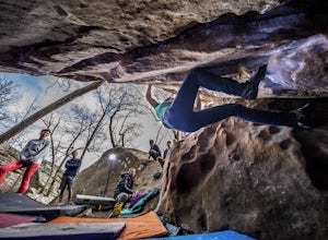
Bouldering Stone Fort, TN
4.50.25 miStone Fort sits atop the Cumberland Plateau just half an hour from downtown Chattanooga, and is one of the premiere bouldering locations in the Southeast. One of the three sites of the annual Triple Crown Bouldering competition, Stone Fort offers a wealth of climbing problems for any climber's a...Read more -
Altamont, Tennessee
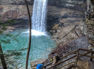
Greeter Falls and Blue Hole
4.91.79 mi / 417 ft gainAn easy, yet extremely beautiful and well marked drive leads to a pretty sizable parking lot at the trailhead. There are multiple trails to hike, depending on how much time you have or how long you want to hike. This particular trail makes for a perfect day trip from Nashville, Chattanooga or Kno...Read more -
Sherwood, Tennessee
Walls of Jericho via Tennessee Trailhead
5.07.74 mi / 1667 ft gainWalls of Jericho via Tennessee Trailhead is an out-and-back trail that takes you by a waterfall located near Belvidere, Tennessee.Read more -
Estillfork, Alabama
Walls of Jericho via Alabama Trailhead
4.55.8 mi / 1417 ft gainAround 5pm, we hiked down the only clearly marked trail that departs from the parking lot. The path begins with gentle switchbacks and great views of the forest, occasionally passing by small waterfalls, sinkholes, and caves; and arriving at the Hurricane Creek crossing (log with handrail) after ...Read more -
Tullahoma, Tennessee
Hike to Rutledge Falls
4.00.4 mi / 3 ft gainFind the trail parking area by following your GPS to “Rutledge Falls Baptist Church”. You will see a small parking area on the side of the road across the street from the church. The path to the falls is extremely short with a steep section to climb down to the base of the falls. This trail is on...Read more -
661-799 Stone Fort Drive, Tennessee
Hike Old Stone Fort Trail
5.02.9 mi / 265 ft gainThe main hiking trail at this small state park follows the wall of Old Stone Fort which was used by the Native Americans as a ceremonial gathering place. The trail threads through dramatic scenery where you can see the original entrance of the fort which was designed to face the exact spot on the...Read more -
Tullahoma, Tennessee
Hike to Lower and Upper Busby Falls
4.82 mi / 275 ft gainShort Springs Natural Area is where these falls are located. There is a decent amount of hiking trails that are a nice getaway for a day to hang out at for waterfalls. Put into your gps "machine falls parking." The gps will take you to the exact parking area. The directions go as follows from Nas...Read more

