Turtletown, Tennessee
Top Spots in and near Turtletown
-
Tallassee, Tennessee
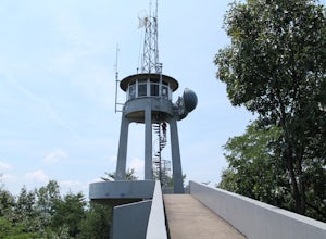
Hike to Look Rock Tower
5.01 mi / 300 ft gainLook Rock tower has spectacular views and is a great hike to enjoy year round. The tower is an old fire tower used for spotting smoke in the valley. Because of this the tower is placed on the highest ridge around making for some amazing views. The only way to get to the tower is along the Foothil...Read more -
Dahlonega, Georgia
Kayak the Chestatee River South of Dahlonega
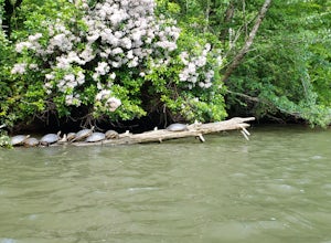
4.0This six mile section of the Chestatee River is a safe, enjoyable float mostly away from civilization. There are several small rapids and bumpy areas (class 1) throughout, with two larger rapids (class 1-2) towards the end of the section. It does get pretty shallow in some sections, so keep watch...Read more -
Franklin, North Carolina
Nantahala National Forest via the Appalachian Trail
4.027.11 mi / 5420 ft gainWinding Stair Gap on Highway 64 is the starting point for this spectacular backpacking trip through the Nantahala National Forest. It's right outside the hiker friendly town of Franklin, NC, so the town is your last chance for a hot meal and any last minute supplies. There is a parking lot at the...Read more -
Tallassee, Tennessee
Abrams Falls Trail
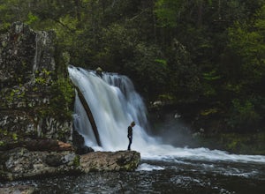
4.84.96 mi / 625 ft gainOne of the biggest perks of hiking Abrams Falls is the drive to get there. The trailhead is located approximately 5 miles into the scenic Cades Cove Loop. Cades Cove is an adventure in itself. Keep your eye out for black bears, deer and wild turkey. If you are taking the self guided auto tour, Ab...Read more -
Townsend, Tennessee
Bike Cade's Cove Loop
4.710.5 miCade's Cove is a valley located smack in the middle of the Great Smoky Mountains National Park. Feel free to drive the 11 mile loop in the day, but if you're really cool, you'll schedule your trip around a full moon so you can bike under the light of night! Allow yourself a few hours to explore a...Read more -
Franklin, North Carolina
Wesser Bald Fire Tower
4.72.36 mi / 807 ft gainThe road leading to the trailhead is rough the last mile, but doable in any car. Just make sure to take it easy going up and be careful, especially if there has been any rain or snow. You will have reached the parking area for the hike once you see a large green Appalachian trail sign and a few...Read more -
Clarkesville, Georgia
Paddle Lake Burton
3.0Lake Burton is, in my opinion, Georgia's most scenic large lake. It is completely surrounded by the Blue Ridge Mountains and has some of the clearest water in the state. Moccasin Creek State Park is a great launching point for all of your paddling adventures, whether you own your own vessel or ...Read more -
Franklin, North Carolina
Backpack the Standing Indian Loop on the Appalachian Trail
24 miBegins at the parking lot for the Standing Indian Campground. (No permits are needed to park here) For the first 3.7 miles, take Kimsey Creek Trail, which runs along the water, until you meet up with the AT at Deep Gap. Rolling hills and lots of foliage throughout, leading up to Standing Indian M...Read more -
Cleveland, Georgia
Hike and Climb to Yonah Mountain
4.94.53 mi / 1417 ft gainThe trail starts at "Mt. Yonah Trailhead" and is 4.4 mile round-trip with elevation of 1,500' to 3,166'. The trail stays below moderate tree coverage until around the halfway point where you will come upon a clearing known as the first LZ (landing zone). The mountain is shared with hikers by Army...Read more -
Cleveland, Georgia
Mount Yonah Trail
4.17 mi / 1430 ft gainMount Yonah Trail is an out-and-back trail where you may see beautiful wildflowers located near Cleveland, Georgia.Read more -
Clayton, Georgia
Camp at Tallulah River Campground
Tallulah River Campground is located in the Chattahoochee-Oconee national forest. It is just outside of Clayton, Georgia. The campground has about 15 spots that are big enough for a small to medium sized RV. Each camping spot also has a nice tent pad for a big tent. Most spots are also on the riv...Read more -
35.604955,-83.770373
Hike to Rocky Top
5.012.8 mi / 3500 ft gainRocky Top is known to be the spot that inspired the famous fight song of the University of Tennessee, which is also an official song for the state of Tennessee. The trailhead for this hike begins in the Cade’s Cove picnic area parking lot towards the back side. There are a few parking spots ri...Read more -
Townsend, Tennessee
Backpack to Spence Field
13.8 mi / 3100 ft gainStart your hike at Anthony Creek Trailhead (elevation 1,800 ft), in the Cade’s Cove area. The trailhead is located at the far end of the day-use picnic area near Cade’s Cove campground. There are a few parking spots right at the trailhead, but note that the picnic area closes at dusk (a gate clos...Read more -
Tiger, Georgia
Hike to Glassy Mountain
5.01 mi / 3415 ft gainIn order to find this hidden gem, you'll have to drive quite a ways up the mountain first, otherwise it is a very steep incline. There will be limited parking at the gate that stops you from driving the whole way up. You will turn onto a road called "Glassy Mountain Rd" and that will be the road ...Read more -
Otto, North Carolina
Hike to and Climb Pickens Nose
4.81.5 mi / 200 ft gainFrom the parking area (fits about 6 cars) follow the trail on the same side of the road up the ridge through dense rhododendron. Several spur trails branch off of the main trail and lead to rock outcroppings with excellent views. Getting to the parking area is slow. The narrow gravel road winds...Read more -
Dayton, Tennessee
Hike through the Laurel Snow Pocket Wilderness
5.06 mi / 900 ft gainThe Laurel-Snow Trail was the first National Recreation Trail designated in Tennessee and at just under 35 miles from downtown Chattanooga, it is perfect for a day hike, for a day of climbing, or for setting up basecamp for the weekend. The 2,000 acre area sits along the Walden Ridge of the Cumbe...Read more

