Luray, Virginia
Looking for the best hiking in Luray? We've got you covered with the top trails, trips, hiking, backpacking, camping and more around Luray. The detailed guides, photos, and reviews are all submitted by the Outbound community.
Top Hiking Spots in and near Luray
-
Stanley, Virginia
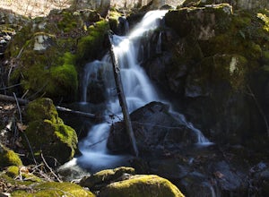
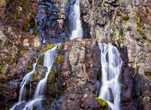
Hike to Naked Creek Falls
3.01 mi / 1000 ft gainPlease note that there is no trail leading to these falls. This hike is for advanced hikers.Park your car at Naked Creek Overlook in Shenandoah National Park and walk through the field staying to the left. As you start to enter the woods you will hear the creek running on your left. Make your wa...Read more -
Stanley, Virginia
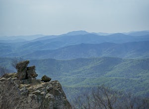
Hike to Bear Church Rock via Bootens Gap
3.59.4 mi / 800 ft gainThe trail leads along the ridge of Jones Mountain to the gorgeous views at Bear Church Rock, and it's the perfect hike for those seeking solitude - didn't see another soul the entire time on a holiday weekend.From the parking lot, head out left on the AT northbound. In .4 miles you will come to a...Read more -
Elkton, Virginia
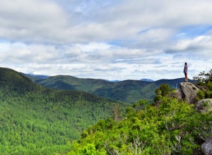
Bearfence Mountain Loop
4.81.04 mi / 220 ft gainThis is one of my favorite hikes in Shenandoah National Park for its views, easy access to the trail, and the option to combine it with a much further hike on the AT. There is also a really fun little rock scramble at the top that scares a lot of people away, but makes for a more secluded summit,...Read more -
Appalachian Trail, Virginia
Hike North Mount Marshall in Shenandoah NP
1 mi / 350 ft gainPark at the Mount Marshall parking area at ~MP 15.6 on the Skyline Drive. From the back of the parking lot, take the white-blazed Appalachian Trail north for a short 0.4 miles to a large rock outcrop with views south. After finished exploring this outcrop, continue on the AT for another 0.1 mil...Read more -
Bentonville, Virginia
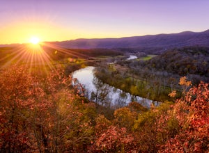
Hike the Shenandoah River State Park Loop
5.08 mi / 650 ft gainShenandoah River State Park is located in the heart of the Shenandoah Valley. The park is full of well-maintained trails great for hiking and mountain biking. The trails both parallel the banks of the river as it snakes through the Shenandoah Valley and through the rolling hills, which provides...Read more -
Madison, Virginia
Hike Bear Church Rock via the Graves Mill Trail
3.58.5 mi / 2250 ft gainStarting at the Graves Mill Parking area, head up the yellow blazed trail that is marked by a big cement marker. The trail will follow closely beside the gorgeous Rapidan River. Hike for half a mile until you come to the intersection of the Staunton River Trail. Turn left (do not cross the river)...Read more -
Madison, Virginia
Fly Fish on the Rapidan River
5.05 miPark at the Graves Mill Parking Area. From here you can easily follow the Rapidan River up the mountain. Fishing reports inform that the lowest concentration of brookies are at the lower boundaries of the park so take some time to enjoy the trail and hike up stream. At the lower boundaries you mi...Read more -
South River, Virginia
Hike to Compton Peak
5.0This unique hike on the Appalachian Trail in Shenandoah National Park is 2.4 miles round trip with an 835' elevation gain, and leads you to two viewpoints as well as a cool rock outcrop.Access this hike from the Compton Gap parking area (elevation 2,145') on the Skyline Drive at Mile 10.4. Cross ...Read more -
Front Royal, Virginia
Explore Skyline Drive In Winter
4.5Skyline Drive is a winding highway that cuts straight through Shenandoah National Park. Being that we are in the south, you will find that the road is closed for the majority of the winter, and usually at the very mention of snow. The first few years of living here it was incredibly frustrating...Read more -
Stanardsville, Virginia
Hike South River Falls
4.54.4 miThe trail head for the South River Falls Trail is located at mile marker 63 off of Skyline Drive via the South River Picnic Area. Loop around the picnic area until you reach the Eastern corner where you will find a sign and a map marking the beginning of the 4.2-mile trail. Over the first mile...Read more -
Basye, Virginia
Orkney Springs Trail
4.94 mi / 1440 ft gainEasy to get to from Bryce resort, Orkney Springs Trail is a moderate to challenging trail. It starts with an easy trail through the woods but does get very steep in mile 2 in what seems like a very rocky dried-out river bed. There is a spectacular view around mile 2. If that's what you’re after y...Read more -
Orkney Springs, Virginia
Hike Laurel Run
6.6 mi / 2100 ft gainThere are two parking spots for this trail. Park at the lower lot if the gate is closed, if the gate is open, continue up the road for another mile until you reach another closed gate. Park here. If the gate is closed you will need to hike a mile up the road to get to the trail head.From the seco...Read more -
Wardensville, West Virginia
Hike Big Schloss
5.04.2 mi / 1000 ft gainBig Schloss (the German word for “palace”) is a popular hike in the George Washington National Forest. The trailhead is conveniently located at the Wolf Gap Campground. To begin, follow the path behind the restrooms at the parking lot. Cross the paved road where you will find a trail map with ...Read more -
Wardensville, West Virginia
Tibbet Knob via Wolf Gap
5.03.17 mi / 702 ft gainPark for free at Wolf Gap Campground and cross the road where you will pass some picnic tables and campsites. Follow the signs to the yellow-blazed Tibbet Knob trail. In half a mile, there is a little path to a summit on your left where you can catch a glimpse of Mill Mountain and Big Schloss. ...Read more -
Wardensville, West Virginia
Camp at Wolf Gap
5.0Wolf Gap is a FREE year round campground located just outside of Woodstock, VA. It is a great base camp for several scenic hikes like the Tibbet Knob trail (trailhead is just across the road) and the popular Big Schloss trail (trailhead begins at campsite number 9) -- super convenient if you hav...Read more -
Wardensville, West Virginia
Big Schloss via Wolf Gap Trail
5.04.27 mi / 997 ft gainBig Schloss via Wolf Gap Trail is an out-and-back trail that takes you by a river located near Lost City, West Virginia.Read more

