Speedwell, Virginia
Looking for the best hiking in Speedwell? We've got you covered with the top trails, trips, hiking, backpacking, camping and more around Speedwell. The detailed guides, photos, and reviews are all submitted by the Outbound community.
Top Hiking Spots in and near Speedwell
-
Traphill, North Carolina
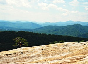
Hike the Stone Mountain Loop
4.5This is a strenuous 4.5 mile hike beginning from the Lower Parking Lot in Stone Mountain State Park (for a 5.2 mile hike, begin at the Upper Parking Lot). From the lot, take the trail by the bathroom. Keep right at the first trail intersection, then left at the second trail intersection to stay ...Read more -
Traphill, North Carolina
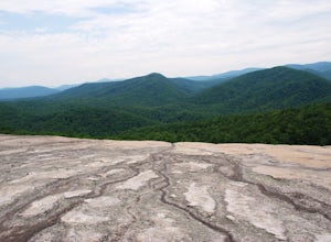
Hike to Wolf Rock and Cedar Rock
5.0This easy 3.0 mile hike begins at the Lower Trailhead Parking Lot at Stone Mountain State Park and includes a 400' ascent to two granite outcrops with nice views. This hike can be combined with the Stone Mountain Loop hike for a 6.5 mile strenuous hike.From the parking lot, walk towards the strea...Read more -
Pearisburg, Virginia
Photograph Dismal Falls
4.50.1 mi / 0 ft gainExplorers in Southwest Virginia run into a common problem: local hikes and waterfalls are often saturated with college students out enjoying a warm day. While it's wonderful to have so many people appreciating the beauty of the Jefferson National Forest, it can be difficult to find a remote, quie...Read more -
Hays, North Carolina
Hike along Basin Creek in Doughton Park
5.011 mi / 1800 ft gainA treasure in North Carolina that doesn't get as much attention as it should, Doughton Park has some of the best trails around. It is the largest park operated by the Blue Ridge Parkway and has over 30 miles of trails available. The parking area for the Basin Creek Trail is small, but rarely cro...Read more -
Creston, North Carolina
Three Top Mountain
4.2 mi / 1260 ft gainThree Top Mountain sits within the same vicinity of Elk Knob. The mountain gets its name from its three prominent rock projections at its peak. The highest point, unofficially named “Big Rock”, is at an elevation of 5020 feet. Prior to the originally named rock peak, you will arrive at Huckleb...Read more -
Purlear, North Carolina
The Lump Trail
4.00.27 mi / 82 ft gainThe Lump Trail is an out-and-back trail where you may see beautiful wildflowers located near Purlear, North Carolina.Read more -
Willis, Virginia
Hike Buffalo Mountain
4.72 mi / 700 ft gainCOVID-19 CLOSURE: Due to Covid-19, this trail will be closed effective April 10, 2020 at 8 PM until June 24, 2020. A short 1.0 mile hike to the summit with 700’ elevation gain, the trail switchbacks steeply up to the exposed rocky summit. To the north you can see Sharp Top and Flat Top at the Pe...Read more -
Narrows, Virginia
Hike Sentinel Point and Mill Creek Falls
5.07.8 mi / 1800 ft gainThere are many trails in the area so here is a map to start out because it can get confusing:http://gilescounty.org/images2/Map-Town%20Farm-Hiking%20Trails%20%282010%29.pdf.From the parking area, keep to the left side of the stream and head up the gravel road. You'll soon come to the Mill Creek ...Read more -
Purlear, North Carolina
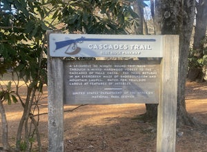
Cascades Trail
5.00.86 mi / 220 ft gainCascades Trail is an out-and-back trail that takes you by a waterfall located near Deep Gap, North Carolina.Read more -
Pearisburg, Virginia
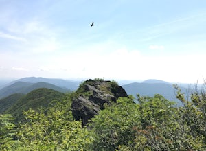
Hike Angels Rest and the Wilburn Valley Overlook
4.6For a tough hike with rewarding views, check out Angels Rest and the Wilburn Valley Overlook. Easily accessible from US-460 near Pearisburg, this hike along the Appalachian Trail gains a total of 1600’ elevation is a 4.6 mile round trip hike. Angels Rest is a large boulder that overlooks the New...Read more -
Saltville, Virginia
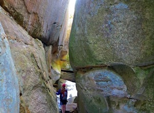
Hike the Great Channels
4.86 mi / 1200 ft gainPark at the parking lot at the crest of Clinch Mountain at Hayters Gap on Rt. 80, and walk along the road (Raven Ridge Road) behind the gate. The trail is fairly easy with minimum elevation gain and follows an old road bed almost the whole way. Be sure to keep to the left when the road splits and...Read more -
Todd, North Carolina
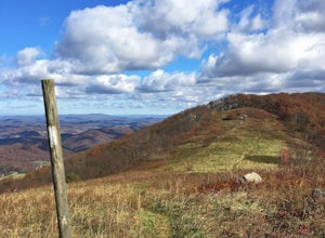
Hike the Elk Knob Summit Trail
5.03.8 mi / 1000 ft gainThere are no bathrooms at the trailhead, so if needed, drive a little past it to the park bathrooms on the left. Park at the summit trailhead and start your hike on the new gravel path. The trail gains 1000 ft in elevation in just under 2 miles so take your time if need be - and bring plenty of w...Read more -
Newport, Virginia
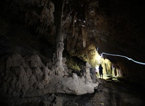
Hike through the New River Cave
4.72 mi / 332 ft gainAfter reaching the parking area, cross the road and continue up the trail for about 0.3 miles. At the kiosk, make sure to register in order to indicate that you are going into the cave. After passing the kiosk and some rocky portions of the trail, you will approach the cave entrance. The cave goe...Read more -
Narrows, Virginia
Rice Fields via Appalachian Trail
5.05.24 mi / 1302 ft gainThis hike begins on the Appalachian Trail just north of Pearisburg, Virginia. To get to the trail head, take Route 460 and turn on to Clendennin Road(Route 641). Take Clendennin road 1.5 miles and then turn left on to Pocahontas road. In about 300ft you will pass a cattle grate and an old barbed ...Read more -
Princeton, West Virginia
White Oak Falls via Brush Creek Falls Trail
3.69 mi / 574 ft gainThis is a wonderfully easy hike to White Oak Falls. After visiting Bush Creek Falls, keep walking down the trail. You'll enter the Bush Creek Nature Preserve area. If you visit after heavy rains, please note that your feet will get wet. There are numerous cascades that come down and cross over t...Read more -
Princeton, West Virginia
Brush Creek Falls
4.50.5 mi / 75 ft gainBrush Creek Falls is a beautiful 25' waterfall that spans across Brush Creek. It is accessed via a short 0.5 mile hike with minimal elevation gain. From the parking area on Brush Creek Falls Road, take the trail to the right of the picnic shelter. This easy and relatively-flat trail through rhod...Read more

