Cougar, Washington
Looking for the best hiking in Cougar? We've got you covered with the top trails, trips, hiking, backpacking, camping and more around Cougar. The detailed guides, photos, and reviews are all submitted by the Outbound community.
Top Hiking Spots in and near Cougar
-
Cascade Locks, Oregon
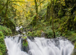
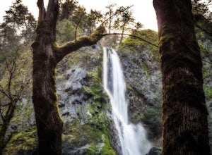
Emerald Falls
2.00.65 mi / 308 ft gainStart at the Wyreth Campground day-use area. If it's closed, park on the side of the road and walk in from the roadway. You'll see an intersection with a wooden bridge crossing the river. Take a few pictures and continue straight on the trail. You'll go about 1/2 mile on the trail until you rea...Read more -
Corbett, Oregon
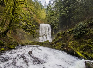
Hike to Upper Bridal Veil Falls
5.00.5 miAt the parking lot for Angel's Rest, turn left uphill on to Palmer Mill Road. Drive for about a mile, and park right past a tributary stream/small waterfall (pictured above) on your left that flows through a small pipe under the road. You will see a small space to park on the right. Park here and...Read more -
Skamania County, Washington
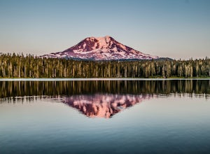
Camp at Takhlakh Lake
5.0Takhlakh Lake is located 7 miles NW of Mt Adams with a 53 site campground on the west side of the lake as well as a day use picnic area.The campground features a boat ramp and a wheelchair-accessible 1.1 mile flat trail, which encircles the lake, and accesses the Meadows Trail that climbs up to t...Read more -
Skamania County, Washington
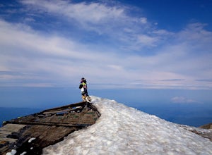
Hike to the Summit of Mount Adams via South Climb
5.012 mi / 6700 ft gainStart by checking in at the Trout Lake Ranger station to pick up a Cascade Volcanoes pass for $10-$15. Continue the South Climb trailhead at the Cloud Cap Campground. Some hikers overnight here for an early start the next day.Sign out a wilderness permit at the trailhead and follow the South Clim...Read more -
Stevenson, Washington
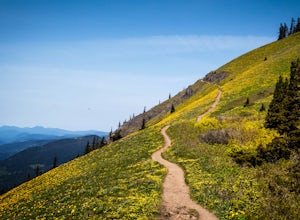
Dog Mountain via Dog Mountain Trail
4.56.53 mi / 2858 ft gainThe Dog Mountain trailhead is located halfway between Stevenson and Bingen. Look for the big signed parking area just after milepost 53 (Eastbound). The parking lot fills up quickly, especially during peak wildflower season, so if you can go on a weekday that would be better. There are 3 trails ...Read more -
Stevenson, Washington
Dog Mountain: The Steeper Route
4.55.55 mi / 2858 ft gainIf you know the Columbia Gorge, you know Dog Mountain. It's the ever-rewarding, incredibly challenging, insanely popular, calf-burning 6.5-mile hike that attracts hundreds of people every weekend, especially during May and June when the wildflowers are in full bloom. If you're like me and you h...Read more -
Portland, Oregon
A Quick Escape to Sauvie Island
3.5During those summer days when you’re desperately seeking some sand between your toes, open space to soak up the sun, and nature to play around in…Sauvie Island is calling your name. Located just 10 miles outside of downtown Portland, Sauvie Island offers a convenient rural escape that’s just begg...Read more -
Cascade Locks, Oregon
Mount Defiance
3.712.55 mi / 5167 ft gainThis hike starts at the Starvation Creek Rest Area. After parking, head west back along the shoulder of the freeway, where you’ll see a wooden sign stating “Mt. Defiance Trail.” Continue heading west along the abandoned Columbia River Highway. Keep going west as you pass the junction with the Sta...Read more -
Cascade Locks, Oregon
Lower Starvation Ridge Loop
3.72.69 mi / 1001 ft gainStarvation Creek Falls is an impressive 190 ft. waterfall just a few feet from the parking lot. If you don't know it's there, you'll miss it. Keep walking past the restrooms, away from the trail head to see this beautiful two-tiered waterfall. There are a couple of picnic tables near the creek to...Read more -
Cascade Locks, Oregon
Warren and Lancaster Falls
4.51.89 mi / 571 ft gainThe hike along Mt. Defiance Trail to Warren and Lancaster Falls is great if you want to get away from some of the more crowded destinations in the gorge, or just want to catch some shade during the summer. The trail is fairly easygoing, though the last 1/4th of a mile to Lancaster Falls is a bit ...Read more -
Yakima County, Washington
Mount Adams Circumambulation
35.1 mi / 8881 ft gain***Before you go on this trek, give the Yakama Nation a call and talk to a Ranger to make sure the trail is open to backpackers or hikers.*** 1-509-865-5121 or 1-509-395-3402 There are a few places you can start this adventure, but starting from the South Climb Trail Head and Cold Spring Campgrou...Read more -
Cook, Washington
Spirit Falls
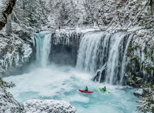
4.01.5 mi / 516 ft gainNOTE: Access to this hike is currently closed. A Part of this hike goes through private land. At this time, the landowner is not granting access to hikers. There are no signs or trail head for the falls, but it's a popular spot for kayakers and photographers, so look for a faint boot path direct...Read more -
Skamania County, Washington
Climb Mount Adams North Cleaver Route
5.017 mi / 7800 ft gainMt Adams is the second tallest volcano in the Cascades and is one of the easiest to climb. There are two main nontechnical routes up Mt Adams, the well-known and crowded route on the south face, and the lesser traveled north cleaver route. The north cleaver offers solitude, views of Rainier, high...Read more -
Skamania County, Washington
Hike to Adams Glacier Meadows
7.5 mi / 1800 ft gainFor the most of the hike, the mountain is hidden behind the firs that surround the hiker as they gain elevation. Because of the dense forest the trail is remains in for most of the hike, it is nicely shaded and pleasant to wander through. At about 2 miles in, the trail leads the hiker into variou...Read more -
Portland, Oregon
Mount Tabor Loop
4.51.88 mi / 325 ft gainMount Tabor City Park is located in the heart of southeast Portland and is situated atop an extinct volcano. It’s comprised of more than 190 acres of beautiful Douglas Fir forest and features several relatively easy routes to the top: the easiest being the road you can drive (but what’s the fun i...Read more -
Portland, Oregon
Powell Butte Nature Park Loop
6.22 mi / 1004 ft gainBefore officially becoming a nature park in 1987, Powell Butte was primarily known for being home to four 50-million gallon underground reservoirs. Today, the wide expanse of land is packed with miles of trails-- the perfect place for hikers, mountain bikers, and even horseback riders to get thei...Read more

