Oak Harbor, Washington
Top Spots in and near Oak Harbor
-
Sequim, Washington
Hike to Royal Basin
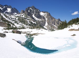
4.715.76 mi / 3409 ft gainIf you're looking for a long day hike or multi-night backpacking trip in the Olympics, add Royal Lake and Royal Basin to your adventure list! The first mile of trail along the Dungeness River gains a gentle 300 feet. When you reach the bridge, do not cross it (the trail across the bridge goes...Read more -
Friday Harbor, Washington
Hike to Lovers Leap on Stuart Island
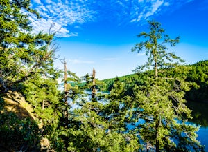
5 mi / 200 ft gainThis hike is only doable if you are already on Stuart Island! There is no public transportation to Stuart Island, so you must already be there or have a plan to be there in order to complete this hike.I frequent this island during the summer months and it is one of my favorites. I always stay in ...Read more -
Friday Harbor, Washington
Kayak Camp on Stuart Island
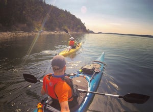
5.0The northwestern-most point of the San Juan Islands, Stuart Island, is arguably the most gorgeous island to circumnavigate. Unfortunately, as Stuart Island is 16 miles away from the closest ferry port, there is no simple way to get there in one day. A couple of options to get there include:1) Onc...Read more -
Quilcene, Washington
Marmot Pass via Big Quilcene Trail
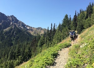
5.010.5 mi / 3481 ft gainThis trail has a nice, steady climb that's perfect for beginner or intermediate backpackers. The first 2.5 miles follow a forest trail along the Big Quilcene River. For the next 3 miles, the trail flows in and out of shaded trees, over a small talus field, and through a meadow before the final ac...Read more -
Quilcene, Washington
Buckhorn Mountain
12.26 mi / 4429 ft gainThe climb to Buckhorn Mountain above Marmot Pass is a must see for every PNW adventurer with the endurance to tackle nearly 14 miles and 4,400 feet of gain. Listen to the rushing waters of the Big Quilcene River as the trail gently traverses up 5.5 miles to Marmot Pass. Be sure to filter water ...Read more -
Quilcene, Washington
Backpack to Marmot and Constance Passes
24 mi / 5200 ft gainThe secret to this trip: Marmot Pass and Boulder Shelter, where you can camp on National Forest Service land. Multiple excellent, large backpacking sites sit just on the edge of the National Park, giving you great access to Mt. Constance and Mt. Deception, two of the tallest peaks in the Olympics...Read more -
Port Angeles, Washington
Camp at Deer Park Campground
5.0Deer Park Campground is really a hidden gem. With an elevation of 5,400 feet, the campground has amazing views of Olympic National Park, making you feel like you are camping above the clouds.There are also several hiking trails in the area that lead to even more spectacular views. Deer Park is on...Read more -
27662-27664 Olympic Highway, Washington
Hike Falls View Canyon
1.5 mi / 300 ft gainThis hike is located immediately off of Highway 101 in the Falls View Campground. If the campground is closed you can park right outside of the gate (but don't block it) and hike in. Inside the gate you will see 3 paths in front of you, take a left and after about a quarter mile you will reach th...Read more -
Port Angeles, Washington
Backpack 1000 Acre Meadows
45.1 mi / 10750 ft gainThere are many different ways to reach 1000 Acre Meadows, but this guide will get you there starting at the Deer Park trailhead (5,400').Day 1: 14 miles You will start out by descending 2,400' and 4.3 miles to reach the Graywolf Camp. This is where the loop meets up with itself later on. Our goal...Read more -
Ferndale, Washington
Take a Stroll through Hovander Homestead Park
5.01.4 mi / 0 ft gainDriving up to the park entrance: take a right to drive towards the barnyards, playgrounds, covered picnic areas, historic house and community gardens, and access to the Snoqualmie River. Or, drive straight and park outside of the fragrance gardens and historic house/ museum, and take a walk to a...Read more -
Brinnon, Washington
Hike to Mt. Walker North & South Viewpoints
3.04 mi / 2000 ft gainDirections: From the Quilcene Ranger Station drive 4.6 miles south on US 101. Watch for the signs for Mount Walker View Point. Turn left onto Mount Walker Road. The trail head is about a quarter mile up the road with pull over parking on the left side of the road. In the winter and early spring, ...Read more -
Mountlake Terrace, Washington
Kayak Lake Ballinger
4.0Getting Here: Heading North on I5 from Seattle Center, take exit 178 for 236th Street SW and Lakeveiw Dr. Take a left on Lakeview Dr. and follow along for a half a mile before you see the Lake Ballinger Boat Ramp parking area on the left. There is a community park and rental facility on the noir ...Read more -
Brinnon, Washington
Hike Lower Big Quilcene River
13 mi / 1800 ft gainWhile this hike does not provide any sort of fantastic views, its does provide an easy ~13 mile roundtrip hike from the trailhead to a parking lot for the Upper Big Quilcene Trail which leads to Marmot Pass. Along the way you will cross several bridges, some large and wide, other simple log bridg...Read more -
Arlington, Washington
Boulder River Trail
4.38.12 mi / 1424 ft gainBoulder River is a great outing for those days when you feel like you just need a good hike through the forest. This makes for a nice long day hike, but because both of the large waterfalls are within the first half of the trail, you can still see the falls without going the whole way. One of the...Read more -
Granite Falls, Washington
Old Robe Canyon Trail
3.69 mi / 771 ft gainNOTE: The trail is currently closed about 1 mile in due to landslides. This trail starts right off the Mountain Loop Highway outside of Granite Falls. Look out for a brick sign with the trail name, as it's easy to miss otherwise. There's parking next to the highway, but since there is a history...Read more -
Port Angeles, Washington
Peabody Creek Trail
5.05.1 mi / 948 ft gainPeabody Creek Trail is an out-and-back trail that takes you by a river located near Port Angeles, Washington.Read more

