Ronald, Washington
Looking for the best hiking in Ronald? We've got you covered with the top trails, trips, hiking, backpacking, camping and more around Ronald. The detailed guides, photos, and reviews are all submitted by the Outbound community.
Top Hiking Spots in and near Ronald
-
North Bend, Washington
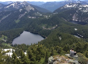
Talapus Lake Trail
3.43 mi / 781 ft gainThe trail up to Talapus Lake is well graded and relatively short, at only about 2.5 miles in length RT. The trail starts off on a wide old road cut and then veers off into the old growth woods in a slowly winding uphill tack. A few mellow switch backs deliver you to the top, where a short stretch...Read more -
North Bend, Washington
Talapus & Olallie Lakes
5.71 mi / 1266 ft gainWith a moderate grade on a wide trail, the hike to Talapus Lake is the perfect introduction to the outdoors for hikers and beginning backpackers. Upon arrival at Talapus, break out lunch or pitch camp. Either way, you can cool off in the large lake. If you feel like pressing on, Ollalie Lake is j...Read more -
Leavenworth, Washington
The Enchantments: Leprechaun Lake via Snow Lake Trailhead
4.719.57 mi / 5948 ft gainThe Alpine Lakes Wilderness named “The Enchantments” draws explorers from all over the world. On a four day backpacking trip you can take day trips from camp to explore over a dozen crystal clear lakes, summit surrounding peaks, and camp at an alpine lake of your choice! Before you set out to c...Read more -
Leavenworth, Washington
The Enchantments Mountain Run
5.018 mi / 6000 ft gainAt the Snow Lake Trail, you start at a elevation of 1400 feet and run up to Nada Lake 5000 feet at 5.6 miles. From here, you make your way to Lower and Upper Snow Lake, 2.2 miles. There are a lot of campsites in this area, but you have to apply to stay the night at these lakes. You will need to...Read more -
Leavenworth, Washington
Winter Camp at Nada Lake
10.6 mi / 3800 ft gainBeing one of the lucky recipients of an Enchantments overnight permit can't happen for everybody. So, for the rest of us, taking to the mountains in the winter is an awesome way to bypass this system and experience the central Cascades in a completely different, colder way. The suffering is almos...Read more -
Leavenworth, Washington
Climb Prusik Peak's West Ridge
18 mi / 5000 ft gainThe Enchantments are an amazing experience in themselves. Yet one of the most striking features of any hike into the core zone of the Enchantments is that of Prusik Peak. This pyramid like spire rises dramatically from the many puddle lakes and boulder fields you pass along your way. With it's...Read more -
Leavenworth, Washington
Hike Fourth of July Creek to Icicle Ridge
12 mi / 4800 ft gainMost adventurers travel down Icicle Creek Road to visit Colchuck Lake and the Enchantment Basin. But, if you're looking for an adventure for a cool summer morning without the crowds, continue past the Colchuck/Stuart forest road and explore this trail! Expansive views of the entire Stuart range...Read more -
Ellensburg, Washington
Hike Manastash Ridge
4 mi / 1700 ft gainManastash Ridge is a popular hike in Ellensburg, Washington, attracting many locals and students of Central Washington University. While attending school, I climbed the Ridge a handful of times, always with struggle. After making my resolution of 40 hikes in 2015, I decided to tackle this hike fo...Read more -
North Bend, Washington
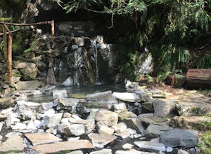
Goldmyer Hot Springs
4.110.48 mi / 817 ft gainGoldmyer Hot Springs is a beautiful little gem nestled within the wilderness of the stunning Cascade Mountains. This hot springs complex is situated on the old remains of a mining town, and delivers steadily flowing water to a set of tiered pools along the mountainside. The “cave” pool at the top...Read more -
Enumclaw, Washington
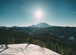
Snowshoe to Sun Top Peak
12 mi / 2000 ft gainFrom Tacoma, Wa. take Hwy 167 to Hwy 410 and follow that until you get to the Chinook Pass Hwy. Then from there follow this road and take the second Service Road on the right and follow this road until it dead ends. The trail starts on NF-7315. You have to walk this road until you reach the first...Read more -
North Bend, Washington
McClellan Butte
5.010.61 mi / 3629 ft gainStarting at the McClellan's Butte Trailhead, right off of I-90 exit 47, head out on the main (only) trail at the trailhad. The first half mile of the trail is quite easy as it meanders through the forest, but don't be fooled or worried, it will get harder. This first half mile has a crossing of a...Read more -
North Bend, Washington
Summit Mt. Defiance
5.011 mi / 3300 ft gainThis hike offers some of the best views one can see in the area. On a clear day, you'll get amazing views of Mt. Rainier. The best part is that as you start heading uphill in the first half mile, you'll get great views of McClellan Butte. Once you reach the summit of Defiance at 5584 feet, you'll...Read more -
North Bend, Washington
Bandera Mountain
4.47.8 mi / 3176 ft gainThis hike has unreal views of Mount Rainier. On a great clear spring day, the mountain is out. It's right in your face. It's incredible. If you tackle this hike in the spring the bear grass and wildflowers are alive and blooming towards the top and it makes for some fantastic picture-taking. Once...Read more -
North Bend, Washington
Mason Lake via Ira Spring
4.26.88 mi / 2316 ft gainIra Spring trail offers up great views prior to reaching the ridge that you go over to reach Mason Lake. The lake itself is an amazing sight—beautiful water with rocks and trees along the shores, making this 6.5-mile roundtrip hike well worth it. The trail to Mason Lake, the Ira Spring trail, pr...Read more -
Enumclaw, Washington
Norse Peak via Silver Creek
7.77 mi / 2405 ft gainStart out in Crystal parking lot A. There is a small and steep trail that heads up the hill labeled as Silver Creek Trail. The trail follows a horse trail for the majority of the route and gets renamed Bullion Basin Trail shortly after you enter the woods, so when it doubt keep following the hoof...Read more -
Skykomish, Washington
Hike Mount Sawyer
8 mi / 1200 ft gainThis trail starts off going through the forest of fir and hemlock for the first mile. Once you reach the top of the first hill, you will get a glimpse of all the views you will have the opportunity to enjoy later on. As you descend, the trees will start to thin out. The trail follows the ridge l...Read more

