Snoqualmie Pass, Washington
Looking for the best hiking in Snoqualmie Pass? We've got you covered with the top trails, trips, hiking, backpacking, camping and more around Snoqualmie Pass. The detailed guides, photos, and reviews are all submitted by the Outbound community.
Top Hiking Spots in and near Snoqualmie Pass
-
Skykomish, Washington
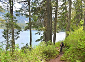
Backpack from Dorothy Lake Trailhead to Snoqualmie Lake
18 mi / 1900 ft gainThe trail was not crowded although when we got to Snoqualmie Lake there were only a couple camping spots left. The trail up from Dorothy is not too hard at all. The weather was perfect. After passing Dorothy you have to ford a creek where the bridge has been washed out. We went through it on foot...Read more -
Skykomish, Washington
Hike to Lake Deer via Lake Dorothy Trailhead
12.6 mi / 1600 ft gainStart off by traveling along Highway 2 and turning towards the Money Creek Campground. Turn off onto Forest Road 6410 and follow that to the Lake Dorothy Trailhead (about 9 miles).This first section of the hike can be pretty crowded on a nice summer day as the trail is very family friendly and it...Read more -
North Bend, Washington
Twin Falls
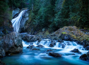
3.32.51 mi / 778 ft gainFor a portion of this 3-mile hike, you'll trek next to the South Fork Snoqualmie River, so take in the peaceful sound of the river running. Along the trail runs a river, where massive boulders create wading pools of icy water for warm summer days. At 1.5 miles, you'll reach a viewpoint bridge, wh...Read more -
Ronald, Washington
Hex Mountain Trail
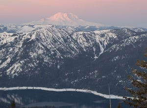
7.36 mi / 2710 ft gainHex Mountain is a steep but rewarding out and back hike/snowshoe with 360 views from the peak. On a clear day you can see Mount Rainier, the Teanaways, the Stuart range, and many other surrounding peaks. Low avalanche risk makes this an enjoyable winter destination for snowshoers and backcountry ...Read more -
North Bend, Washington
Drive Along the Middle Fork Snoqualmie River
5.0Some days you don't need to tackle a grueling summit or long mileage loop, just getting outside the city is enough. Driving forest roads is always an adventure and pays its dividend in seclusion, viewpoints, and peacefulness. The Middle Fork Snoqualmie (FR56) offers a photo enthusiast numerous pi...Read more -
King County, Washington
Teneriffe Falls (Kamikaze Falls)
4.55.64 mi / 1732 ft gainThe lesser known Mt Si Rd trail starts off as a relatively flat road. This continues for two miles until you reach the Teneriffe Falls sign. Upon turning right at this junction, the terrain takes a shift and the incline steepens. This is where most of the elevation is gained. The rest of the way...Read more -
Enumclaw, Washington
Hike to Kelly Butte
3.4 mi / 1100 ft gainAfter a rough drive to the trailhead you’ll have little time to catch your breath as the trail laces up the mountain side, but with Rainier to distract you, it won’t be long until you’re at the top with a view that is more than enough reward for your efforts. Pay very close attention to the drivi...Read more -
North Bend, Washington
Mt. Si
4.67.91 mi / 3241 ft gainMount Si is probably one of the most well trekked hikes around the Seattle area, but one that any hiker-new to the game or an old pro-should experience as least once. I usually use it as a starter hike to kick start the season and highly recommend you get an early start on this one as the further...Read more -
Ronald, Washington
Hike Cathedral Rock and Mount Daniel
5.011.5 mi / 2300 ft gainHike easy switchbacks for almost 2 miles until the trail junction at elevation 4400 feet, then veer right onto trail #1345 toward Squaw Lake and Cathedral Rock. Pass by Squaw Lake on your left (a great place to take a short swim on a hot day) and stay on the trail until you reach another junction...Read more -
Skykomish, Washington
Hike to Big Heart Lake
5.014.6 mi / 3300 ft gainThis hike takes you past 5 lakes and a few different waterfalls, so if you don't wish to push on to Big Heart, you won't be disappointed! Start at the West Fork Foss River Trailhead, about 2.6 miles past the Necklace Valley Trailhead. The first mile is relatively flat. Once you reach the bridge t...Read more -
Skykomish, Washington
Hike to Foss River and Lakes
4.04.2 mi / 2400 ft gainChoose from Trout Lake (1.6 miles each way with 500 feet of elevation gain), Copper Lake (4.2 miles each way with 2400 feet of elevation gain), or Big Heart Lake at 7.3 miles each way, with 3300 feet elevation gain). There are plenty of camp sites if you decide to go overnight at any of the lakes...Read more -
Ronald, Washington
Tuck and Robin Lakes
4.313.94 mi / 4199 ft gainRobin Lakes have been coined "The Little Enchantments", and once you visit, you'll realize the nickname is strikingly accurate. But while the hike up is no Aasgard Pass, it's far from a walk in the park. When you leave the car at the end of the pothole-ridden Salmon La Sac forest service road, y...Read more -
Ronald, Washington
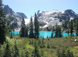
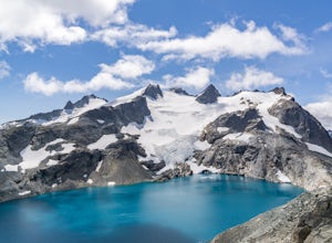
Marmot and Jade Lakes via Deception Pass Trail
5.020.29 mi / 4370 ft gainThe road in is passable with basically any vehicle, though there are some potholes to be avoided. Start at the Deception Pass Trailhead near the parking lot. There is a quick and easy 4.5 miles as you pass Hyas Lake, then you start climbing up to the trail junction for Tuck and Robin Lakes and th...Read more -
Ronald, Washington
Backpack to Circle Lake, Alpine Lakes Wilderness
16 mi / 2800 ft gainStart at the Cathedral Rock Trailhead and start to head up the long switchbacks. After running into the Trail Creek trail, keep right heading towards Cathedral Rock and Squaw Lake. There are a couple nice spots around Squaw Lake, about 2.5 miles in, to stop and have a snack. Now head around the l...Read more -
Ronald, Washington
Climb Mt. Daniel via the Southeast Ridge
5.016 mi / 6000 ft gainFar from the iconic skyline of Seattle, on King County's Eastern boundary, is a lesser known natural skyscraper named Mt. Daniel. At 7960 feet plus, Mt. Daniel's true summit effortlessly juts into the sky as King County's tallest point.From Roslyn, head North for roughly 15 miles on Salmon La Sac...Read more -
Ronald, Washington
Hike to Dip Top Gap
25 mi / 5000 ft gainThis is a great side trip from Backpacking to Marmot & Jade Lakes. Check out the Adventure linked above for directions on how to get as far as Jade Lake. I would recommend 2 nights at either Marmot or Jade to allow for a full day of exploration from your camp. From Jade what is described be...Read more

