Winthrop, Washington
Looking for the best camping in Winthrop? We've got you covered with the top trails, trips, hiking, backpacking, camping and more around Winthrop. The detailed guides, photos, and reviews are all submitted by the Outbound community.
Top Camping Spots in and near Winthrop
-
Twisp, Washington
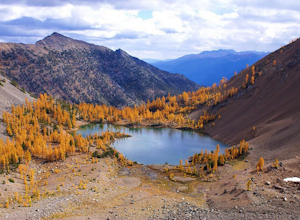
Backpack to West Oval Lake
14 mi / 4100 ft gainThe trail to West Oval Lake begins at the Eagle Creek Trailhead, outside of Twisp, Washington. Follow the Eagle Creek trail for 1.9 miles until the trail splits. Take the left fork for Oval Creek and Oval Lakes. The trail continues winding through thick forest for approximately 4 more miles befor...Read more -
Winthrop, Washington
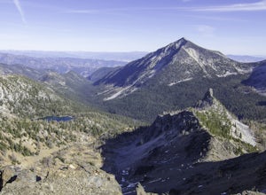
Hike Abernathy Peak
9 mi / 5100 ft gainAbernathy Peak is one of the shortest and easiest peak on the Bulger List, as it's just a walk-up covering around 9 miles and 5100 feet in gain. The trail to starts at the Twisp River Trail, but a few paces after the trailhead, the trail splits and you head left for Scatter Lake. The next 3.5 mi...Read more -
Winthrop, Washington
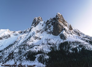
Ski Washington Pass
Because the North Cascades highway usually closes from November to May due to heavy snow and huge slides that bury the road, few people expend the energy to get there, meaning it's one of the only places where fresh tracks are almost guaranteed through the winter and early spring.To start, you'll...Read more -
Winthrop, Washington
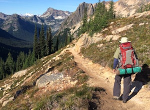
Hike to Cutthroat Pass
11 mi / 2300 ft gainLooking for a distinctive high-country hike just east of the pass? Cutthroat Pass is a hearty day hike perfect for gaining elevation and views with every step. It's even more dynamic as a point-to-point, exiting via the Pacific Crest Trail if you have two vehicles. Also great for a one-night back...Read more -
Chelan County, Washington
Camp at Snowy Lakes
22 mi / 3550 ft gainTake Hwy 20 to Rainy Pass, and park at the trailhead on the east side of the highway. Begin on the Pacific Crest Trail (PCT), heading towards Cutthroat Pass.The trail winds it's way towards the pass at a gentle grade over 5 miles. As the trail ascends, you'll leave the forest behind as you enter ...Read more -
Pacific Crest Trail, Washington
Summit Black Peak
5.010 mi / 4400 ft gainStarting at the Heather-Maple Pass Loop Trailhead, jump onto the trail that will take you counter-clockwise along the loop. After about 1.25 miles, you will come to a split in the trail, take the right path and continue for just under a mile until you reach Heather Pass. Off to the right there ar...Read more -
Winthrop, Washington
Heather-Maple Pass Loop
5.07.5 mi / 2185 ft gainNote to any hikers taking on this trail, this is a non-repeating trail meaning it goes in a big loop. The trailhead has 2 trail points of entrance. To the right (the pathway that is not paved) is the counter-clockwise route, a little less steep and more scenic at the start. To the left, the trail...Read more -
Loomis, Washington
Backpack the Pasayten Wilderness via Horseshoe Basin
5.020 mi / 3500 ft gainPlease consult with the Forest Service for current road and trail conditions, especially of your are planning a trip on the fringes of the season, i.e. early spring and late fall, as conditions may change without notice and this trail is a long ways from anywhere. When planning a trip to Horsesho...Read more -
Chelan, Washington
Chelan Lakeshore Trail
5.018.13 mi / 4478 ft gainMake Note: This adventure requires out-and-back travel via the 'Lady of the Lake' ferry from Chelan, Washington or Field's Point Landing on Lake Chelan. Schedules, fares, and reservations can be made at: http://ladyofthelake.com/ The route described herein utilizes the Lake Chelan Lakeshore Trai...Read more -
Leavenworth, Washington
Spider Gap to Buck Creek Pass
5.034.4 mi / 8317 ft gainBackpacking the Spider Gap to Buck Creek Pass Loop in the Glacier Peak Wilderness is no easy task, but yields some of the most spectacular views found in Washington. Plan for at least four days in order to stay fresh and to allow for extra time to soak in the Cascadian beauty that assaults your ...Read more -
Skagit County, Washington
Pelton Basin Camp
8.82 mi / 2543 ft gainStarting at 3,640 feet elevation, the Cascade Pass Trailhead begins adjacent to the Johannesburg Camp and proceeds east along a relentless series of switchbacks. Though the trail is consumed by a thick Washington evergreen forest, the switchbacks frequently open to sweeping vistas of the far-reac...Read more -
Skagit County, Washington
Climb Sahale Peak via the South Slope Route
5.012 mi / 4000 ft gainTo get to Sahale Peak, drive to Marblemount, WA and continue on the Cascade River Road (Forest Road 15) for 23.5 miles. The road ends at the Cascade Pass trailhead, where the climb begins.The first part of the climb follows the Cascade Pass trail for 3.5 miles and 1,800 feet. Cascade Pass makes a...Read more -
Marblemount, Washington
Sahale Glacier Camp via Cascade Trailhead
5.011.09 mi / 4183 ft gainAs an initial note, to spend an overnight at Sahale Glacier Camp, you need to obtain a permit at the North Cascades Ranger Station in Marblemount, Washington. Permits are limited, so get there early or call in advance. To start, go to Marblemount, WA and then drive ~23 miles east on Cascade Rive...Read more -
Leavenworth, Washington
Scramble Fortress Mountain
5.022 mi / 6000 ft gainThe Approach Starting at the Trinity trailhead you'll hike the Buck Creek Trail towards Buck Creek Pass. The trail is fairly obvious once the snows have melted but if you are going early season (June-early July) you will definitely want to bring a GPS. The trail works it's way up the valley alon...Read more -
Marblemount, Washington
Climb Eldorado Peak via the East Ridge
8 mi / 6800 ft gainStanding on the knife edge summit, the terrain around you plummets steeply into glacier-filled basins that trickle into turquoise alpine lakes. Serrated snowy peaks give way to forest covered valleys below that craft a rugged landscape. Eldorado Peak delivers you atop this wild and mountainous wo...Read more -
Rockport, Washington
Backpack Thunder Creek
10.48 mi / 1027 ft gainThis hike along Thunder Creek in North Cascades National Park is perfect for families and beginner backpackers. The trail is at a lower elevation in the park so it is a great early-season hike, but be sure to check with the ranger station for trail and weather conditions before you go. Starting ...Read more

