

Watch the Sunset from Echo Rock
Twentynine Palms, California
5.0
0.5 mi
/ 200 ft gain
Park your car at the Echo Rock Parking Area. The trail starts next to the outhouse and heads north. As you walk through the sand, there is a large rock pile to your right, the top of that is your destination. Continue walking until you've reached the far north end of the rock formation and then turn right and walk along the northern end of the pile until you find a good spot to start your sc...

Climb the Praying Monk
Phoenix, Arizona
4.3
0.5 mi
Park at the Echo Canyon Parking Area.From the trailhead, hike up Echo trail until your reach the saddle. At the saddle, you will turn south and start taking the climbers trail to the headwall, which is just past the sign that says "caution, active bee area." Once you reach the headwall, there are multiple, easy options to start with. There are two class 4 routes and then to the right of thos...

Ride the Peak to Peak Gondola
Whistler, British Columbia
4.8
From Whistler Village, purchase your Peak to Peak ticket at the main ticket booth (where you can also purchase ski passes and such). This ticket is good for one ride up the mountain, but then you can stay up there as long as you'd like.Once you have your ticket, head over to the Whistler Gondola and be prepared to wait in line. The Whistler Gondola is about a 20 minute ride to the top. Once ...

Hike to John-Suwan Viewpoint
Tambon Ko Tao, Thailand
0.6 mi
This trail is located on the south of Koh Tao. You will want to head to the Freedom Beach Resort parking area. It is located down a hill with clear signs. I parked my motorbike at the top of the hill and then walked down. Across from the resort (opposite side of parking area) is a trail with wooden signs signifying the viewpoint. If you are unsure, the Maps.Me app has the trail marked and ...

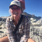
Clouds Rest to Half Dome
Mariposa County, California
18.52 mi
/ 4000 ft gain
Because this is not a loop, you will need to figure out a shuttle situation. There are two options for this:
1. Drive your car to the Tenaya Lake Trail Head, and leave it parked there. Once you reach the Valley you will be car-less, but then the next day you can take one of the free shuttles up to Tuolumne to retrieve your car.
2. Leave your car in the Valley, and take the first shuttle up ...

Snowshoe the Rainbow Lake Loop
Whistler, British Columbia
6 mi
/ 400 ft gain
In Whistler Village, stop by the information booth and get one of the maps that has the mountain bike paths on it. This will be your map of all the different snowshoeing options in the area, and any of the trails are sure to take you on a fun adventure.From Whistler Village make your way to Rainbow Park on Alta Lake. You can get there by either driving your car, or if you're like me and don't h...
Community
Mobile Apps

© 2024 The Outbound Collective - Terms of Use - Privacy Policy