Coquitlam, British Columbia
Top Spots in and near Coquitlam
-
Olga, Washington
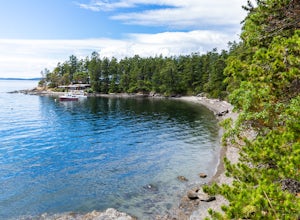
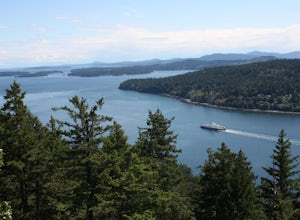
Obstruction Pass State Park is something of a hidden gem on Orcas Island given that its nearby neighbor, Moran State Park, gets most of the tourist attention. What this means is that you can find solitude and quiet, *and* make a visit to the only publicly owned beach on the island.
There are seve...
Read more
-
Olga, Washington
The nine primitive campsites and one Cascadia Marine Trail campsite of Obstruction Pass State Park are the only first come, first serve campsites available on Orcas Island. The campsites themselves overlook a fantastic (and accessible beach) and Obstruction Pass itself.
There are four composting ...
Read more
-
Sechelt, British Columbia
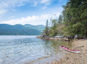
Set off from Sechelt, a small seaside community on the Sunshine Coast - about two hours from Vancouver which is accessed by ferry or float plane.As soon as you start paddling from the harbour in Sechelt, the calm waters are so clear that starfish and other marine life are easily visible beneath t...
Read more
-
Salt Spring Island, British Columbia
From Ganges head south on Fulford-ganes road toward Fulfrod harbour. Turn right on Dukes road then a right on Seymour Heights. Seymour Heights turns into a dirt road, with a number of pot holes but nothing a non 4x4 car can't handle. At the trail head there is a small turn around and not a ton of...
Read more
-
Salt Spring Island, British Columbia
From the Fulford ferry terminal, turn left onto Morningside Drive and follow the road to the end, where you’ll find a small area to park your car. From here, head up towards the subdivision and keep an eye out for the trail marker on your left, located 100m past the gate into Reginald Hills Estat...
Read more
-
Sechelt, British Columbia
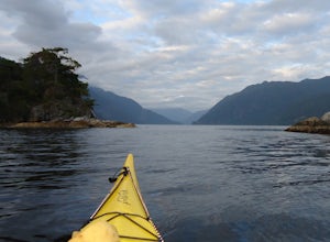
The Sechelt Inlet provides the perfect place for an afternoon adventure or multi-day kayak trip. Kayaks and canoes can be rented from a number of outfitters in the Sechelt area, and many allow multi-day rentals for those keen paddlers.A great place to set off is from Porpoise Bay Provincial Park...
Read more
-
Deming, Washington
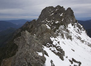
Start by driving roughly 2.5 miles up Forest Road 3040, conveniently named E Church Mt Road, to the trailhead. The road is bumpy, but lacking the pot-holes that occupy many of the other forest roads. The only issue comes at 2 miles in where a stream runs over the road and has eroded a small ditch...
Read more
-
Blakely Island, Washington
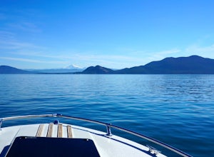
From Washington Park in Anacortes, Washington we launched our 19' Beachcraft with a deep hull into Puget Sound on a beautiful blue sky morning. The weather and water was favorable for an overnight adventure to Blakely Island!
We made our way across Rosario Straight and toward James Island (20 mi...
Read more
-
Fraser Valley E, British Columbia
Even at the parking lot, there is a stunning view of Lady Peak and Mount Cheam. Walk towards the big pile of logs and towards the old logging road. You will also see an outhouse – this will be your one and only time to use a toilet, so go now. The road continues for about 15 min. before reaching ...
Read more
-
Bow, Washington
1.0
7.71 mi
/ 2047 ft gain
The HikeThe hike there isn't short, has several steep sections, and ends at the top of the mountain. There are cliff warnings at the top, so be careful as you explore the view! The steepest portions are at the beginning and right at the end. The trail is very well maintained (because it is so pop...
Read more
-
Bow, Washington
4.3
6.57 mi
/ 1857 ft gain
The trail begins on the Pacific Northwest Trail, which ascends quickly up the side of Blanchard Mountain. The trail contains several switchbacks which wind through second-growth alder, Western red cedar, and Douglas fir forest.
After about one mile there is an overlook with a bench that offers a...
Read more
-
Bow, Washington
The sunset is amazing at Sammish Overlook. The view is the definition of panoramic and you almost have to strain your eyes because there is so much to look at. Plan to arrive before sunset if you want to capture some photos. This is a great "date spot" and you're likely to see couples up here pic...
Read more
-
Deming, Washington
If driving 13 miles on a forest road, and hiking miles of switchbacks doesn't bother you, your in for one of the most exquisite views that you can get from hiking in Washington state.Just a mile outside of the town of Glacier, turn onto Forest Road 37 and follow it up switchbacks for the majority...
Read more
-
Whistler, British Columbia
5.0
19 mi
/ 5708.7 ft gain
This is a very challenging trail! If you are going to carry in a backpack for an overnight hike, you should have a good level of fitness. For a day hike, the trail is nearly 30km long, so still a good level of fitness is required. The trail isn’t technically challenging, but it is up in the alpin...
Read more
-
Whistler, British Columbia
5.0
18.6 mi
/ 5700 ft gain
The Black Tusk is a distinctive landmark just south of Whistler (the remnants of an old volcano). There is nothing else like it, and it is visible from all over the Sea to Sky area.Depending on your experience and fitness level, you can either: climb right to the top of the Tusk (expert hiking/sc...
Read more
-
Whistler, British Columbia
4.8
17.17 mi
/ 5289 ft gain
Take the Sea to Sky Highway (HWY 99) north from Vancouver up towards Whistler. Turn off the highway about 30 minutes before Whistler Village onto Daisy Lake Road. There are signs along the highway indicating the Garibaldi Lake turn off. The trailhead is located at the end of Daisy Lake Road. Ther...
Read more

