East Kootenay G, British Columbia
Top Spots in and near East Kootenay G
-
Canmore, Alberta
4.0
3.1 mi
/ 49.2 ft gain
From the TransCanada highway, take the second exit into Canmore (from either direction), and head uphill on Elk Run Boulevard. At the top of the hill, across from the Iron Goat restaurant, there is a three way intersection, head right across the bridge and take an immediate left into the parking ...
Read more
-
Canmore, Alberta
Wind Ridge is a 7,217 ft / 2,200 m mountain peak near Canmore, Alberta, Canada, with spectacular views into the Bow Valley. The trail is primarily used for hiking and is accessible from May until November.Take the Spray Lakes Road from the town of Canmore for 22km. The trail head is just below th...
Read more
-
Canmore, Alberta
From Highway 1A take the exit to the Alpine Club of Canada. Park near the woodpile as the actual parking lot is for Alpine Club customers. The trailhead about 30 metres up the road from the woodpile.The start of the trail is fairly relaxed but it quickly becomes a steep uphill battle. There are t...
Read more
-
Canmore, Alberta
Important note: trail closure from December 1 - June 15th.Altitude: 2,394m (7,852 ft)Elevation gain: 990m (3,247 ft)Round trip: 6-6.5 hours (15 kms)Heading West from Calgary on Trans Canada Highway #1 - take the Dead Mans Flats overpass, and go South for 1 -1.5 kms until you reach a parking lot. ...
Read more
-
Kananaskis, Alberta
Located on Highway 40 (Kananaskis Trail) and marked by the "Galatea" sign, there's not much more to this hike other than putting one foot in front of the other, but the amount of traffic it sees is a testament to the quality of this hike.Even on the backend of winter the numerous shades of green ...
Read more
-
Kananaskis, Alberta
2.0
9.3 mi
/ 3018.4 ft gain
Make the trek down Hwy. 40 (about 33 km’s) to the trail head - Galatea Day Use Area. It’s very easy to find, as this is one of Kananaskis most popular day hikes. The trail leads into the forest, crossing a suspension bridge and a couple more bridges after that. Due to some flood damage, the bridg...
Read more
-
Field, British Columbia
5.0
12.3 mi
/ 2867.5 ft gain
The trailhead is accessed at the Takakkaw Falls parking lot, and then you walk to the Whiskey Jack Hostel where the trail officially begins (you can not park here unless you are a guest). The well marked trail then begins its very steep ascent through the forest where you will catch glimpses of ...
Read more
-
Kananaskis, Alberta
If you have a topographic map of Kananaskis Lakes, the trailhead is just to the east of Blackshale Creek. If you don't have a topographic map of the area, the Google Maps pin on this adventure will help you get there --- you'll see a pretty large opening on the south side of the road. Luckily, th...
Read more
-
Field, British Columbia
4.0
10.92 mi
/ 2274 ft gain
An 18 km hike with approx 300 m elevation gain, with good variety, several waterfalls, Twin Falls themselves, Twin Falls Tea House (especially if it's open), a walk through a rock field with great views, a dried up lake bed.
Start at the Takakkaw Falls parking lot and follow the well marked trai...
Read more
-
Kananaskis, Alberta
Opal Ridge is located on the East side of highway 40 in Kananaskis.The trailhead starts at Fortress Gas Station. Park at the North end of the parking lot. The trailhead is easy to spot from here. Follow the creek a couple hundred meters till you reach an open area with power lines. Turn left. Con...
Read more
-
Field, British Columbia
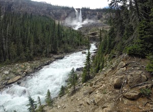
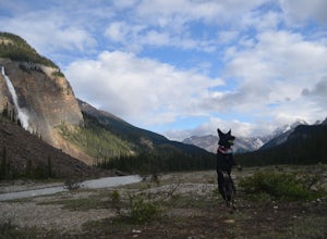
Takakkaw is the third highest waterfall in Canada. Mountain vistas, rushing glacial fed rivers, and waterfalls galore make Yoho a prime destination. This is the nicest drive-to campground around, and with little effort you have a semi-backcountry experience that is accessible to everyone.Take the...
Read more
-
Field, British Columbia
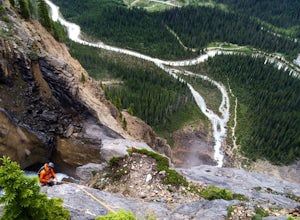
Summit Elevation- 991 ftNamed after Bernie Schiesser and Sid Marty- Park warden at the time- Takakkaw is derived from a cree word meaning “It is wonderful”5.6- 12 pitches- MixedPark in the designated parking area for Takakkaw Falls in Yoho National Park, Follow a paved trail to the base of the wa...
Read more
-
Field, British Columbia
4.0
1.2 mi
/ 196.9 ft gain
This powerful waterfall is unquestionably, one of Canada's largest and most magnificent waterfalls. It falls at around a whopping 381 meters over the sheer cliff of the beautiful Canadian Rockies. The word 'Takakkaw' loosely translates from the language of 'Cree,' into the English phrase, "it is ...
Read more
-
Turner Valley, Alberta
Just off Highway 1 in Kananaskis Country is a beautiful pond that makes for a wonderful spot to enjoy the first light on the Canadian Rockies. Bring warm clothes as this place can be especially cold. Don't forget a camera and a blanket. I recommend going for sunrise as this is when the lighting i...
Read more
-
Kananaskis, Alberta
Drive south on Highway 40 and your adventure begins at Wedge Pond. Parking in the parking lot is easy enough if you're there early enough in the day (before 10:00). The trail up the Wedge starts near the bathrooms, and heads south - not southwest towards the pond. After only a few minutes of walk...
Read more

