East Kootenay G, British Columbia
Top Spots in and near East Kootenay G
-
Banff, Alberta
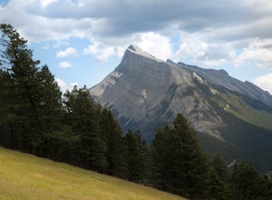
The "Green Spot" is a beautiful grassy slope that opens up to sweeping views of downtown Banff and the surrounding area. It's a great spot for photography, especially capturing the peak of Mt. Rundle. There's also a set of chairs conveniently placed on the slope so you can kick back and enjoy t...
Read more
-
Kananaskis, Alberta
4.0
7.5 mi
/ 2000 ft gain
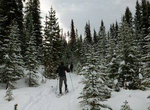
The trailhead to Rummel Lake/Pass is off of Kananaskis Trail (Smith Dorrien Trail) directly across from the turn to Mt. Shark at the south end of Spray Lakes - it will likely be marked by cars attempting the same trail. The trail is well packed and snowshoes aren't even necessary until after Rumm...
Read more
-
Field, British Columbia
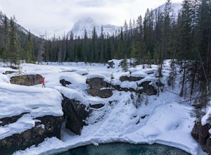
Whether you are traveling north or south on the Trans-Canada Highway in Yoho National Park you will see a sign that directs you west to travel on Emerald Lake Road. When you turn west you will travel about one mile, or 1.6 km, and then you will see the parking area for the Natural Bridge. After p...
Read more
-
Canmore, Alberta
4.1
5 mi
/ 2296.6 ft gain
Start at the Goat Creek parking lot and cross the road towards Ha Ling. There is an access road with a gate on the other side. Walk up the road and across the bridge. From there the trail is obvious and will lead you to the summit. Overall it's a fairly easy hike with switchbacksOnce above tree l...
Read more
-
Kananaskis, Alberta
4.4
4.7 mi
/ 2880 ft gain
This well marked, fun hike that has a bit of everything, from easy forest walking, to steep slabs, minor hands on scrambling, and a scree slope to the summit.From the parking lot, head north up the hill, where the trail begins around the power poles. There a few different paths to start, so it's ...
Read more
-
Kananaskis, Alberta
The trialhead is found on West Side Road on the west side of Spray Lakes Resevoir. In winter, West Side Road is closed to vehicles due to dogsled tours, but is still open to walking - it's a pretty neat experience to get passed by a dozen sled dog teams. Since the road is closed, it adds an extra...
Read more
-
Canmore, Alberta
From the parking lot walk about 350 meters back towards Canmore. At this point you will go down the hill towards Grassi Lakes. From here you have your pick of climbs, be warned though the area is a popular, short hike for locals and tourists. Get there early to enjoy some peace and quiet.You will...
Read more
-
Kananaskis, Alberta
Head to the northwest corner of the parking lot to find the trail. For the first 5.5 km the trail is quite easy, with only modest elevation increase. At 5.5 km you will arrive at what is known as the gravel flats. Depending on the time of year the gravel flats can be either quite dry or a wide, s...
Read more
-
Kananaskis, Alberta
5.0
9.3 mi
/ 1542 ft gain
The trail begins along the berm beside Mud Lake. After a rather uninspiring 3 km (you can mountain bike this part) the trail narrows and enters trees where tangled roots twist across the path and you breathe in the smells of damp earth and moss.Ten minutes later the trail spits you across a spl...
Read more
-
Lake Louise, Alberta
4.6
8.96 mi
/ 1565 ft gain
Starting from the parking lot on the east end of Lake Louise, there are a few options you can take to get to the Plain of Six Glaciers. One is to head directly along the lakeshore trail, and in about 7 km (4.2 miles) you will be at the lookout offering the best vantage point of the glacier field....
Read more
-
Lake Louise, Alberta
4.8
4.58 mi
/ 1260 ft gain
Towering peaks, glaciated valleys, and crystal clear water draw thousands of visitors a year to the shores of Lake Louise in Banff National Park. A short hike takes you beyond the crowds up to Lake Agnes, a beautiful valley surrounded by jagged peaks and golden Larch trees.
At the foot of Lake ...
Read more
-
Lake Louise, Alberta
Fairview Mountain is a non-technical objective alpine summit located on the south side of Lake Louise. It's trailhead is accessed from the Lake Louise parking lot. The trail is well established and well marked throughout. You can expect a distance of about 11km return and elevation gain of 1000m,...
Read more
-
Lake Louise, Alberta
From the TransCanada Highway take the exit for the Fairmont Chateau Lake Louise. Just before you arrive at the hotel there will be a large parking lot on the left. It's best to arrive early as a lot of tourists and locals alike use this parking area for hikes and visiting the the lake.From the pa...
Read more
-
Lake Louise, Alberta
This is a fairly steep, short hike that gives you a great view of Lake Louise. The hike begins right behind the canoe rental shop on the South side of the lake. The trail is very easy to follow and there are quite a few people that hike it. The hike is an hour and half round trip.
The hike leads...
Read more
-
Field, British Columbia
This hike begins at a trailhead 1.5 km (0.9 mi) from Field, B.C., Canada. When heading west on the Trans Canada Highway towards Field, turn right 1.5 km before Field onto a small dirt road. Immediately turn left and continue driving straight for 500 m (0.3 mi) to a small open area for parking at ...
Read more
-
Lake Louise, Alberta
5.0
6.2 mi
/ 1710 ft gain
The hike to Big Beehive begins at the base of Lake Louise.
From the parking lot, hike along the paved trail on the northeastern shore of Lake Louise. The Fairmont Chateau Hotel will be to your right with the lake to your left. Continue toward the junction for the Lake Agnes Trail. Keep right t...
Read more

