British Columbia
Looking for the best photography in British Columbia? We've got you covered with the top trails, trips, hiking, backpacking, camping and more around British Columbia. The detailed guides, photos, and reviews are all submitted by the Outbound community.
Top Photography Spots in and near British Columbia
-
70 Mile House, British Columbia
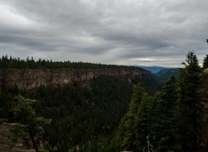
Photograph Chasm Provincial Park View Point
5.0Chasm Ecological Reserve, or Provincial Park is one of those places you have to see for yourself. Some call it the Grand Canyon of British Columbia and its easy to see why once there.This park is the perfect spot to get out for a good stretch on a road trip heading north or south and for the avid...Read more -
D'Arcy, British Columbia
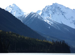
Paddle Duffey Lake
Duffey Lake sits just under Cayoosh Pass on the Duffey Lake Road (HWY 99), one of the most scenic drives in southwestern BC. Leaving from Pemberton, you'll climb just under 4000ft up to the lake, which is nestled between big, steep mountains, with the impressive Joffre group at the southwestern e...Read more -
Comox-Strathcona C, British Columbia
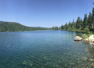
Backpack to Circlet Lake Campground
13.9 mi / 2664 ft gainIf you are looking for a beautiful, stress-free campground nestled in the mountains far from the city but within a morning's drive and a day's walking distance, suitable for the whole family and offers tons of activities, Circlet Lake is the right choice for you. It features an alpine lake that i...Read more -
Kitimat, British Columbia
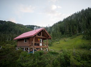
Backpack to Clague Cabin
5 mi / 2300 ft gainFrom the Kitimat Service Centre head north along Enterprise Avenue until you reach the Wedeene Mainline Forestry Road. Continue north along the mainline for approximately 1 km. Turn left and follow the rough road for approximately 2 km. to the trailhead. Trail is gated approx 0.5 km from trailhea...Read more -
Tofino, British Columbia
Explore Tide Pools at Chesterman Beach, Tofino, BC
4.81 mi / 30 ft gainBeyond surfing, skim boarding, biking, and hiking, there are plenty of beaches to comb and coastal tide pools to explore near Tofino BC. The best rocky coastal tide pools are between North Chesterman and South Chesterman beach just 3.6 miles south of the town of Tofino. This area is also known as...Read more -
Pemberton, British Columbia
Tenquille Lake
14.99 mi / 3373 ft gainTenquille Lake is the perfect spot to head from Vancouver if you have the time for a long drive and are looking for a people-less adventure. The hike is a manageable 24km round trip with a 1,000m elevation gain that takes you through wildflower meadows, lush forest, and past some stunning views...Read more -
Whistler, British Columbia
Snowshoe the Rainbow Lake Loop
6 mi / 400 ft gainIn Whistler Village, stop by the information booth and get one of the maps that has the mountain bike paths on it. This will be your map of all the different snowshoeing options in the area, and any of the trails are sure to take you on a fun adventure.From Whistler Village make your way to Rainb...Read more -
D'Arcy, British Columbia
Overnight at Keith's Hut
2.05.6 mi / 1312.3 ft gainStarting from the side of the highway outside of Pemberton, continue towards Duffy Lake past Joffre Lake trail head. Cross the Cayoosh Creek bridge and pass the work sheds on your right with a green roof, 3.3km from this is a shoulder and between no-stopping avalanches areas, you will see a pull ...Read more -
South Hazelton, British Columbia
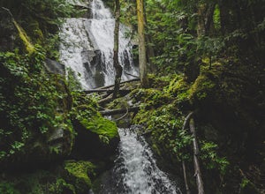
Hike the New Hazelton Lookout and Waterfall Trail
4.01.2 mi / 49.2 ft gainThis waterfall almost looks like it belongs in Oregon or Washington but instead its in Northern British Columbia in a cute little mountain town. The hike is an easy, gradual and well maintained trail. To get to the trailhead drive to the end of Laurier Street in New Hazleton and you'll see the s...Read more -
Lillooet, British Columbia
Camp at Cottonwood Recreation Site
5.0Located 3+ hours North of Vancouver on Duffey Lake Road (Highway 99), Cottonwood Recreation Site is one of 4 sites managed by the BC Forest Service. Duffey Lake Road is an extension of Highway 99 and connects Pemberton to Lillooet.If you plan on hiking or backcountry camping at Joffre Lakes, you...Read more -
Sea to Sky Gondola, British Columbia
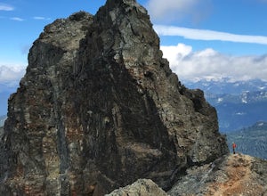
Scramble Sky Pilot
4.010 mi / 3800 ft gainSky Pilot Mountain is the highest peak past Stawamus Chief, Squamish's famous vertical rock face. Luckily, the rock just beyond the Chief is just as beautiful and reliable for climbers, hikers, and scramblers looking to stretch their legs and challenge their vertigo limits on an exposed, thrillin...Read more -
Whistler, British Columbia
Backpack Helm Creek
11.2 mi / 3000 ft gainStart your drive by driving up the Cheakamus Lake forestry road to the parking lot (approximately 7km up the road). From the parking lot, start walking down the trail towards Cheakamus lake. About 2km down the trail, you will see a sign post indicating that you can continue straight to Cheakamus...Read more -
Bowen Island, British Columbia
Snowshoe to Black Mountain and Eagle Bluffs
5.6 mi / 1312.3 ft gainEagle Bluffs is a perfect hike for anyone looking to get away but not too far from the city! Your trip will start by grabbing your (free) backcountry pass from the Black Mountain lodge in the lower parking lot at the top of cypress bowl road. This is not the main lodge (Cypress Creek Lodge), but ...Read more -
West Vancouver, British Columbia
Snowshoe to St. Mark's Summit
1.08 mi / 1500 ft gainIf you are looking for the perfect snowshoe adventure you've found the right place. St. Marks is located on Cypress Mountain. It is more difficult than the nearby Hollyburn, and sometimes inaccessible due to heavy snow. For those two reasons makes it the most secluded hike just minutes from downt...Read more -
Columbia-Shuswap B, British Columbia
Hike to Broken Bridge Falls
1.03.1 mi / 82 ft gainTo get to Broken Bridge Trail head follow the switched back road of Meadows in the Sky Pkwy up through Mt Revelstoke National Park. Make sure to get a trail brochure at the park gate this will help as the directions are easier to understand while reading the map on the brochure. Make your way up ...Read more -
Whistler, British Columbia
Hike along the Whistler Valley Trail Lit Section
1.2 mi / 164 ft gainThe best place to start you adventure on the Valley Trail at night is at the Whistler Golf Club - Directly across highway 99 from the whistler conference centre. From the parking lot (pay attention to pay parking times), walk west towards the clubhouse, where you will find the entrance to the Val...Read more

