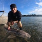
Fort George Canyon Trail
Fraser-Fort George C, British Columbia
Details
Distance
6.25 miles
Elevation Gain
1050 ft
Route Type
Out-and-Back
Description
Added by Kaila Walton
Fort George is a beautiful Canyon with big and small volcanic rock islands.
The hike to Fort George Canyon is relatively flat for the first half of the hike and then gradually starts to descend into the canyon with the final stretch a switchback trek right to the water.
It starts out walking through a cut block for around 2km and then you head into a lush green forest full of wild roses, bunchberry, ferns, alder, fireweed and many other plants. There are a few boardwalks over swampy bodies of water that can get slippery when wet so walk over them carefully. Luckily most of this hike has cell phone service so if there is an emergency it is easier to get a hold of the emergency services. Always remember when you are in Northern BC it is bear and cougar country so be vigilant while you are anywhere away from civilization.
During late summer when the Fraser River water level is low you are able to walk to some of the islands in the middle of the big river. Always use caution when walking through a river, especially one the size of the Fraser River.
Fort George Canyon and the area have a rich history. In the early 1900s the only access to Northern BC was via the Fraser River. Steam paddle wheelers were used to travel up the river and they had to navigate through the canyon. Which, at the time, was quite a treacherous task. Here is an excerpt from the BC Parks site about the history of the Fraser River and this specific area. "The Fraser River is designated as a Canadian Heritage River and Provincial Heritage River. As the largest river in British Columbia, and the most productive salmon fishery in the world, the Fraser River has played a major role in supporting human life along its length. Locally, Fort George Canyon was an important fishing site for First Nations peoples. The river was an important route for early explorers. In more recent years, the river was used as a route for transportation of people and resources. Fort George Canyon was one of the few obstacles along the river in north central British Columbia. In the early 1900’s sternwheelers would have to be winched through this treacherous section of river while passengers would have to
portage."
Google Maps directions to the trail head from downtown Prince George BC can be found here.
Directions from Prince George: Take Highway 16 West to the Blackwater Road. Turn left onto the Blackwater Road. Follow it for about 11.3 km and turn left onto the West Lake Road. Continue on West Lake Road for 9.7 km. Turn left onto an unnamed road. There will be a sign saying Fort George Canyon 2km with an arrow pointing left. Follow this road for approximately 2 km to a parking lot. The hiking trail is approximately 5 km (10-12km round trip) to Fort George Canyon, another 2 km added if you follow a side trail to a better lookout of the canyon. There is a pit toilet near the trail head if you need to use the washroom before hiking.
Download the Outbound mobile app
Find adventures and camping on the go, share photos, use GPX tracks, and download maps for offline use.
Get the appFeatures
Fort George Canyon Trail Reviews
A little more than a beginner hike as it is quite long. Be prepared for a long beautiful hike. Bug spray is a must!
3.0
If you are a beginner or advanced hiker you can do this hike. If you are a beginner I would recommend planning on around 5 hours round trip including stopping and lunch. Take 2-3 litres of water because it isn't readily available. The area is so beautiful and worth it though!! You won't regret the hike! I loved it even though my legs are starting to get pretty sore a day and a bit later! haha
5.0
Leave No Trace
Always practice Leave No Trace ethics on your adventures and follow local regulations. Please explore responsibly!
Nearby
Explore Hixon Falls
Ferguson Lake Loop
Ridgeview Lake Loop
Swim at The Rock Quarry
Teapot Mountain
Photograph Sunrise at Pinnacles Provincial Park
Community
© 2024 The Outbound Collective - Terms of Use - Privacy Policy


