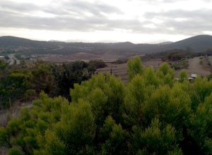
Aguanga, California
A top choice for outdoor adventures in Aguanga, California is the Pacific Crest Trail. This must-visit hiking trail spans a significant portion of the state, offering scenic views of the diverse California landscape. Hikers can enjoy views of the nearby Lake Riverside and the Cahuilla Creek Casino, both located within Aguanga. The trail is moderately difficult, making it suitable for most hikers. Unique features of the trail include the vast array of rock formations and the opportunity to spot local wildlife. The Pacific Crest Trail is one of the best trails and outdoor activities in Aguanga, California. It's an ideal spot for those seeking to explore the great outdoors and enjoy the natural beauty of the area. Whether you're a seasoned hiker or a beginner, this trail has something to offer everyone.
Top Spots in and near Aguanga
-
Palm Springs, California
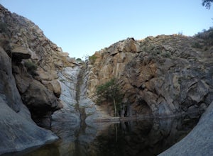
South Carl Lykken Trail - North Section
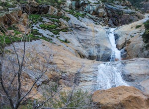
3.42 mi / 1076 ft gainSouth Carl Lykken Trail - North Section is an out-and-back trail that takes you by a waterfall located near Palm Springs, California.Read more -
Palm Springs, California
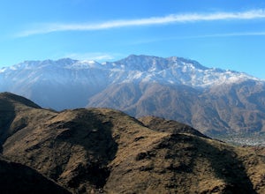
Earl Henderson and Shannon Trail Loop
4.31 mi / 1257 ft gainThis is a short but sweet trail close to the Araby and Garstin Trails. Great views of Palm Springs and the San Jacinto Mountains. Parking area is off of Lansdale Street. From here, head down the Earl Henderson Trail and you will see where in connects with the Shannon Trail. You can choose to swit...Read more -
Poway, California
Relax at Lake Poway
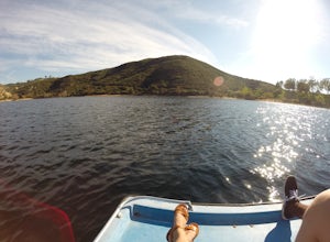
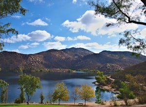
4.0It costs $5 to enter the park and they are open 6am to sunset everyday. There is plenty of parking and this park is huge! This place has so many outdoor recreational activities such as fishing, hiking, running, archery, feeding ducks, or just having a picnic. With so many possibilities in this on...Read more -
Poway, California
Mount Woodson and Potato Chip Rock
4.66.45 mi / 900 ft gainMt. Woodson is located in Poway's most eastern region and is one of San Diego's most popular and most iconic hiking trails. Known for its grand photo opportunistic "Potato Chip Rock", Mt. Woodson is a 7.5mi out-and-back trail with amazing vistas, convenient rest stops and breathtaking views. The...Read more -
Ramona, California
Cedar Creek Falls
4.85.52 mi / 1024 ft gainThe trail to Cedar Falls starts out at a hill in a residential area and ends in an unexpected spot where there is a beautiful waterfall complete with a swimming hole. Surrounded by 75-foot-high cliffs, a magnificent waterfall splashes into a pool known as the Devil’s Punch Bowl. Hikers have been ...Read more -
Palm Springs, California
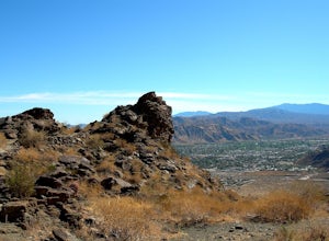
Araby Trail
4.58 mi / 1545 ft gainThis hike takes you up to Bob Hope’s massive mushroom shaped house. The neighborhood also includes a house where Steve McQueen lived and the Elrod House featured in the James Bond film “Diamonds are Forever”. It’s a fairly easy hike up to Bob’s but really climbs after you pass the estate. You c...Read more -
Palm Springs, California
Araby and Berns Trail Loop
4.76 mi / 1293 ft gainAraby and Berns Trail Loop is a loop trail that takes you past scenic surroundings located near Palm Springs, California.Read more -
Palm Springs, California
Murray Hill via Araby Trail
5.08.85 mi / 2844 ft gainMurray Hill is the highest point in the surrounding trail system. You can access it from Araby Trail or anyone of the others in the area. It's about 9 miles round-trip and a healthy 2,850 vertical feet gain. From the top of the Shannon Trail bear right until you reach the Wildhorse Trailhead. Go...Read more -
Palm Springs, California
Skyline Trail to Aerial Tramway Top Station
5.09.41 mi / 8238 ft gainSkyline Trail to Aerial Tramway Top Station is a point-to-point trail where you may see beautiful wildflowers located near Palm Springs, California.Read more -
Palm Springs, California
Museum Trail
1.52 mi / 860 ft gainThe Museum Trail is a very steep climb with a 1,000 feet elevation gain in just one mile but has some great views of downtown Palm Springs. The hike starts behind the Palm Springs Art Museum. This trail can also access the Cactus to Clouds Trail that goes all the way to the top of Mt. San Jacinto...Read more -
Palm Springs, California
North Lykken Trail from W. Crescent Drive
1.67 mi / 906 ft gainNorth Lykken Trail from W. Crescent Drive is an out-and-back trail that takes you past scenic surroundings located near Palm Springs, California.Read more -
Ramona, California
Iron Mountain Peak Trail
4.15.67 mi / 1030 ft gainIron Mountain is the longest wilderness trail in Poway, CA. The parking lot is free and provides bathroom and water fountain amenities. The distance from the parking area to the summit is approximately 3.2 miles. Beginning with a wide smooth trail, slowly transitioning into semi-technical incline...Read more -
Cabazon, California
Check Out the Cabazon Dinosaurs
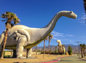
4.3For any fans of Pee-Wee’s Big Adventure or The Wizard, the Cabazon Dinosaurs are instantly recognizable. A roadside attraction off of Hwy 10 - 90 miles east of Los Angeles - the dinosaurs, heralded as the “World’s Biggest Dinosaurs", are a quick adventure.To get to the dinosaurs, you’ll travel on...Read more -
Santa Ysabel, California
Three Sisters Falls
4.93.42 mi / 906 ft gainThree Sisters Falls is by far the best hike, for the most reward, that I've gone on in the close vicinity of San Diego. Only a short hour and a half drive from downtown San Diego, the hike offers all the draws of a National Park: remote wilderness, strenuous hiking, scenic mountain views, and ama...Read more -
Poway, California
Catch a Sunset at Twin Peaks Mountain
2 miStart by parking at Silverset Park. You will see the trail head for Twin Peaks just behind the park. Park outside of the park if you think you'll be staying past sunset, as the park gates close at dark! Once you spot the trail head, veer left to the path heading up towards the peaks. You will eve...Read more -
San Diego, California
Black Mountain Peak via Miner's Ridge Loop Trail
2.54.3 mi / 951 ft gainThe Miner's Ridge Loop Trail is a relatively mild 4.3-mile loop that takes you to the 1554-foot summit of Black Mountain Peak. Even from the parking lot, the views to the east are stunning. Get there early in the morning on a clear day, or arrive just before sunset to get the full experience. T...Read more

