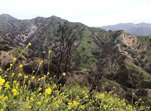
Azusa, California
Looking for the best hiking in Azusa? We've got you covered with the top trails, trips, hiking, backpacking, camping and more around Azusa. The detailed guides, photos, and reviews are all submitted by the Outbound community.
Top Hiking Spots in and near Azusa
-
Azusa, California
Summit Mt. Baden-Powell
5.07.86 mi / 2808 ft gainThis well maintained and well traveled trail is a popular route with day hikers, backpackers, and Pacific Crest Trail through hikers. Since the trail is on the face of the mountain, snow may linger late into the season. The Pacific Crest Trail is clearly marked on the western corner of the Vinc...Read more -
Los Angeles, California
Secret Swing in Elysian Park
4.20.16 mi / 360 ft gainFor the most direct directions to the swing, plug in "Swing on top of Elysian Park" into google maps, which will take you directly to the trailhead. If you want to do it the more old fashion way, the swing is on top of a hill at the intersection of Angels Point Drive and Park Row Drive in Elysian...Read more -
Glendale, California
Mt. Thom and Tongva Peak
6.06 mi / 1480 ft gainMount Thom and Tongva Peak are accessed by using the 6.2 mile out and back trail, Las Flores Motorway located in the north part of Glendale, CA. Roadside parking is not allowed near the trailhead, you will need to park in the nearby residential area along Sunshine Drive about 0.15 miles away from...Read more -
Chino Hills, California
Adobe Loop
3.01.92 mi / 312 ft gainThe best place to park for this hike is at Hunter's Hill park. From there, the trailhead is located on Natalie Road just South of the park. There is a large sign marking the start of the trail, but it does not give a name for either the trail head or the trail itself. For reference, it is the But...Read more -
Glendale, California
Beaudry Loop
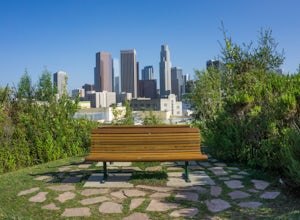
5.79 mi / 1572 ft gainThe Beaudry Loop trail features a bench at the top with 360 degree views of the greater LA area. The trailhead is a little hidden on Beaudry Blvd. As Beaudry Blvd turns into Beaudry Terrace, you'll see cars parked at the paved trailhead. There is very little shade on the trail so bring ample sun...Read more -
Pearblossom, California
Devil's Punchbowl and Devil's Chair
4.57.37 mi / 1870 ft gainWhat a hidden gem! A martian landscape full of faultline desert rock formations and joshua trees against a mountainous backdrop of the San Gabriels. Devil's Punchbowl Natural Area features a 1 mile well-marked, well-maintained single track loop trail inside the Punchbowl (great for kids) and a 7 ...Read more -
Los Angeles, California
Elysian Park
4.01.88 mi / 282 ft gainThe trail at Elysian Park in Los Angeles, California, is a moderate difficulty hike that spans approximately 1.88 miles. The trail is well-marked and offers a variety of terrain, including dirt paths and paved roads. The trail is known for its panoramic views of the city, including the iconic Dod...Read more -
Valyermo, California
Blue Ridge Trail via Inspiration Point
4.97 mi / 692 ft gainThere are two trail heads for the Blue Ridge Trail, one via the Grassy Hollow Visitor Center, and the other across from Inspiration Point. When parking gets crowded over at Grassy Hollow Visitor Center, than parking at Inspiration Point is the better option. To access the Blue Ridge Trail from In...Read more -
Los Angeles County, California
Big Tujunga Canyon Lookouts
1.22 mi / 453 ft gainPark at the Condor Peak Trailhead, please note that this trail head is unmarked so keep your eyes peeled on the right side of the turnout for a small single track trail. The trail gradually climbs along the side of the canyon until reaching a 4 way intersection. To your left and to your right wil...Read more -
Los Angeles, California
Secret Stairs Astro Loop
2.34.21 mi / 600 ft gainI learned about these remnants of Los Angeles history, just a few months ago. When I found myself in L.A. this past month, I decided to find some of these stairs, and find out what they’re all about. Back in the 1920’s these stairs were created for pedestrians to have direct routes to the trans...Read more -
Los Angeles, California
Vista Hermosa Natural Park
4.20.58 mi / 36 ft gainVista Hermosa Natural Park is part of the Santa Monica Mountains Conservancy and the Mountains Recreation and Conservation Authority. Located in the western gateway to Downtown Los Angeles, it’s very easy to drive by this hidden gem if you’re not looking for it. This park is the perfect mix of ur...Read more -
Los Angeles, California
Silver Lake Reservoir Trail
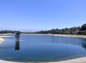
3.02.18 mi / 79 ft gainSilver Lake Reservoir Trail is a loop trail that takes you by a lake located in the Silver Lake neighborhood of Los Angeles, California. This urban escape is used by people running, walking, and birding. The trail is stroller-friendly, so you may see parents along the trail with their younger fam...Read more -
Wrightwood, California
Snow Hike Lightning Ridge
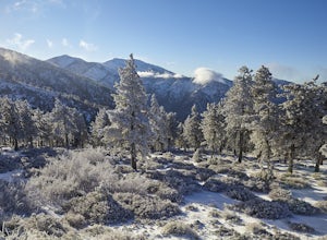
5.1 mi / 900 ft gainWhen you hear the report about snow in the San Gabriels, it's time to plan this hike!Only a short 90 minute drive is all that separates nearly a third of California's population from high-altitude snowy adventures. This isn't about Yosemite, but Southern California's very own San Gabriel Mountain...Read more -
Los Angeles, California
Beacon Hill via Coolidge Trail
5.02.84 mi / 587 ft gainThe starting point for your run is at the Griffith Park Southern Railroad. From the parking lot walk east crossing Crystal Springs Drive and find the Coolidge Hiking Trail. Begin running up Coolidge Trail toward Upper Beacon Trail making sure to stay straight at the first intersection (0.2 miles)...Read more -
Glendale, California
Brand Library Loop
5.06.56 mi / 2648 ft gainYour adventure will start at the Brand Library parking lot. Walk behind the library towards the gated day use area and you will find the start of the trail on your right, Las Flores MTWY. The first half-mile rises over 500 feet to a plateau, equipped with benches, a park map and views of Griffit...Read more -
Los Angeles, United States
Verdugo Crest Trail
4.06.71 mi / 2510 ft gainThe Verdugo Crest Trail is a 6.6 mile loop near Glendale, California. The trail features lovely wildflowers in the spring and beautiful views year-round. The trail is steep, so make sure you are wearing sturdy running or walking shoes. Dogs are allowed on the trail but must be kept on leash. Va...Read more

