California
Looking for the best backpacking in California? We've got you covered with the top trails, trips, hiking, backpacking, camping and more around California. The detailed guides, photos, and reviews are all submitted by the Outbound community.
Top Backpacking Spots in and near California
-
Mammoth Lakes, California
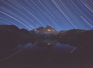
Backpack to Garnet Lake
5.014 mi / 2030 ft gainAlthough this trip specifically describes how to get to Garnet Lake, there are several other pristine alpine lakes (Shadow Lake and Thousand Islands Lake) along this looped trail, only a few short miles away from each other, that are just as worthy if you have the time. A minimum of 3 days/2 nigh...Read more -
YOSEMITE NATIONAL PARK, California
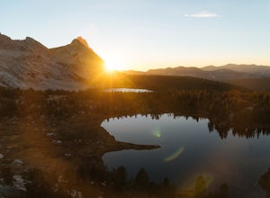
Young Lakes
4.714.14 mi / 1700 ft gainThe Young Lakes trail starts from the Lembert Dome parking area and then winds up around 6 miles into the high country past alpine meadows and stunning views of the surrounding mountains. Lower and Middle Young Lakes are beautiful, but you're going to want to push on to Upper Young Lake, where y...Read more -
Yosemite National Park, California
Buena Vista Lake via Chilnualna Falls Trailhead
24.64 mi / 5453 ft gainHiking and camping at Buena Vista Lake is a beautiful way to see the south side of Yosemite… the name says it all. With beautiful 360 degree views from Buena Vista Peak you get to look at the backside of Half Dome, up to Clouds Rest and all the domes and peaks in-between. You can reach the trail...Read more -
Shasta County, California
Seven Lake Loop in Lassen Volcanic NP
11.54 mi / 1545 ft gainThis hike is one of my favorites for when I only have a weekend to get my nature fix. To start off, visit either the Loomis Museum, Loomis Ranger Station, Butte Lake Ranger Station, Kohm Yah-mah-nee Visitor Center, Warner Valley Ranger Station, or Juniper Lake Ranger Station and pick up a wildern...Read more -
Kyburz, California
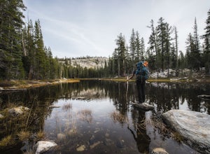
Hike the Grouse, Hemlock, and Smith Lake Trail
5.0Starting from the Wright's Lake parking area, walk past the service gate to find the loop trail. Follow the loop trail to the signed trail for Twin, Grouse, Island, and Hemlock Lakes heading toward the right. You will begin an approximate 150 foot ascend before coming to a saddle. Another 150 foo...Read more -
Madera County, California
Ediza Lake via Agnew Meadows
4.013.54 mi / 1804 ft gainStart at the Agnew Meadows Trailhead. You will need to arrive before 7:30AM or take the Shuttle from Mammoth Mountain. Start out by heading north on the John Muir Trail. You will pass Shadow Lake; walk around the south side of the lake for mountain views. Then, follow the trail up Shadow Creek u...Read more -
Madera County, California
Ansel Adams' Garnet Lake
5.014.46 mi / 2717 ft gainGarnet Lake is one of the premier stops along the Pacific Crest Trail. However, even if you don't have time for an entire thru-hike (like most of us), this beautiful lake is still easily accessible as an overnight trip! While there are many possible routes for reaching Garnet Lake, the Agnew Me...Read more -
Trinity Center, California
Backpack to Bear Basin and The Four Lakes Loop
30.1 miDay 1 Swift Creek Trail Head to Bear BasinThe trip begins at the Swift Creek trailhead in the Trinity Alps Wilderness. Permits are very easy to get, just stop by the Ranger station in Weaverville, CA. They are free and can be self-issued in front of the ranger station, or you can go in if you wou...Read more -
Highway 108, California
Backpack to Blue Canyon Lake
5.03.6 mi / 1280 ft gainTrailhead Coordinates: 38º 19'08.46"N 119º39'49.26"W Elev 8897ftThe trail is kind of tricky to find. It is West of the PCT trailhead at Sonora Pass and it is not marked. You park along the side of Hwy 108 and scramble down an embankment where a creek flows at the bottom. Cross this creek and you ...Read more -
Mariposa County, California
Backpack to Clouds Rest from Glacier Point
4.023.85 mi / 6942 ft gainStart from Glacier Point around 7,200 feet leaving on the Panoramic Trail. Head down 2 miles to Illilouette Falls (5,800 feet). Once you cross the bridge at Illilouette Falls you go up Panorama Point and head back down to Nevada Falls (5,971 feet). Once you reach Nevada Falls fill up on as much w...Read more -
Riverside County, California
Backcountry Camp in Joshua Tree
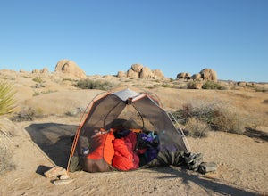
5.02 miBackcountry camping can be done at various locations throughout the park (13 different locations). Upon arrival to the park, you will be given a map and can backcountry camp from any of the locations marked with a "B".At these locations you will find a backcountry registration board. It's extrem...Read more -
Madera County, California
Backpack the Shadows of the Minarets Loop
5.016 miAnsel Adams Wilderness is located in Mammoth Lakes, California. The trail to Lake Ediza is frequently traveled and is usually completed as an out-and-back day hike. In the summer, from 7am-7pm the road to the trail head is inaccessible to cars. To reach the trailhead you must take the shuttle fro...Read more -
Inyo County, California
Backpack Mount Langley
5.021 mi / 4000 ft gainMt. Langley sits four hours north of Los Angeles and is one of the easier 14ers to bag in California. Mt. Whitney absorbs most of the foot traffic, so enjoy the relative quiet and seclusion.The trailhead starts at Horseshoe Meadows/Cottonwood Lakes Trailhead Campgrounds and meanders for 7.5 miles...Read more -
Three Rivers, California
Backpack the Little Five & Big Five Lakes Loop
5.026.5 mi / 10000 ft gainDay 1: A long, rewarding day. Over the course of 11.5 miles you will complete around 10,000ft of elevation change. To start, park the car at the Sawtooth-Monarch Trailhead (7500ft) and begin on the trail, immediately ascending to Timber Gap (9500ft). Once at the gap, the trail makes it's way do...Read more -
YOSEMITE NATIONAL PARK, California
Dewey Point via McGurk Meadow Trailhead
5.07.51 mi / 300 ft gainBefore you start, be sure to visit the Yosemite Valley Visitor Center and grab an overnight permit. More info on this at nps.gov. This trail meanders through beautiful, dense meadows full of wildlife - watch for bears! When you're not hiking among the wildflowers and babbling brooks, you're enc...Read more -
Lakeshore, California
Hike to George Lake
9.2 mi / 1050 ft gainThe hike to George Lake starts out about 4 miles after you turn off 168 onto Kaiser Pass Rd. You'll want to park at the parking lot right before Badger Flat Campground. The parking lot is easy to notice and it is located on the right hand side of the road, two pit toilets and bear lockers are loc...Read more

