California
Looking for the best backpacking in California? We've got you covered with the top trails, trips, hiking, backpacking, camping and more around California. The detailed guides, photos, and reviews are all submitted by the Outbound community.
Top Backpacking Spots in and near California
-
Inyo County, California
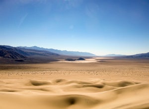
Panamint Dunes
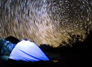
5.07.23 mi / 935 ft gainYou can do this as a day trip and just wander the dunes, but I really enjoyed the overnight with great evening views, amazing stargazing, and a sunrise exploration of the sand dunes. For an overnight trip I recommend you start hiking later in the day, when the temperature is a bit cooler. If you...Read more -
Bishop, California
Photography in the ButterMilks
5.0The Eastern Sierras have some of the most spectacular views in the world. This area in particular is known for its rock climbing. It also has amazing opportunities for photographers.The nights during a new moon are incredibly dark and create great astro photography shots. During the day, the l...Read more -
Yosemite Valley, California
Thru-Hike the John Muir Trail
5.0203.17 mi / 44944 ft gainTo thru hike the JMT is probably one of the sickest trips to do! It's not a heavy commitment like the PCT or AT but it's also no week long vacation from work, backpacking the woods of your local forests either. There's a sweet spot in thru hiking and I believe this trail gives the full taste. You...Read more -
Twin Bridges, California
Ropi Lake via Pyramid Creek
4.74.87 mi / 1581 ft gainThe trailhead to begin this hike is located at: 38.8117 N, 120.1237 W. From Hwy 50 just south of Lake Tahoe, take Hwy 50 southwest for almost 11 miles, where you'll turn into the parking lot after crossing Pyramid Creek. There is a $5 day-use fee to park in the trailhead parking lot. The hike i...Read more -
Inyo County, California
Green & Camp Lakes via Meysan Lakes
5.08.16 mi / 3248 ft gainGreen Lake via Meysan Lakes Trail is hiked from mid-June to end of September most seasons. Once the snow starts to fall, the road to the trailhead will be closed. A permit is require for overnight. You can obtain the permits online or at the ranger station in Lone Pine. Book online if you plan on...Read more -
Sequoia National Park, California
Mount Silliman, Sequoia NP
5.011.24 mi / 4449 ft gainThere is available parking at the campgrounds at the Lodgepole Visitor Center. Lodgepole's elevation starts at 6720 ft. Twin Lakes Trailhead starts right at the base, which you will be following to get to Mount Silliman. Along Twin Lakes Trail are several campgrounds for your journey, you can go...Read more -
Palm Springs, California
Palm Canyon Trail
4.51.94 mi / 308 ft gainThe fifteen mile long Palm Canyon, one of the Indian Canyons, is among the most beautiful natural sites in Western North America. Its indigenous flora and fauna, expertly used by the Cahuilla people, and its abundant Washingtonia Filifera (California Fan Palm) stand in breathtaking contrast to th...Read more -
Twin Bridges, California
Hike Pyramid Peak via Rocky Canyon
5.07.4 mi / 4100 ft gainPyramid Peak is the tallest peak in the Crystal Range and the Desolation Wilderness, just west of Lake Tahoe. On a clear day it can be seen from the Bay Area over 150 miles away. Named for its distinct shape, Pyramid a massive heap of glaciated granite slabs and talus, and the Rocky Canyon route ...Read more -
Madera County, California
Backpack to Lower Merced Pass Lake
4.023 mi / 880 ft gainLMPL (let's be honest, the full name is a mouthful) is situated just below the crest of Merced Pass, and can be accessed by hiking south from Yosemite Valley, or north from Chiquito Pass. This is a stunning and much less crowded spot to camp, or a great way to access some of the less climbed moun...Read more -
Mariposa County, California
Dewey Point via Tunnel View
5.09.25 mi / 2979 ft gainDewey Point lies on the western side of the Pohono Trail, across the valley from El Capitan and above Cathedral Rocks. When I was there in September, it was deserted but for a few birds drifting on the thermals above the cliffs. The sunset was stunning. It felt like there was nothing between me a...Read more -
Twin Bridges, California
Summit Price & Agassiz from Desolation Wilderness
5.0Mount Price (9,975') is the second highest summit in the Desolation Wilderness, standing just eight feet lower than Pyramid Peak to the south. In between these two peaks stands Mount Agassiz (9,967'), whose overhanging summit resembles a granite wave poised to crash down into the Desolation Vall...Read more -
Mariposa County, California
May Lake Trail
4.02.34 mi / 489 ft gainMay Lake is a stunning, serene subalpine lake that rests at the base of Mt. Hoffmann. The May Lake turnoff is located four miles past Tenaya Lake. From the turnoff, it's 1.8 miles to the trailhead parking lot. During summer time, I will recommend getting to the parking area early to get a spot ...Read more -
Tulare County, California
John Muir Trail: Camping Above Guitar Lake
Plan your last night to be spent near Guitar Lake at one of the unnamed lakes just a half mile above it along the trail. You'll find sun late into the afternoon and it serves as a great basecamp to hit Mt. Whitney for sunrise early on your final morning on the JMT.Find out everything you need to ...Read more -
Del Norte County, California
Backpack to Raspberry Lake
1.012 mi / 1800 ft gainIf you wish to experience the beauty of the Siskiyou Wilderness and avoid the crowds associated with The Devil’s Punchbowl, then consider a visit to Raspberry Lake. Beginning at the Young’s Valley Trailhead (Coordinates: 41.889919, -123.654755), this hike is a great option for those seeking wide...Read more -
Independence, California
Charlotte Lake via Kearsarge Pass
4.016.38 mi / 4078 ft gainThis adventure begins at Onion Valley Campground outside of Independence, CA. The parking is abundant and the road is snow dependent. Snow will be plowed as long as it is not currently being hit with a massive storm. Dogs are allowed on trail up to Kearsarge Pass (4.5 miles from the trailhead). H...Read more -
Madera County, California
Cecile Lake via Agnew Meadows
16.11 mi / 2667 ft gainLocated in the heart of the Ansel Adams Wilderness, Cecile Lake can be reached from a variety of trailheads. I chose to start out in Agnew Meadows. From here, the trail criss-crosses through a serene lowland environment with several crystal clear streams. After passing Olaine Lake, veer left an...Read more

