Camptonville, California
Looking for the best hiking in Camptonville? We've got you covered with the top trails, trips, hiking, backpacking, camping and more around Camptonville. The detailed guides, photos, and reviews are all submitted by the Outbound community.
Top Hiking Spots in and near Camptonville
-
Nevada City, California
Hike the Diggins Loop Trail
5.02.7 miCheck in and pay for your parking or present California State Parks Pass at the museum building in North Bloomfield. After paying for parking there are several different options to get onto the Diggins Loop trail. Access to the Diggins Loop trail can be found by the Park Headcounters by jumping...Read more -
Nevada City, California
South Yuba River: Edwards Crossing to Purdon Crossing
5.04.2 mi / 639 ft gainSouth Yuba River: Edwards Crossing to Purdon Crossing is a point-to-point trail that takes you by a river located near North San Juan, California.Read more -
Nevada City, California
Swim at Edwards Crossing on the South Yuba River
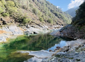
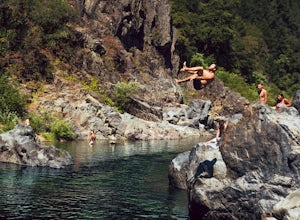
5.02.74 mi / 1302 ft gainThere are endless swimming holes on the South Yuba River the feature crystal clear water, massive granite boulders and pristine pocket beaches, particularly those lower in the foothills. Many are separated by sections of rapids, but can be reached via the growing trail system of the South Yuba Ri...Read more -
Nevada City, California
Hike the Independence Trail
4.5Starting from the free easy access parking lot right off highway 49 you head left up the trail. You will notice two trails side by side, one wider path for wheelchair access and another slightly narrower path for hikers on foot.The trail is set on the cliff side overlooking the South Fork of the ...Read more -
Nevada City, California
Backpack to Lower Rock Lake
3 mi / 713 ft gainThis adventure begins at the Lindsey Lake Campground parking lot (6,200 feet) where you leave your vehicle, takes you three miles up a trail rife with amazing photo opportunities and seasonal wildlife, and ends on the shore of Lower Rock Lake. Here you will find a dispersed camping site owned by ...Read more -
Nevada City, California
Bowman Road and Meadow Lake Road to Henness Pass
3.035.45 mi / 4895 ft gainBowman Road and Meadow Lake Road to Henness Pass is a point-to-point trail that takes you by a lake located near Alta, California.Read more -
Nevada City, California
Emerald Pools
4.00.68 mi / 49 ft gainEmerald Pools is an out-and-back trail that takes you by a river located near Emigrant Gap, California.Read more -
Sierra City, California
Sierra Buttes Lookout Trail
5.09 mi / 1365 ft gainSierra Buttes Lookout Trail is an out-and-back trail where you may see beautiful wildflowers located near Sierra City, California.Read more -
Colfax, California
Hike The Historical Stevens Trail
5.08 mi / 3376 ft gainBest known as one of the most popular hiking and biking trails to the North Fork American River, in part because of the easy access from Colfax. However, this is a remote trail, and hikers are advised to bring plenty of fluids as well as carry a whistle. The entire trail is primarily shaded, pa...Read more -
Sierra City, California
Sardine Lakes
1.32 mi / 253 ft gainSardine Lakes is a loop trail that takes you by a lake located near Sierra City, California.Read more -
Sierra City, California
Sierra Buttes and Sardine Lakes
4.86.19 mi / 3333 ft gainThe Sierra Buttes are one of the most scenic mountain features in all of the Sierra Nevadas. Nestled below the buttes are Upper and Lower Sardine lakes which both offer amazing fishing. Sardine Lake Resort lies at the base of the mountains and offers boat rentals, dining and cabin rentals. Just m...Read more -
Calpine, California
Camp at Salmon Creek Campground
Salmon Creek Campground is a quiet campground in the Northern Sierra Buttes. Since it is right up the road from Sardine Lakes it seems to get overlooked a bit. We were able to reserve three campsites the same week of our trip. There were 11 to choose from! The campground is just passed the turn f...Read more -
Foresthill, California
Explore Sugar Pine Reservoir
4.3Just a few miles north of Foresthill, Sugar Pine is a lesser known reservoir found in Placer County that is surprisingly unpopulated for how much the park provides. A swim suit, some friends, and some good music can be all it takes to have a good time.There is a boat-launching station that is eas...Read more -
Penn Valley, California
Fairy Falls Trail to Shingle/Beale Falls
4.14.87 mi / 535 ft gainStart at the Fairy Falls trailhead in Spenceville Wildlife Area Field Trial Grounds in Penn Valley (careful on the bumpy roads in). From the parking lot, cross a small bridge and make a right onto a dirt road. After about a mile you will follow the road to the right and continue through the gate....Read more -
Colfax, California
Hike to the Jumping Rock on the Bear River
2 mi / 150 ft gainThough lesser known than its neighbors the Yuba and the American, the Bear River still features fantastic hiking, swimming, river-raft, tubing, and rock-jumping but without the crowds.A local favorite spot, the "Jumping Rock" near the Dog Bar Crossing, provides an excellent hike with several swim...Read more -
Plumas County, California
Hike to Little Jamison Falls
3.02 mi / 500 ft gainTo get to the falls from the town of Graeagle, CA take Graeagle-Johnsville off Highway 89 towards the town of Johnsville. After 4.5 miles take a left on a dirt road to Jamison Mine Day Use Parking. If you go over the bridge and into the town of Johnsville, you have gone too far. Continue down th...Read more

