Colfax, California
Colfax, California offers some of the top trails and outdoor activities. A must-visit is the Stevens Trail, a scenic 9-mile round trip hike that offers breathtaking views of the American River. Known for its wildflowers and unique rock formations, it's a moderate difficulty trail that's perfect for a day hike. For a shorter trek, try the Colfax Trail. This 3-mile trail follows an old railroad grade with views of the city and surrounding hills. For water-based outdoor adventures, Rollins Lake is a popular spot for boating and fishing. Nearby, Bear River Park offers a sandy beach and picnic areas. Whether you're a hiker or boater, Colfax offers some of the best outdoor activities for all.
Top Spots in and near Colfax
-
South Lake Tahoe, California
Cascade Falls
4.81.32 mi / 98 ft gainStarting out at the Bayview Trailhead you will make your way out through the campground towards the trail. Once you find the trail it is a simple way to the falls. It starts out as a wide trail and winds through the pine and fir trees. You will come to some stone steps as the trail narrows for th...Read more -
South Lake Tahoe, California
Backpack to Eagle Lake and Dick's Lake
4.513 mi / 1500 ft gainGet ready to get your lake on! This backpacking trip will take you 13+ miles through awesome scenery to several alpine lakes.Starting at the Bayview Campground, off of HWY 89, this hike follows the Granite Lake Trail along a difficult climb. Don't let the climb discourage you! As you climb, the v...Read more -
South Lake Tahoe, California
Hike to Snow Lake in Desolation Wilderness
5.05 miThis wonderful alpine lake is a relatively short hike in Desolation Wilderness and is a perfect introduction to off trail exploration. This area lacks the crowds that other lakes in Desolation garner because most maps don't show the trail leading to the lake. Although there is a rough trail, the ...Read more -
South Lake Tahoe, California
Lower, Middle, and Upper Velma Lakes
3.010.14 mi / 2316 ft gainThe hike starts at Bayview Trailhead (Latitude: 38.938619 | Longitude: -120.14197). A wooden sign points right to "Desolation" and left to Cascade Falls. Follow the sign towards Desolation. The first 3/4 mile is comprised of switch-backs that lead to a high point with a spectacular view of Lake T...Read more -
South Lake Tahoe, California
Swim in Granite Lake
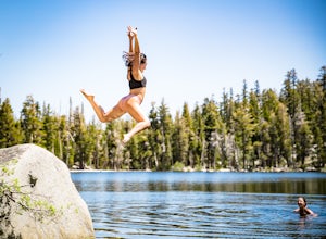
5.01.25 mi / 900 ft gainGranite Lake is a pristine alpine lake near Lake Tahoe just off the Highway 89 above Emerald Bay. To get there park at the Bayview Campground Trailhead, which can be pretty crowded in peak season so get there early. The trail begins with an split: right takes you into the Desolation Wilderness (a...Read more -
Carnelian Bay, California
Explore Carnelian Bay
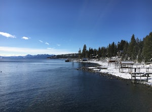
5.0Located on the northwest side of Lake Tahoe, Carnelian Bay is a fun place to spend the afternoon. However, there is no sand at Carnelian Bay as the ground is all large rocks. It's a great place to go swimming or SUPing in the summer, and it has a pier that you can jump off. It is usually less cr...Read more -
South Lake Tahoe, California
Explore Lake Tahoe's Vikingsholm Castle
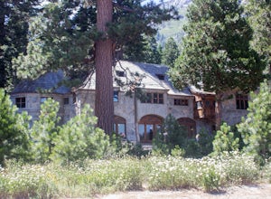
4.0The drive to the location of Vikingsholm was beautiful with spectacular views of Lake Tahoe and Emerald Bay, when approached from South Lake Tahoe. The hike down the hill to see this gem was worth it but could be hard for some (because the only return is up this somewhat steep path with switchbac...Read more -
Calpine, California
Camp at the Calpine Fire Lookout
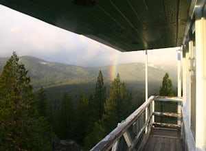
5.0I think all explorers agree there is nothing more serene than being surrounded by nothing but wilderness. If you are one of these said explorers, a trip to Calpine's fire lookout is a must.Calpine is a forest fire lookout tower that was constructed in 1934 and is one of 3 remaining examples of th...Read more -
Twin Bridges, California
Hike Pyramid Peak via Rocky Canyon
5.07.4 mi / 4100 ft gainPyramid Peak is the tallest peak in the Crystal Range and the Desolation Wilderness, just west of Lake Tahoe. On a clear day it can be seen from the Bay Area over 150 miles away. Named for its distinct shape, Pyramid a massive heap of glaciated granite slabs and talus, and the Rocky Canyon route ...Read more -
Twin Bridges, United States
Hike Horsetail Falls
4.22.8 mi / 700 ft gainGreat views are waiting for you at the top of Horsetail Falls. Pyramid Creek flows down the steep, glacier carved granite faces of Desolation Wilderness to create this awesome waterfall that is estimated to be about 800 feet tall. You will follow Pyramid Creek up the granite rocks to the top of t...Read more -
Twin Bridges, California
Ropi Lake via Pyramid Creek
4.74.87 mi / 1581 ft gainThe trailhead to begin this hike is located at: 38.8117 N, 120.1237 W. From Hwy 50 just south of Lake Tahoe, take Hwy 50 southwest for almost 11 miles, where you'll turn into the parking lot after crossing Pyramid Creek. There is a $5 day-use fee to park in the trailhead parking lot. The hike i...Read more -
South Lake Tahoe, California
Baldwin Beach
4.5Baldwin Beach offers a half mile of views of Lake Tahoe and the Sierra Nevada mountains. People come to this beach to relax and picnic. This is also a popular launch spot for those kayaking or stand up paddling to Emerald Bay. This beach is on national forest land and has a parking fee of $8.00...Read more -
South Lake Tahoe, California
Paddle from Baldwin Beach to Emerald Bay
4.0Explore Lake Tahoe's southern shores by paddling from Baldwin Beach to Emerald Bay. There are many places to stop along the way for photographs, snorkelling, or swimming. The more popular ways to paddle from Baldwin Beach to Emerald Bay are by SUP or kayaks. But paddling a foamie can be extra f...Read more -
South Lake Tahoe, California
Hike Mount Tallac
4.99.5 mi / 3255 ft gainThe classic 9½ mile out-and-back day hike to Mount Tallac begins at the trailhead on the southwestern side of Lake Tahoe, between Emerald Bay and Camp Richardson. When driving to the trailhead, make a turn inland at Mt. Tallac Road and follow the well-signed route to the reasonably sized parking ...Read more -
Tahoma, California
Glen Alpine Falls and Grass Lake
4.85.29 mi / 725 ft gainPark your car at the Glen Alpine Trailhead adjacent to Lily Lake and southwest of Fallen Leaf Lake. Head west on Glen Alpine Creek Trail passing Lily Lake on your left. After a little over a mile and a half of trekking through the alpine forest and taking in mountain views, you'll arrive at Alpin...Read more -
Tahoma, California
Susie Lake, Desolation Wilderness
5.07.96 mi / 1496 ft gainStarting at the Glen Alpine trailhead (best access to Susie Lake): To get to the trailhead, head toward Fallen Leaf Lake in South Lake Tahoe. From HWY 89, turn onto Fallen Leaf Rd and drive past the summer homes and marina until you reach a small firehouse on the left side of the road. You'll fol...Read more

