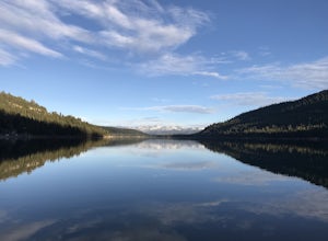
Markleeville, California
Looking for the best hiking in Markleeville? We've got you covered with the top trails, trips, hiking, backpacking, camping and more around Markleeville. The detailed guides, photos, and reviews are all submitted by the Outbound community.
Top Hiking Spots in and near Markleeville
-
Bridgeport, California
Matterhorn Peak
5.012.1 mi / 5036 ft gainMatterhorn Peak is an out-and-back trail that takes you by a lake located near Bridgeport, California.Read more -
Bridgeport, California
Climb Matterhorn Peak via the East Couloir
10 mi / 6000 ft gainMatterhorn Peak in the northeastern Yosemite Wilderness is an SPS Emblem Peak and many regard it as the beginning of the High Sierra, as there are no peaks higher to the north in the Sierra Nevada.There are many routes to the summit, but the shortest and most direct (though not easiest) begins at...Read more -
Truckee, California
The Five Lakes Hike
4.0The Five Lakes Trail is located in the Granite Chief Wilderness in between Alpine Meadows and Squaw Valley ski resorts and is easily accessible at the intersection of Alpine Meadows and Deer Park roads. The 5-mile moderate trail ascends approximately 900-1000 ft. along granite canyons and pine f...Read more -
Bridgeport, California
Hike to Peeler Lake
11 mi / 2400 ft gainThis trip can be done as a day trip or backpacking trip. It is around an 11 mile out-and-back trip.Park at Twin Lakes in Bridgeport, CA. There is a $10 fee and it can take a while on busy weekends. A permit is required to stay overnight in Hoover Wilderness. The trailhead can be hard to find; it ...Read more -
Reno, Nevada
Jones Creek Loop
1.5 mi / 335 ft gainNestled in a forested area on the eastern slope of the Sierra Nevada, Galena Creek Regional Park is seven miles up the Mt. Rose Highway from the intersection with I-580. Galena Creek flows through the park creating separate north and south portions of the park, and the Jones Creek Loop is a great...Read more -
Reno, Nevada
Church's Pond via the Jones-Whites Creek Trail
4.06.49 mi / 2185 ft gainFor the first 0.6 miles the trail follows a peaceful creek, before upping the steepness as it ascends the mountain sides via multiple switchbacks. At 2.5 miles in, you reach a peak that allows you to see from Reno to Washoe City; a perfectly good place for sane people to enjoy and turn back. Howe...Read more -
Reno, Nevada
Jones Whites Creek Loop
5.09.65 mi / 2405 ft gainStarting at about 6500 ft of elevation Jones Creek Trail is a 9.2 mi loop trail starting in Galena Creek Park. The park itself is very accessible off of Mt. Rose Highway, parking is free, and there is plenty of it during a typical weekend. When entering the park simply follow the signs that say "...Read more -
Bridgeport, California
Backpack to Green Lake and Virginia Pass
17 mi / 4452 ft gainDay 1 Green Creek Trailhead to Green Lake When we went on this hike, it was primarily to explore the area and see if it would be a feasible entrance to Northern Yosemite for extended backpacking trips. However, it also is a great two night trip to a lovely area of the Hoover Wilderness. Best...Read more -
Truckee, California
China Cove Loop at Donner Lake
4.63.11 miThis is a casual hike in an area with a ton of history. Stop by the museum before or after your hike to learn about the Donner Party, the Transcontinental Railroad, and local Native Americans Park at the Donner Lake and Memorial State Park Visitor Center and walk west towards the lake. Cross the...Read more

