Mill Valley, California
Looking for the best hiking in Mill Valley? We've got you covered with the top trails, trips, hiking, backpacking, camping and more around Mill Valley. The detailed guides, photos, and reviews are all submitted by the Outbound community.
Top Hiking Spots in and near Mill Valley
-
San Francisco, California
Lands End Trail
4.73.26 mi / 500 ft gainThe Lands End Trail is a 3.26 mile out-and-back hike located in the northwest corner of San Francisco along the city's rugged coastline. Offering spectacular views of the Golden Gate Bridge, Marin Headlands, and the Pacific Ocean, the hike is one of the most popular trails in San Francisco for ...Read more -
San Francisco, California
Presidio Bay Area Ridge Trail
5.02.73 mi / 203 ft gainPresidio Bay Area Ridge Trail is a point-to-point trail where you may see wildflowers located near San Francisco, California.Read more -
San Francisco, California
Presidio Ecology Trail
5.01.82 mi / 427 ft gainPresidio Ecology Trail is a loop trail through the Presidio located near San Francisco, California. This loop can be started at the Upper Ecology Trail off of Arguello Blvd near Pacific or down at the Lower Ecology Trail near the Inn at the Presidio. This trail is dog friendly on-leash.Read more -
San Francisco, California
Lover's Lane, Ecology, Mountain Lake Trail Loop
4.52.04 mi / 344 ft gainTucked into a corner of the Golden Gate National Recreation Area is the Presidio, a beautiful little oasis of forests, beaches, and sweeping views that locals love. While the coastal trails get most of the attention here, the park covers 300 acres of prime real estate with lots of notable attract...Read more -
San Geronimo, California
Roys Redwood Preserve Loop
5.02.37 mi / 430 ft gainRoy's Redwoods Preserve is an easily missed pocket of Redwoods off Nicasio Valley Road in Marin County. Don't miss it: heading North on Sir Francis Drake Blvd turn right onto Nicasio Valley Rd--the gate for this little park is about a half mile up on the right. From the main entrance you enter a ...Read more -
Novato, California
Buck Gulch Falls Trail
5.01.26 mi / 203 ft gainBuck Gulch Falls (also known as Fairway Falls) is an easy, scenic hike that takes you through a beautiful forest on your way to a 15-foot waterfall. This little neighborhood treasure is tucked away in Novato, CA at the end of Fairway Drive and there is ample parking near the trailhead. If you v...Read more -
San Francisco, California
Fairy Gates Trail
5.00.89 mi / 328 ft gainFairy Gates Trail is an out-and-back trail that takes you through a nice forest located near San Francisco, California.Read more -
Bolinas, California
Alamere Falls via Palomarin Trailhead
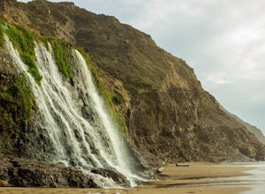
4.513.54 mi / 1614 ft gainAlamere Falls is the tallest waterfall in the bay area. It is known as a tide fall because it empties directly into the Pacific Ocean. This is extremely unique because there are only 34 tide falls in the world and two in California, the other being McWay Falls in Big Sur. Enjoy stunning views of...Read more -
Bolinas, California
Point Reyes' Wildcat Camp via Coast Trail
5.011.19 mi / 1926 ft gainIn order to make this trip possible, go to recreation.gov and make a reservation for Wildcat Camp (available year-round). On your way to the trailhead, make sure to stop by the Bear Valley Visitor Center to grab your camping permit. For more information, visit: http://www.nps.gov/pore/planyourvis...Read more -
Bolinas, California
Bass Lake via Palomarin Trailhead
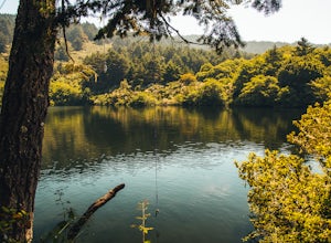
4.26.11 miFollow the Coast Trail from Palomarin Trailhead to Bass Lake. It's a fairly easy ~2.5-3 miles to the Lake. As soon as you pass the lake, on the left you will see a narrow unmarked dirt trail. Take this trail and you'll get to a nice clearing with easy lake access (this will be a great spot for lu...Read more -
Bolinas, California
Glen Camp Loop via the Palomarin Trailhead
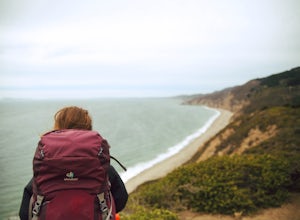
4.715.72 mi / 3091 ft gainDay 1 Before heading to the trailhead, make sure to stop by the Bear Valley Visitor Center to pick up your permit. To stay overnight in Point Reyes, you must stay at one of the trail camps. Camping anywhere else in the park is not allowed. Permits for the trail camps can be booked up to 6 mo...Read more -
Bolinas, California
Backpack to Coast Camp in Point Reyes via Palomarin Trailhead
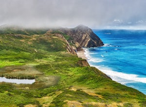
20.5 mi / 2705 ft gainSpanning from just north of the small town of Bolinas (about an hour north of San Francisco) across Inverness ridge and to the top of Tomales Point, Point Reyes National Seashore is as stunning park featuring breathtaking ocean views and solitude among the grassy hillsides and forested ridges. Th...Read more -
San Francisco, California
Mount Sutro Open Space Reserve Loop
4.42.14 mi / 617 ft gainThe Mount Sutro Open Space hike is one of those gems that's just hiding in plain site. Most people live in San Francisco for years without ever knowing this hike even exists - which is totally fine with us. This 2+ mile loop is an easy, quick way to get back in touch with nature after a long day....Read more -
San Francisco, California
Corona Heights Park
5.00.65 mi / 115 ft gainCorona Heights Park is a park located north of the Castro and South of Buena Vista Park. The peak of the hill is windy, but it offers an unobstructed panoramic view of the city of San Francisco from downtown to Twin Peaks. It is perfect for taking panoramic pictures of San Francisco at night. Y...Read more -
San Francisco, California
Vulcan Steps
5.00.18 mi / 79 ft gainVulcan Steps is an out-and-back trail that takes you past scenic surroundings located near San Francisco, California.Read more -
San Francisco, California
Twin Peaks Loop
4.02.04 mi / 259 ft gainThere are a ton of ways to get here (and obviously that can affect the total distance) but this is starting from Clarendon. Follow along up Twin Peaks boulevard where you'll see the peaks upon your approach. Keep an eye out for traffic as there may be visitors driving toward and away from Twin Pe...Read more

