Mount Hamilton, California
Looking for the best hiking in Mount Hamilton? We've got you covered with the top trails, trips, hiking, backpacking, camping and more around Mount Hamilton. The detailed guides, photos, and reviews are all submitted by the Outbound community.
Top Hiking Spots in and near Mount Hamilton
-
Oakland, California
Hike Redwood Regional Park via the Dunn Loop
5.03.6 mi / 606 ft gainThe Redwood Regional Dunn Loop is just outside of Oakland, and can be reached from anywhere in the Bay Area for a fun day or half-day trip. The trail is open year-round. In the spring, wildflowers are abundant. The trail has a great mix of sun and shade. Dogs are allowed, but must be kept on leash.Read more -
Half Moon Bay, California
Hike the Cowell-Purisma Trail
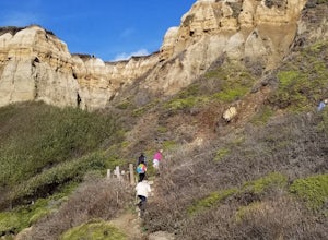
5.07 mi / 400 ft gainThis is a popular trail that has beach access to Cowell Ranch Beach. Along the trail, there is a steep staircase that goes down to the beach. The trail also features fields, a bridge, and beautiful views of California's rugged coastline. This trail is paved in some parts, and can also be biked...Read more -
Antioch, California
Hike the Old Homestead Loop
5.06.5 miThis is a fun day hike that takes you through the beautiful hills of the Black Diamond Mines Regional Preserve and a bit of the Contra Loma Recreational Area as well. You can hike here year round, but I suggest going in the spring time when the hills are covered in soft, green grass and the wild ...Read more -
Burlingame, California
Hike the Ed Taylor Loop Trail in Mills Canyon
4.01.4 mi / 300 ft gainThis hike can be done at any time of year. Hiking in winter and spring means that many varieties of wildflowers will be present, and the creek will have much more water. Summer and fall mean higher temperatures and drier conditions, but the hike is still a pleasant experience. Begin the hike at t...Read more -
Walnut Creek, California
Southern Lime Ridge Loop
4.05.57 mi / 1089 ft gainThe Southern Lime Ridge Loop is a trail system located near Walnut Creek, CA. There is a parking lot at the trailhead located across the street from the Boundary Oak Golf Course. The trail is fairly exposed with limited shade, so bring appropriate sun protection especially on the warmer days. D...Read more -
Half Moon Bay, California
Hike Along the Half Moon Bay Coastal Trail
4.65 mi / 104 ft gainStart at the visitor center along Kelly Avenue. Take note that the day parking fee is $10 in 2016 for each vehicle. You will then be able to enjoy both the Coastside Trail and Francis Beach (plus other beaches) with access to the amenities such as coin-operated showers and a semi-private beach.Th...Read more -
Oakland, California
East & West Ridge Loop
4.53.47 mi / 833 ft gainTucked away in the hills of Oakland, you will find one of the homes of California's Coastal Redwoods. Created by a unique geographical circumstance, this forest breathes winds funneled through the Golden Gate across the bay, which created environment opportune for Redwood growth. These Redwoods a...Read more -
Lafayette, California
Lafayette Reservoir via Nature Area Rim Trail
5.05 mi / 758 ft gainLafayette Reservoir is perfect for canoeing, mountain biking, trail running, and hiking. The Reservoir trail system is also used for nature walks and birding. The loop has several high points that have amazing views. The trails become very muddy after wet weather - so tread with caution. Th...Read more -
Oakland, California
Sibley Volcanic Trail Labyrinths
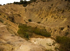
3.52 mi / 144 ft gainFrom Skyline Blvd, pull into the staging area for Sibley Volcanic Regional Preserve, you'll see the sign. Parking here is usually easy to find. You'll find an unstaffed visitor center with a restroom, park maps and informational displays featuring the history and geology of the park. Sibley is a...Read more -
Lafayette, California
Briones Park's Lafayette Ridge
4.35.31 mi / 981 ft gainThis is a nice and casual hike through the meadows and rolling hills, dotted with cows and hawks and sometimes goats or foxes. As you head up Lafayette Ridge, you'll be rewarded with the beautiful vista spanning from the Oakland Hills to sparkling Lafayette Reservoir. The hike is mostly through ...Read more -
San Francisco, California
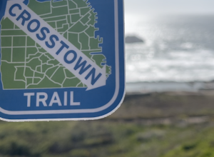
San Francisco Crosstown Trail
5.016.71 mi / 1975 ft gainThe San Francisco Crosstown Trail runs point-to-point from Candlestick Point to Land End. The SF Crosstown Trail officially opened in 2014. It connects park trails to neighborhoods and communities. In it's in entirety it's almost 17 miles long with 5 Sections available for those looking to bre...Read more -
Marina, California
Explore Fort Ord Dunes State Park
5.0One of the best parts of Monterey is the beaches – but their popularity is also their weakness, so if you want seclusion head to the lesser-known Fort Ord Dunes for solitude and beautiful views of Monterey Bay and the Pacific Coast. Historically, this location was chosen as the location for Fort ...Read more -
Half Moon Bay, California
Catch the Sunset at Maverick's Beach
5.01 miMaverick's beach is most well-known for the Maverick surf competition and the gnarly waves which surface here in the winter months. For the rest of the year, the beach is still a site to see. With huge waves crashing ¼ mile off shore and bluffs towering 100 feet above you, it’s a picturesque plac...Read more -
San Bruno, California
Sweeney Ridge via Sneath Lane
4.53.88 mi / 646 ft gainStarting from the parking lot on Sneath Lane Trail, you’ll head through the gate and continue on the path up Sweeney Ridge. This is a 5.7 mile out-and-back trek. There is a 600 ft. elevation gain, which comes mainly in the first 1.5 miles of the trail. Your legs and lungs may hurt a bit, but if t...Read more -
Pacifica, California
Montara Mountain Trail
5.06.77 mi / 1900 ft gainMontara Mountain Trail is a loop trail that takes you through a forest out to ocean views at the top of Montara Mountain. This hike located near Pacifica, California. and can be accessed from Highway 1 as well. If you're looking to do a similar loop hike from the coast, consider Montara Mountain ...Read more -
Moss Beach, California
Pillar Point Bluff Loop
4.71.84 mi / 154 ft gainSitting on a 140 acre bluff top, the Pillar Point Bluffs are a simple, easy hike with breathtaking views throughout. The bluffs are 22 miles from San Francisco – a 30 minute drive depending on the traffic. There is a small 10 car or so parking lot off of Airport Blvd, but there are two additional...Read more

