Oakley, California
Oakley, California offers some of the best trails and outdoor activities for those seeking scenic adventures. The Big Break Regional Shoreline is a must-visit, featuring a trail that winds along the San Joaquin River, providing stunning views of Mount Diablo and the river's diverse birdlife. The trail's difficulty is moderate, making it suitable for most fitness levels. For a more challenging trek, the Marsh Creek Regional Trail offers a mix of flat stretches and gentle inclines, taking hikers past rolling hills, vineyards, and the sparkling Marsh Creek. In addition to hiking, Oakley boasts top attractions like the Antioch Dunes National Wildlife Refuge, home to rare plants and butterflies. For water-based activities, the Delta provides opportunities for fishing and boating. These are just a few examples of the outdoor adventures awaiting you in and near Oakley, California.
Top Spots in and near Oakley
-
Napa, California
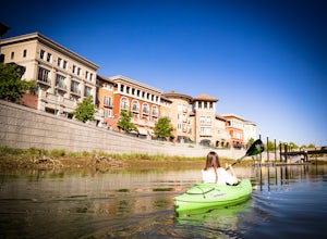
Kayak the Napa River
4.0The Napa River is one of the largest California Central Coast Range rivers, draining approximately 426 sq. miles on its 50 mile journey beginning just south of the summit of Mt. St. Helena to the San Pablo Bay, passing through many of the landmark towns of Napa Valley including an incredible 6 mi...Read more -
Richmond, California
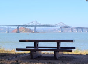
Picnic at Point Molate Beach Park
The beach park is very small but has sand along the shore for water access. Along the small cliffs of the beach there are picnic tables and grills for a nice cookout and family picnic. This beach would also be a great place for kayaking or standup paddle boarding as it is fairly secluded and away...Read more -
Napa, California
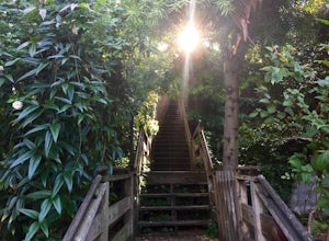
Westwood Hills Park Loop
4.02.12 mi / 476 ft gainThis park can get a little crowded on weekends, so best to go early if possible. In terms of parking, there's a lot at the trailhead, but also plenty of available street parking. The loop can be broken up in a various ways as there are several offshoots from the main trailhead/trail leaving fro...Read more -
San Francisco, California
Run the Coit Tower Stairs
3.8There are 2 sets of stairs for Coit Tower on Sansome St. The first set is at Greenwich and the second is at Filbert. The Filbert steps are a little deeper per step and are mostly wood and concrete. The Greenwich steps are a little tougher because of the shallower, brick stairs as you get toward t...Read more -
San Francisco, California
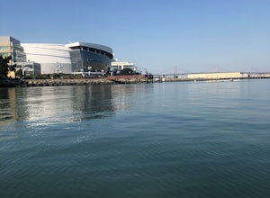
Paddle at Crane Cove
5.0Crane Cove is a beautiful waterfront park with access for paddle boards and kayaks. This area is protected from the wind (it will be less choppy here than in the middle of the bay). If you decide to paddle up to mission bay or down towards Islais Creek you'll most likely face more currents and w...Read more -
Tiburon, California
Angel Island Perimeter Loop
5.98 mi / 794 ft gainAngel Island Perimeter Loop is a loop trail around the circumference of the island in the San Francisco Bay. The island is located near Tiburon, California with views of downtown San Francisco, Alcatraz, the Golden Gate Bridge, Oakland, Sausalito, and TIburon as you traverse around the island. ...Read more -
Belvedere Tiburon, California
Mt. Livermore via North Ridge Trail
4.54.92 mi / 1178 ft gainUnless you own a boat or a kayak, this adventure requires a ride on the Blue and Gold Ferry from Pier 41 in San Francisco. But let’s be honest, that’s actually half the fun. Who doesn’t love a ferry ride? Angel Island State Park is the largest island in the Bay, and recommend the 6-mile loop aro...Read more -
Tiburon, California
Camp on Angel Island
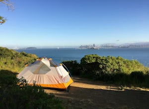
5.0Thousands of years ago, this island was a fishing and hunting ground for the Miwok Native Americans. It has also been an outpost for the U.S. Army and a cattle ranch. Now, it’s one of the closest places to escape from the hustle of San Francisco and set up camp. Camping on the island requires ba...Read more -
San Francisco, California
Catch a Sunrise at Ina Coolbrith Park
5.0This tucked away neighborhood gem is less than a square block in size, but offers some of the best views of San Francisco. After a quick, but steep, 5 minute walk, you'll be rewarded with incredible views of: the city skyline, Coit Tower, Alcatraz, and the Bay Bridge. There are a few benches avai...Read more -
San Francisco, California
Aquatic Park
3.7Take an early morning swim and watch the sunrise over the east bay or catch an afternoon swim on a sunny SF day. A full lap around the buoys (out-and-back) is about 1/3 mile and the perimeter of the park is 1 mile. Bring your dog for a swim too! Afterward, you can head up Columbus to one of the m...Read more -
Napa, California
Alston Park Loop Trail
2.76 mi / 184 ft gainAlston Park Loop Trail, located in Napa, California, is a 2.76-mile loop trail that offers a moderate level of difficulty for hikers. The trail is primarily used for hiking, walking, and running and is accessible year-round. The trail is well-maintained and clearly marked, making it suitable for ...Read more -
Winters, California
Homestead & Blue Ridge Loop
5.04.46 mi / 1299 ft gainAt the bend in the road on Highway 128, you will pass two silver gates. The gate with the UC Davis logo is the entrance to the trailhead. Past the entrance there is a large dirt pullout off the road with plenty of parking. Starting at the trailhead, go left in the fork to start the loop trail. T...Read more -
Winters, California
Hike the Stebbins Cold Canyon Loop
4.04.5 mi / 350 ft gainStebbins Cold Canyon is a great day hike for all skill levels, accessible year round, and offers an abundance of wild flower viewing, including the California poppy. Tog get to the hike, head about 8 miles west of Winters, CA, where a silver fire gate marks the main entrance to the Stebbins Cold ...Read more -
Winters, California
Hike the Homestead-Blue Ridge Loop
5.0From the official trailhead, start off by taking the Homestead Trail, which forks towards the right. A trail connecting Homestead and Blue Ridge will take you to a creek nearby. Veer off the trail along the creek and there is a water hole for cooling off on hot days. Onward into the trail, you wi...Read more -
San Francisco, California
San Francisco Crosstown Trail
5.016.71 mi / 1975 ft gainThe San Francisco Crosstown Trail runs point-to-point from Candlestick Point to Land End. The SF Crosstown Trail officially opened in 2014. It connects park trails to neighborhoods and communities. In it's in entirety it's almost 17 miles long with 5 Sections available for those looking to bre...Read more -
Winters, California
Fly Fishing on the Putah
4.0Putah Creek is a little over an hour drive from SF without traffic. The creek has flows beginning in April, which can reach up to 700cfs during the summer months. The creek begins to drop after September. Keep in mind that wet-wading isn't recommended until the river is under 300cfs. Most fly fis...Read more

