Springville, California
Looking for the best photography in Springville? We've got you covered with the top trails, trips, hiking, backpacking, camping and more around Springville. The detailed guides, photos, and reviews are all submitted by the Outbound community.
Top Photography Spots in and near Springville
-
Sequoia National Park, California
Hike to Emerald Lake, Sequoia National Park
4.510.4 mi / 2200 ft gainBegin this hike at the Alta Peak Trailhead in the Sequoia National Park. The trail initially takes you east-southeast through a loosely forested area that is stark and arid. Around 1.5 miles in you'll cross a small creek, but this creek may dry up in the late spring/summer. Shortly after the cree...Read more -
Sequoia National Park, California
Hike to Pear Lake via the Lakes Trail
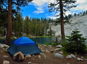
5.012.4 mi / 2300 ft gainThe Lakes Trail to Pear Lake can be done as either an overnight stay or a day hike. For overnight, you'll need to get a permit but there are beautiful camping spots available at both Emerald Lake and Pear Lake. As a day hike, plan to spend all day since you'll undoubtedly pause at each lake for...Read more -
Sequoia National Park, California
Mount Silliman, Sequoia NP
5.011.24 mi / 4449 ft gainThere is available parking at the campgrounds at the Lodgepole Visitor Center. Lodgepole's elevation starts at 6720 ft. Twin Lakes Trailhead starts right at the base, which you will be following to get to Mount Silliman. Along Twin Lakes Trail are several campgrounds for your journey, you can go...Read more -
Three Rivers, California
Hike Little Baldy
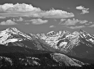
5.03.5 mi / 700 ft gainA short hike with impressive views of Sequoia National Park, the Little Baldy trail is the less touristy version of Moro Rock. When we hiked it on a beautiful Sunday morning in the summer, we had the entire summit to ourselves. Even if other hikers had been up there, it would have still felt em...Read more -
Inyo County, California
Summit of Mt. Whitney
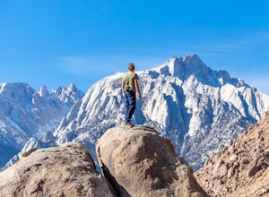
5.020.85 mi / 6100 ft gainMt. Whitney is the highest peak in the contiguous United States. It stands over 14,500ft high at its peak (elevation gain of 6100') and it sure feels like it when you are up there. Getting There Located just West of Lone Pine, CA you take Whitney Portal Road West for 13 miles all the way to its...Read more -
Inyo County, California
Winter Summit Mt. Whitney
22 mi / 6500 ft gainDay 1: We arrived at the Lone Pine Visitors Center at the intersection of HWY 395 and HWY 136 just south of Lone Pine, CA. We issued ourselves our overnight permits to climb Mt. Whitney and picked up our Wag Bags. You can self issue yourself the free permit Nov. 2 through Apr 30. Climbing during ...Read more -
Kern County, California
Remington Hot Springs
2.00.27 mi / 36 ft gain...One thing about hot springs is that no matter where it may be, they always bring an attraction of people. I can honestly say I don't think I've ever been to a hot spring that didn't gather more then 20+ people in a single sitting. I mean, in all seriousness aside, what's not to like about a ba...Read more -
Kern County, California
Remington Ridge Trail
11.45 mi / 3927 ft gainTo get to the trailhead, take Highway 178 and turn onto Borel Road, then turn onto Kern Canyon Road and follow the road. It might be easiest to put the Hot Springs into Google Maps and use that to navigate you to the parking lot. Park in the lot and walk across the road, where you'll see a sign l...Read more -
Inyo County, California
Meysan Lakes Trail
9.23 mi / 3724 ft gainMeysan Lakes Trail is located on the ever popular Whitney Portal Road. Park on the side of the road next to the Whitney Portal Campground. Start the hike by cutting through the campground, and passing some seasonal cabin style residences. Follow the Meysan Lakes Trail signs. The trail cuts throu...Read more -
Inyo County, California
Green & Camp Lakes via Meysan Lakes
5.08.16 mi / 3248 ft gainGreen Lake via Meysan Lakes Trail is hiked from mid-June to end of September most seasons. Once the snow starts to fall, the road to the trailhead will be closed. A permit is require for overnight. You can obtain the permits online or at the ranger station in Lone Pine. Book online if you plan on...Read more -
Inyo County, California
Fossil Falls Trail
4.30.58 mi / 43 ft gainFossil Falls is located east of Highway 395, a few miles south of Coso Junction, 45 min north of Ridgecrest. There is Bureau of Land Management sign pointing the way, but it is small, faded, and easy to miss, so be on the lookout. After about a mile drive on a marked dirt road, you'll reach the ...Read more -
Bakersfield, California
Hike the Mill Creek Trail to Breckenridge Road
7.5 mi / 3000 ft gainStarting at about 2000 elevation this hike is very gentle and nice for the first 2 miles. On the third mile it is a steep climb with short lengths of level ground the rest of the way. The junction at Breckenridge Road is at about 5500 elevation. If you hit the trail in the winter, there are some ...Read more -
Bakersfield, California
Oak Flat Lookout
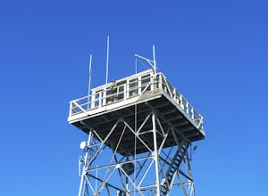
4.0/ 80 ft gainSpend a few nights under the stars in a unique piece of outdoor history. The Oak Flat Lookout, constructed in 1934, was once staffed by rangers providing critical wild life management services on watch for wildfires in the surrounding Sequoia National Forest through the 1980s. The Oak Flat lookou...Read more -
Tulare County, California
Jennie Lake via Fox Meadows
4.510.71 mi / 1929 ft gainJennie Lake is a beautiful subalpine lake located in the Jennie Lakes Wilderness just outside of Sequoia National Park. There are no backpacking quota restrictions making this a perfect trip that requires little planning. Your journey starts at the Fox Meadows trailhead on paved Forest Service R...Read more -
Tulare County, California
Hike to the Summit of Big Baldy, Kings Canyon National Park
4.55 mi / 650 ft gainThis short and easy trail to the summit of Big Baldy in Kings Canyon National Park is not to be missed if you are in the area.The trail winds through forest and boulders as it climbs the north shoulder of Big Baldy. When you think you have reached the end, and you see people sitting down with the...Read more -
Lone Pine, California
Rock Climb the Candy Store
The Candy Store is a group of boulders and small spires with around 30 climbing routes ranging from 5.6 to 5.11. The majority are trad routes with a significant portion toprope and a couple of sport. The major features/boulders are: First BoulderThe GumdropLollipop BoulderRock Candy TowerSecond B...Read more

