Stinson Beach, California
Looking for the best hiking in Stinson Beach? We've got you covered with the top trails, trips, hiking, backpacking, camping and more around Stinson Beach. The detailed guides, photos, and reviews are all submitted by the Outbound community.
Top Hiking Spots in and near Stinson Beach
-
Inverness, California
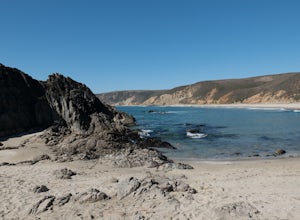
McClures Beach
1.44 mi / 243 ft gainThis beach is really easy to get to. Just follow Pierce Point Road until you see the sign to the beach. It's an easy hike down from the parking lot. There is very little shade, so make sure to bring some sunscreen. Be extremely cautious with getting into the water. There is likely underwater cu...Read more -
Oakland, California
Hike Redwood Regional Park via the Dunn Loop
5.03.6 mi / 606 ft gainThe Redwood Regional Dunn Loop is just outside of Oakland, and can be reached from anywhere in the Bay Area for a fun day or half-day trip. The trail is open year-round. In the spring, wildflowers are abundant. The trail has a great mix of sun and shade. Dogs are allowed, but must be kept on leash.Read more -
Moss Beach, California
Fitzgerald Marine Reserve
5.00.89 mi / 46 ft gainLocated beside a residential neighborhood, Fitzgerald Marine Reserve offers a rare glimpse of life in the northern California intertidal zones. There are parking spaces and restrooms available, as well as ranger-led guided tours. Be sure to check the tide charts and go during low tide (preferab...Read more -
Moss Beach, California
Cypress Tree Tunnels at Moss Beach
4.50.79 mi / 105 ft gainThe Cypress Tree Tunnels are a quick jaunt from San Francisco (22 miles) and make for a great half-day trip. Getting here depends on traffic, but 30 minutes from the center of the city is doable. Parking is relatively easy. You can either park at the south end of the area at the Cypress Cove entr...Read more -
Lafayette, California
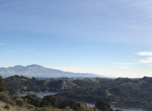
Lafayette Reservoir via Nature Area Rim Trail
5.05 mi / 758 ft gainLafayette Reservoir is perfect for canoeing, mountain biking, trail running, and hiking. The Reservoir trail system is also used for nature walks and birding. The loop has several high points that have amazing views. The trails become very muddy after wet weather - so tread with caution. Th...Read more -
Moss Beach, California
Pillar Point Bluff Loop
4.71.84 mi / 154 ft gainSitting on a 140 acre bluff top, the Pillar Point Bluffs are a simple, easy hike with breathtaking views throughout. The bluffs are 22 miles from San Francisco – a 30 minute drive depending on the traffic. There is a small 10 car or so parking lot off of Airport Blvd, but there are two additional...Read more -
Oakland, California
Run the Circumnavigation of Redwood Regional Park's Ultimate Trail Loop
5.07.5 mi / 1600 ft gainIt’s difficult to have a car in San Francisco, but oh-so worth it when it comes to weekend getaways, especially with all the Bay Area has to offer. This is a super accessible trail system just 30 minutes outside of the city that makes for a fun, easy trail run or hike.Redwood Regional Park, part ...Read more -
Martinez, California
Muir Farm And Mount Wanda: John Muir Nature Trail
2.59 mi / 512 ft gainMuir Farm And Mount Wanda: John Muir Nature Trail is a loop trail located near Martinez, California.Read more -
Half Moon Bay, California
Catch the Sunset at Maverick's Beach
5.01 miMaverick's beach is most well-known for the Maverick surf competition and the gnarly waves which surface here in the winter months. For the rest of the year, the beach is still a site to see. With huge waves crashing ¼ mile off shore and bluffs towering 100 feet above you, it’s a picturesque plac...Read more -
Lafayette, California
Briones Park's Lafayette Ridge
4.35.31 mi / 981 ft gainThis is a nice and casual hike through the meadows and rolling hills, dotted with cows and hawks and sometimes goats or foxes. As you head up Lafayette Ridge, you'll be rewarded with the beautiful vista spanning from the Oakland Hills to sparkling Lafayette Reservoir. The hike is mostly through ...Read more -
San Mateo County, California
Run Sawyer Camp Trail
5.012 mi / 300 ft gainThe Sawyer Camp Trail is a popular paved trail that stretches alongside the Crystal Springs Reservoir all the way to Hillcrest Blvd. The sixth mile crosses over the San Andreas Dam with nice views of San Andreas Lake.There are markers every half mile which makes timing and tracking your run easy....Read more -
Santa Rosa, California
Hike Crane Creek Regional Park
4.03.5 miWith multiple loops of varying length, this park is great for anyone looking for a casual hike around a beautiful area in the foothills of Rohnert Park. Crane Creek has nice secluded picnic areas next to the creek in the cover of willow, alder, buckeye and bay trees. There's also an 18-hole disc ...Read more -
Belmont, California
Hike San Mateo's Sugarloaf Mountain
5.01.5 mi / 500 ft gainSugarloaf is tucked away in Laurelwood Park which is located in a residential neighborhood right off of Hwy 92 in San Mateo, making this a great hiking & trail running option for Peninsula residents.I always park on Glendora Dr. and follow the paved path down towards the playground. At the bo...Read more -
Half Moon Bay, California
Hike Along the Half Moon Bay Coastal Trail
4.65 mi / 104 ft gainStart at the visitor center along Kelly Avenue. Take note that the day parking fee is $10 in 2016 for each vehicle. You will then be able to enjoy both the Coastside Trail and Francis Beach (plus other beaches) with access to the amenities such as coin-operated showers and a semi-private beach.Th...Read more -
Glen Ellen, California
Sonoma Ridge Trail
9.2 mi / 1955 ft gainSonoma Ridge Trail is a beautiful 9.2-mile out-and-back hike located near Glen Ellen, California. This hike is moderately difficult, with about 1955 feet in elevation change. 95% of the trail is covered in forest shade. Important Notes:Bikes and Horses are permitted on the trails. Dogs are NOT p...Read more -
Glen Ellen, California
Wolf House in Jack London SP
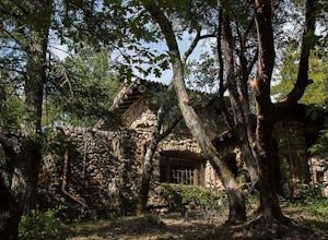
There is a museum in "The House of Happy Walls" which Mrs. London built in redwood grove find park information, exhibits and a small sales area there. A nearby trail leads to Jack London’s grave and to the remains of "Wolf House," London’s dream house which was destroyed by fire in 1913. The par...Read more

