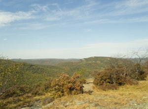
Kent, Connecticut
Looking for the best hiking in Kent? We've got you covered with the top trails, trips, hiking, backpacking, camping and more around Kent. The detailed guides, photos, and reviews are all submitted by the Outbound community.
Top Hiking Spots in and near Kent
-
Berlin, Connecticut
Hike the Ragged Mountain Memorial Preserve
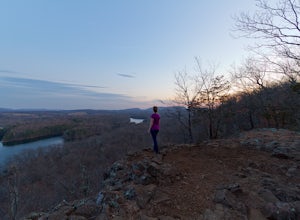
4.55.5 mi / 560 ft gainRagged Mountain main loop is approximately 5.5 miles long, and is known for its expansive bare-rock vistas, vertical cliff faces, and scenic views overlooking cliff-side reservoirs and ponds. The trail is rated moderate, with some flat stretches among the trees, mixed with some uneven rocky foot...Read more -
Simsbury, Connecticut
Hike to the Heublein Tower on Talcott Mountain
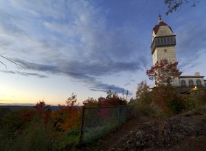
4.32.54 mi / 404 ft gainThe Heublien Tower Trail, located just inside the Talcott Mountain State Park entrance off of Route 185 in Simsbury CT, is a short 1.25 miles. While the hike isn't long, the first 1/3 of a mile is a steep incline that will get your heart pumping. The trail itself it very well kept, and although ...Read more -
Hamden, Connecticut
Hike the Tower Trail to the Blue Trail at Sleeping Giant SP
5.03 mi / 518 ft gainSleeping Giant State Park is a place very close to my heart. I spent 4 years right across the street at Quinnipiac University and have hiked “The Giant” more times then I can count and at all different hours. There are a few different trails you can explore but my favorite one is up to the cliffs...Read more -
Hamden, Connecticut
Hike the Mill River Trail to the Blue Trail at Sleeping Giant SP
5.03 mi / 518 ft gainSince I was a child, I’ve always enjoyed hiking the Giant. As Connecticut parks go, this terrain is some of the most challenging (and unfortunately, the most dangerous) in the state. The actual ridge is approximately 2.75 miles long by 1.75 miles wide, and offers approximately 24 miles of hiking ...Read more -
Hamden, Connecticut
Boulder & Free Climb off the Blue Trail In Sleeping Giant SP
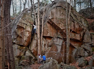
Sleeping Giant State Park does not just have great hiking, it also has great climbing and bouldering. Pick up the blue trail starting at the backside of the visitor center. This trail climbs pretty steadily but take note that as you hike up the cliff below you is a great spot to checkout for boul...Read more -
Great Barrington, Massachusetts
Hike Monument Mountain
4.02 mi / 720 ft gainAt 1642 feet (with a total elevation gain of 720 feet), Squaw Peak is a great spot to see both Mt Greylock along the Vermont border, and the Catskills in New York. There are several trail options here to get to the summit, but no matter which combination you choose, you can keep your trip under ...Read more -
3197 U.S. 44, New York
Hike to Sky Top via the Undercliff Road
7.3 mi / 900 ft gainStarting from the East Trapps parking area ascend the East Trapps connector trail marked with yellow blazes. You can also park at the Mohonk Preserve visitor center where you can purchase your access pass ($15 per person) and pick up a free map of the presere trails and carriage roads. The conn...Read more -
Philipstown, New York
Hike the Osborn Loop
7.6 mi / 850 ft gainThe Osborn Loop trail itself is not a loop. It connects to a 2.5 mile section of the Appalachian Trail. Hiking these together creates the loop. Start at the trail head for the Appalachian Trail on South Mountain Pass Road. There is parking for two or three cars. Walk up the road a short dist...Read more -
Gardiner, New York
Hike the Dickie Barre, Peters Kill and Awosting Falls Loop
3.07.8 miThis loop hike takes you to Awosting Falls (65 ft.), as well as to great valley views along the ridge of Dickie Barre, and across Peters Kill, on the way.Start out on West Trapps Connector Trail (yellow blazes) at the east end of the West Trapps parking lot (get their early because the lot will ...Read more -
Gardiner, New York
Hike The Millbrook Mountain Ridge Trail
5.07 mi / 1400 ft gainWant to walk on the edge? visit Millbrook Mountain in the Catskills of NY. This loops hike follows the mountains ridge line most of the way to the summit with multiple viewpoints and cliff ledges to walk out on. This hike is recommended those in the area.Park at West Trapps Parking Lot and head ...Read more -
Gardiner, New York
Hike the Overcliff - Undercliff Road Loop
5.3 mi / 350 ft gainFrom the West Trapps parking lot ($15 for hikers), walk to the end of the parking lot and past a large kiosk. The trail connects the parking lot to the Overcliff Road/Undercliff Road junction. The loop can be done in either direction. I turned left on the Overcliff Road. This takes you behind...Read more -
Hudson, New York
High Falls Conservation Area Loop
1.41 mi / 194 ft gainHigh Falls Conservation Area Loop is a loop trail that takes you by a waterfall located near Philmont, New York.Read more -
Philipstown, New York
Anthony's Nose via Appalachian Trail
4.61.95 mi / 682 ft gainParking for the trail runs along both sides of 9D right up until the Bear Mountain Bridge. It can be busy on the weekends so just make sure you're as far off the road as you can and be especially careful unloading kids and dogs. The trailhead is located at approximately 41.322571, -73.975949 and ...Read more -
New Windsor, New York
Hike Jessup/West Ridge Loop via the Sweet Clover Trail
10 mi / 1700 ft gainSchunnemunk Mountain State Park is one of my favorite parks. It offers many trails and possibilities for different loops. The attraction of Schunnemunk Mountain is the long double ridges running parallel to each other and amazing views in all directions.This hike starts at the Taylor Road parki...Read more -
Cortlandt, New York
Hike the Camp Smith Trail
4.55.92 mi / 1759 ft gainThis approximately 3-hour hike borders the Hudson River, and is one of the best in Westchester County. Start off at the parking area at the Bear Mountain Tollhouse, or at a small parking area farther up Bear Mountain Road, if you want a slightly shorter hike. The trail is fairly steep in places, ...Read more -
Bear Mountain, New York
Hike Bald Mountain, Bear Mountain State Park
4.76.8 mi / 1080 ft gainFrom your starting point at the Bear Mountain Inn, go left along the Cornell Mine Trail. (This part can be a bit confusing, but go past the carousel to a shaded picnic area; that is where the trail starts.) You will go under a bridge and follow the trail until it takes a sharp left and descends t...Read more

