Kent, Connecticut
Looking for the best hiking in Kent? We've got you covered with the top trails, trips, hiking, backpacking, camping and more around Kent. The detailed guides, photos, and reviews are all submitted by the Outbound community.
Top Hiking Spots in and near Kent
-
Ridgefield, Connecticut
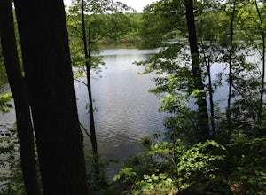
Hike the Hemlock Hills & Pine Mountain Loop
7.5 mi / 1174 ft gainThere are several trailheads for Hemlock Hills But the least crowded is at the intersection of Ned's Mountain road and Bogus Road. I took my 3 year old black lab. There are ton's of little ponds for your dog to jump in and do dog things. For the most part the hike is flat but at some parts it c...Read more -
Mount Washington, Massachusetts
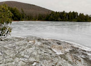
Guilder Pond and Mount Washington Lookout Trail
3.92 mi / 909 ft gainGuilder Pond and Mount Washington Lookout Trail is a loop trail that takes you by the lake located near Copake Falls, New York.Read more -
Hopewell Junction, New York
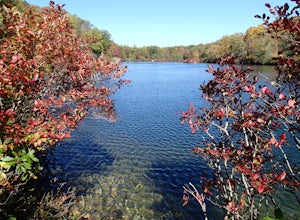
Beaver Pond via Appalachian Trail
5.03 mi / 400 ft gainBeaver Pond is a small body of water created by a dam that was constructed during the days of iron ore mining in the area. The pond is crystal clear and has a wonderful tree line right on the water. The best time to visit here is early morning in the fall. With the leaves changing color they m...Read more -
Hopewell Junction, New York
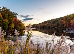
Lake Canopus Viewpoint
4.02.07 mi / 148 ft gainIts a great place to explore as it has a beautiful calm lake especially in the fall, the reflection of the water and the awesome colors are unbelievable. Its a short hike but you certainly could go further up. Parking is free by the road, hike towards the lake about a mile or so. The sound of bi...Read more -
Mount Washington, Massachusetts
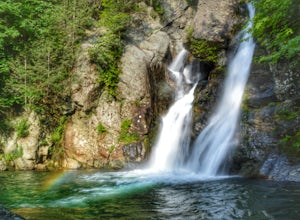
Explore Bash Bish Falls
4.21 miOne of my favorite walks to a spectacular falls. The trail is easy to follow and one mile from NY parking lot and 0.5 from the parking lot. The apparent place to swim. There are several very nice, family safe swimmable pools in the creek above and after the falls. There are signs at the top of t...Read more -
Beacon, New York
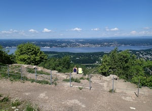
Hudson Highlands Overlook Trail
3.29 mi / 1017 ft gainHudson Highlands Overlook Trail is an out-and-back trail that takes you through a nice forest located near Beacon, New York.Read more -
Cold Spring, New York
Hike the Perkins/Fahnestock/Charcoal Burners Trail Loop
7.5 mi / 800 ft gainThis is one of my favorite hikes in the Clarence Fahnestock State Park. A real mixed bag but mostly very enjoyable. The trail starts at the Charcoal Burners Trailhead Route 301. There is only road side parking on a soft shoulder, both sides of the road. After a short walk into the forest, you re...Read more -
Beacon, New York
Hike Fishkill Ridge
Fishkill Ridge is a strenuous but rewarding hike, and one of the less known areas in the Hudson Valley. The parking area is at the very end of Sunnyside Road in Beacon, along with the information board at the trailhead. The red trail leaves the lot and will take you up to the first peak on the ri...Read more -
Beacon, New York
Hike the Scofield Ridge Loop
7.5 mi / 1850 ft gainThere are some great view points along this route. Start from the Mount Beacon Park trailhead parking area. This leads to the Casino Trail (red markers). The trail climbs steeply to some old ruins of a casino. Most of what remains is only the brick structure housing the mechanics for a trolle...Read more -
Beacon, New York
Malouf's Mountain Camp on Mt. Beacon
7.02 mi / 2087 ft gainStarting in the quaint town of Beacon there are a couple of options for hikes of varying difficulty. From the station the walk is about 1.5 miles to the trail heads, alternatively if you choose to stay the night at Malouf's Mountain Sunset Campground you can arrange for the host to meet you, take...Read more -
Beacon, New York
Mt. Beacon Fire Tower
4.83.83 mi / 1332 ft gainMount Beacon is a very popular trail along the Hudson River, and for good reason. It offers a good workout, fantastic views for both sunrise and sunset (and of course the time in between), a recently rebuilt fire tower, and all with incredibly easy access right on the edge of a lively town. The ...Read more -
Beacon, New York
Explore Long Dock and Dennings Point Parks
4.0Long Dock and Dennings Point are two of the most popular parks in Beacon, that just so happen to be connected by a train track turned trail. Plenty of parking is available at Long Dock, and its a perfect spot to picnic, launch your kayak into the Hudson, or cast your line hoping to reel in the bi...Read more -
Cold Spring, New York
Photograph Indian Brook Falls
2.8This is about as short a walk and as little effort as you can put in for a beautiful waterfall. You can barely call it a hike, but I'll list it as such since you do walk through the woods for 5 minutes. The trail is extremely well built, and is pretty easily accessible through the winter.The trai...Read more -
Beacon, New York
Sugarloaf Mountain via Wilkinson Memorial Trail
5.02.15 mi / 820 ft gainTrail is currently closed. Get updates at parks.ny.gov. Sugarloaf Mountain is part of the Hudson Highlands State Park, along with Breakneck Ridge, Bull Hill, and Mt Beacon. Though the views are just as impressive as its sister trails, it is never as crowded and it's one of my favorite spots in ...Read more -
Beacon, New York
Sunset Point - South Beacon Mountain Loop
4.08.92 mi / 2470 ft gainThis loop hike form the Notch Trail northern trailhead on Route 9D. There is enough parking at this trailhead for about 5-6 cars. The Notch Trail is identified with blue trail markers. It is well maintained and plenty of markers to guide your way. This is important because there are m...Read more -
Cold Spring, New York
Sugarloaf Mountain and Breakneck Ridge Loop
4.74.33 mi / 1562 ft gainThe Breakneck Ridge to Sugar Loaf Loop gives rise to various bypasses that offer hikers moderate to advanced terrain and multiple rock scrambles. The loop entails a total elevation gain of 1,670 feet and a total distance of 5.5 miles. The start of the trail begins at the (white blazes) at the no...Read more

