Kent, Connecticut
Looking for the best hiking in Kent? We've got you covered with the top trails, trips, hiking, backpacking, camping and more around Kent. The detailed guides, photos, and reviews are all submitted by the Outbound community.
Top Hiking Spots in and near Kent
-
Highland Falls, New York
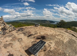
Popolopen Torne
4.51.18 mi / 531 ft gainPopolopen Torne is a hidden gem in the Hudson Valley, a surprisingly unknown trail with a beautiful payoff and a far deeper meaning. A short hike to the top puts you at the foot of a memorial to those who have served their country, a pile of painted rocks carried up by those who want to pay their...Read more -
Gardiner, New York
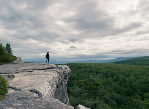
Gertrude's Nose
4.96.97 mi / 919 ft gainIt would be impossible to see all of Minnewaska’s beautiful spots in one day. Gertrude's Nose is, in my opinion, the best view in the entire park. Round trip, the hike is approximately 5 hours, and is a 7.5 mile trip. To get to the trailhead: Drive to the Minnewaska State Park entrance, pass the...Read more -
Gardiner, New York
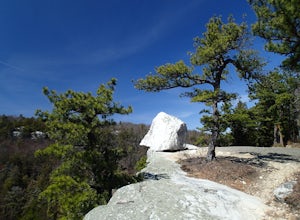
Hike the Millbrook Mountain/Gertrude Nose loop
9 mi / 1700 ft gainThis great loop hike starts from the upper parking lot of Lake Minnewaska State Park. Walk towards Lake Minnewaska and once on that carriage road, turn left and follow the road to the to the opposite end of the lake. Along the way are great view points of the lake and several picnic areas for day...Read more -
Gardiner, New York
Lake Minnewaska Loop Trail
2.01 mi / 348 ft gainLake Minnewaska Loop Trail is a loop trail where you may see beautiful wildflowers located near Kerhonkson, New York.Read more -
Stockbridge, Massachusetts
Laura's Tower and Ice Glen
5.02.4 mi / 676 ft gainYou will park at the end of Park Street in Stockbridge, Massachusetts. From the parking are you will cross a beautiful bridge over the Housatonic River. The trail crosses railroad tracks and immediately begins to climb into the woods. You will reach a split in the trail, a left will take you...Read more -
Meriden, Connecticut
Higby Mountain Trail
2.11 mi / 486 ft gainThe popular route for this hike is to park your car at the base of the trail which is located right before merging onto 91-S in Middlefield, CT. The parking lot does seem to get crowded mid-day, especially if the weather is nice! The beginning of the hike is mostly flatter land and an incline w...Read more -
Elka Park, New York
Hike to Huckleberry Point
4.54.5 mi / 644 ft gainThis is a 4.5 mile hike that is great for hikers of all skill levels. Because it is short and not overly difficult, beginners will enjoy this hike. There are some steep sections that will get your heart pumping, though, and a stunning payoff is waiting for you at the end.From the trailhead, follo...Read more -
Elka Park, New York
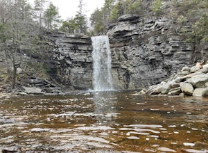
Hike to Plattekill Falls
0.5 mi / 137 ft gainJust outside of Elka Park, New York, Plattekill Falls is accessible from Albany and New York City alike. This is a great hike for families and all skill levels. The falls are spectacular year-round, but the best time to visit is in the spring. From the trailhead, walk left past the red house unt...Read more -
Bridgeport, Connecticut
Stroll around Fayerweather Island
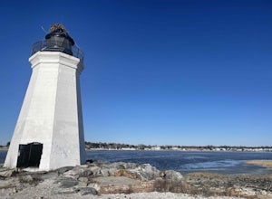
0.5 miParking is at the end of Barnum Road in the Seaside Park. Though the lighthouse grounds are accessible the tower itself is not open to the public. To access the island you must walk across the breakwater. Please use caution as it is uneven footing and at times can be slippery. From the isla...Read more -
Middletown, Connecticut
Explore Wadsworth Falls
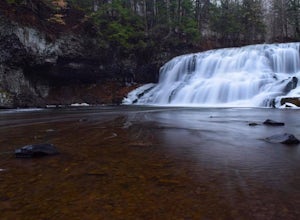
5.00.25 miWhen it comes to exploring Wadsworth Falls its ease of access couldn't be better. As soon as you pull into the parking lot you hear the falls roaring. Take the quick walk to see the picturesque scenery.Facts about Wadsworth Falls:Height: 25ft tall and doubled in width Rock: Hampden Basalt -the ro...Read more -
Elka Park, New York
Hike Indian Head Summit via Jimmy Dolan Notch Overlook
4.9 mi / 1512 ft gainThe view from the summit of this hike is incredible. Bring a sack lunch and a camera - you'll want to stay for a while! This trail is open for use year-round and provides great snowshoeing in the winter and fabulous wildflowers in the spring and summer. This is also a great location for birding!Read more -
Elka Park, New York
Hike Twin Mountain
6 mi / 1586 ft gainThe DEC Parking lot, is located at the very end of a dead end, along Prediger Rd. Start at the trail head to the right of the trail kiosk and sign in sheet. The trail starts out very easy going as you approach the base of Twin. At mile 0.25, you’ll hit a junction where you’ll turn RIGHT towards T...Read more -
Elka Park, New York
Backpack the Eastern Half of Devil's Path in the Catskill Mountains
5.014 mi / 3900 ft gainThe Eastern half of Devil's Path has four major summits: Indian Head, Twin, Sugarloaf and Plateau. Each summit is a straight climb up and down, then back up to as much as 3,900 ft. There are some sparse sections of level ground, but most is a steep descent uphill or steep slide downhill. Your ...Read more -
Elka Park, New York
Backpack Devil's Path in the Catskills
24.2 mi / 9000 ft gainDevil's Path is roughly more than 24 miles long, althought it feels like an eternity of milage. Going thru the summits of Indian head, Twin, Sugarloaf, Plateau, Hunter, and Westkill Mountains.Its brutal. Its painful, Its unique. Be prepared for anything and everything. You will encounter wild lif...Read more -
Greene County, United States
Hike to Newman's Ledge
4 mi / 584 ft gainLocated in the beautiful Catskill Mountains, this is an outdoors-mans(and woman's) dream spot! Although this hike is accessible year round, if you decide to go during the summer you should expect crowds. Luckily, there are so many different trails and activities that it won't even matter. North-S...Read more -
Woodstock, New York
Sugarloaf Mountain via Blue Trail
6.54 mi / 2297 ft gainSugarloaf Mountain, is one the 35 highest peaks in New York's Catskills at 3806 ft. There are many ways to approach this peak, and this is an out-and-back hike via Mink Hollow. The parking area is located at the end of Milk Hollow Rd (42.10405386879072, -74.17148500019927). From here, get on the...Read more

