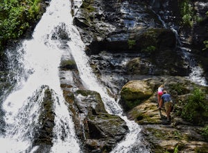
Dahlonega, Georgia
Top Spots in and near Dahlonega
-
Cleveland, Georgia
Mount Yonah Trail
4.17 mi / 1430 ft gainMount Yonah Trail is an out-and-back trail where you may see beautiful wildflowers located near Cleveland, Georgia.Read more -
Blairsville, Georgia
Camp at Vogel State Park
5.0Nestled at the foot of Blood Mountain is one of Georgia's most scenic State Parks. With over 90 campsites and 35 charming cottages, 17 miles of hiking trails, a beautiful alpine lake, and a charming waterfall, Vogel State Park highlights all of the best things that North Georgia has to offer. T...Read more -
Blairsville, Georgia
Hike the Trahlyta Lake Trail to Trahlyta Falls
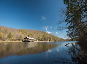
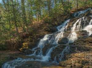
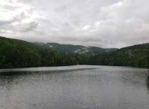
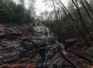
1 mi / 30 ft gainLake Trahlyta in Vogel State Park offers a truly unique combination of natural beauty and opportunity for recreation. The easy one-mile Lake Trahlyta trail circles the emerald colored lake and has a short deviation that leads to a calming, yet impressive waterfall. The trail starts on the edge...Read more -
Helen, Georgia
Raven Cliff Falls
4.64.78 mi / 584 ft gainThe hike to Raven Cliff Falls round-trip is about 5 miles. The scenery is amazing the whole way through with beautiful cascading waterfalls and running streams filled with wildlife everywhere you look. Along the way, there are a few campsites where during the warm months you'll see many tents set...Read more -
Helen, Georgia
Hike the Unicoi Lake Trail
1.9 miUnicoi State Park is a pleasant, refreshing park just outside of Helen, GA. There is a hiking trail, kayaking/canoeing launch, paddle boat rentals, camping area, and even a 3 segment zipline course (all three were fantastic)! Fishing is allowed, and when we went last there were a few kayakers fis...Read more -
Jasper, Georgia
Mount Oglethorpe
0.69 mi / 49 ft gainMount Oglethorpe, located in Jasper, Georgia, offers a challenging hiking trail that spans approximately 0.69 miles. The trail is marked by a steady incline, making it suitable for intermediate to advanced hikers. The path is well-maintained and clearly marked, ensuring a safe journey for all hik...Read more -
Blairsville, Georgia
Hike to Horsetrough Falls
5.00.4 mi / 10 ft gainTo get to the trail head you will follow Wilks road five miles to Upper Chattahoochee River Campground. The five miles down the gravel road should be doable for a majority of cars as the gravel road is in good condition. Pretty much if you feel comfortable driving your car on a regular gravel roa...Read more -
Cumming, Georgia
Hike the Indian Seats Trail
4.33.24 mi / 453 ft gainThe Sawnee Mountain Preserve is easy to get to with a GPS and offers plenty of parking. To get to the Indian Seats Trail you will start down a short (.17 mile) trail that will take you to the trailhead. The Indian Seats Trail is a loop so once you reach the marked trail you can go either left or ...Read more -
Gainesville, Georgia
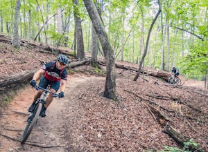
Mountain Bike Chicopee Woods' Flying Squirrel Trail
4.7 mi / 200 ft gainThere is a designated parking lot for the Chicopee Woods mountain bike trails with plenty of parking, but it can fill up on weekends.To access the trailhead for Flying Squirrel, you have to take a few other trails (a good warm-up!) to get back to a junction known as ‘Confusion Corner’, which is w...Read more -
Cumming, Georgia
Mountainside Loop Trail
4.05.35 mi / 823 ft gainMountainside Loop Trail is a loop trail where you may see beautiful wildflowers located near Cumming, Georgia.Read more -
Sautee Nacoochee, Georgia
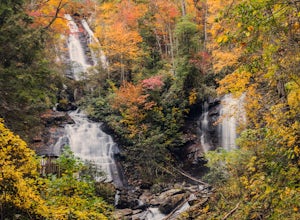
Anna Ruby Falls
4.01 mi / 374 ft gainThe hike to Anna Ruby Falls located in the Chattahoochee National Forest, bordering and often mistaken for being located in Unicoi State Park, begins at the Anna Ruby Falls Visitor Center. There is a $3 per person fee (16 years and under are free) to access the parking lot of the visitor center a...Read more -
Sautee Nacoochee, Georgia
Unicoi Gap and Indian Grave Gap Loop
5.05.04 mi / 1765 ft gainThe Unicoi Gap and Indian Grave Gap Loop in Sautee Nacoochee, Georgia, is a moderately challenging hiking trail. Spanning approximately 5.04 miles, the loop offers a variety of terrain, including forested areas, open fields, and rocky paths. The trail is known for its two significant landmarks: U...Read more -
Hiawassee, Georgia
Blue Hole and High Shoals Creek Falls
4.82.45 mi / 479 ft gainLocated just a few miles north of Helen, Georgia is this hidden gem. The road that leads up to the starting point of the hike is a bit tricky to find so make sure you have your GPS to help a little, its a gravel road that winds up the mountain for a about a mile. The dirt trail winds down throug...Read more -
Arkaquah Trail, Georgia
Hike the Arkaquah Trail to Brasstown Bald
11 mi / 3756 ft gainThe Arkaquah Trail is unique as far as North Georgia trails go for any reasons. Its elevation gain and distance puts it near the top for most challenging day hikes in the Blue Ridge Mountains. If the 11 miles round-trip sounds a bit daunting, this hike can also be done as a 5.5 mile point-to-po...Read more -
Blue Ridge, Georgia
Long Branch Loop Trail
5.02.33 mi / 299 ft gainLong Branch Loop Trail is a loop trail where you may see beautiful wildflowers located near Blue Ridge, Georgia.Read more -
Blairsville, Georgia
Hike to the Brasstown Bald Peak
4.31.42 mi / 430 ft gainOnce you make it to the parking area (parking fee required) to Brasstown Bald you will be at about 4284 feet elevation. From there you will have a short (0.6 mile) but steep hike to the tower that sits atop Brasstown Bald. Along the path you will see Rhododendron and various other blooms dependi...Read more

