Cashiers, North Carolina
Cashiers, North Carolina is a great place to enjoy the outdoors! With its stunning mountain views and lush greenery, it's a perfect spot for outdoor adventures. The area has a variety of trails and activities to choose from, so there's something to suit everyone. From mountain biking to kayaking, there are plenty of thrilling outdoor activities to try. For those looking for a more relaxed experience, there are plenty of scenic hikes and nature walks to enjoy. Popular attractions in and near the area include Whiteside Mountain and Panthertown Valley, both of which provide awe-inspiring views and plenty of opportunities for exploration. If you're looking for the best outdoor activities and attractions, Cashiers, North Carolina is the place to be!
Top Spots in and near Cashiers
-
Pickens, South Carolina
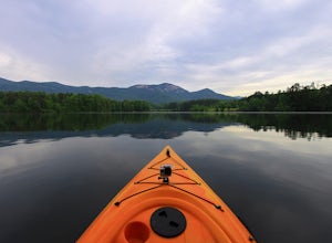
Paddle on Lake Oolenoy
5.0Part of Table Rock State Park, Lake Oolenoy is a 67-acre lake providing private boat access for kayaks, canoes, or small boats with electric trolling motors.To get to the boat ramp, when traveling on scenic Highway 11, turn Sah Ka Na Ga View Road on the opposite side of the road as the Table Rock...Read more -
Sylva, North Carolina
Waterrock Knob Trail
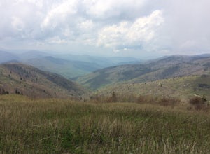
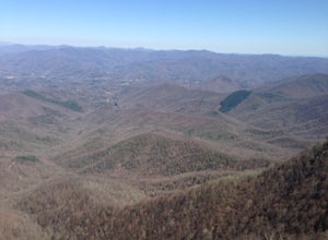
5.01 mi / 407 ft gainThe trail begins paved and quickly climbs up into a heavily forested area. Once at a 1/4 of a mile in, you will come to a nice overlook that will give you your first real good view of the surrounding mountains. The trail then continues on, though now unpaved, with great views off to your left as ...Read more -
Sylva, North Carolina
Abandoned Cessna 414A at Waterrock Knob
3.71.72 mi / 430 ft gainThis is an AWESOME day hike for anyone looking to get outside for a few hours and see some special views of the blue ridges, as well as check out the abandoned plane crash of a Cessna 414A that happened back in 1983. The remains of the plane are still scattered along the hillside making it a supe...Read more -
Brevard, North Carolina
Art Loeb Trail
4.830.07 mi / 7467 ft gainStart at The Davidson River Campground just outside of Brevard, NC (276 Pisgah Ranger District). Have a shuttle car or a friend waiting at the Daniel Boone Boy Scout camp for the finish line. Hop on the 30.1 mile long Art Loeb Trail at the trailhead in the Davidson River Campground. Pull into th...Read more -
Brevard, North Carolina
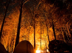
Camp at Davidson River Campground in the Pisgah National Forest
4.5Pisgah National Forest, in my opinion, is one of the best national forests in the United States. Being just a short drive from Great Smokey Mountain National Park it has all the feel of being in the smokies with more to explore. Pisgah has anything you could want to see or do from tens of water...Read more -
Franklin, North Carolina
Backpack the Standing Indian Loop on the Appalachian Trail
24 miBegins at the parking lot for the Standing Indian Campground. (No permits are needed to park here) For the first 3.7 miles, take Kimsey Creek Trail, which runs along the water, until you meet up with the AT at Deep Gap. Rolling hills and lots of foliage throughout, leading up to Standing Indian M...Read more -
Pisgah Forest, North Carolina
Drive the Forest Heritage National Scenic Byway
5.076 mi / 1000 ft gainYou can drive this highway getting different views during the different seasons. Along the drive, have your camera ready for beautiful vistas, Looking Glass Falls, and many adventures along the highway. The views are especially beautiful in the autumn with the leaves changing colors. This route d...Read more -
Franklin, North Carolina
Nantahala National Forest via the Appalachian Trail
4.027.11 mi / 5420 ft gainWinding Stair Gap on Highway 64 is the starting point for this spectacular backpacking trip through the Nantahala National Forest. It's right outside the hiker friendly town of Franklin, NC, so the town is your last chance for a hot meal and any last minute supplies. There is a parking lot at the...Read more -
Cleveland, South Carolina
Hike to Jones Gap Falls
8.2 mi / 1200 ft gainFor Caesar's Head State Park access, head North from Pickens on HWY 178 until it intersects with HWY 11. Turn right onto HWY 11 North and continue for 10 miles until the 276 intersection where you veer off to the left. Follow 276 to the top of the mountain. 1 miles past the Caesars Head Visitors ...Read more -
Cleveland, South Carolina
Raven Cliff Falls
4.57.76 mi / 2185 ft gainLocation: From the intersection of US276 & SC11, head Northwest on US276. Drive to the top of the mountain, 1 mile past the visitor's center, and The Raven Cliff Falls Parking Area and trail head will be on your right. After parking in the Raven Cliff Falls Parking Area, the trailhead is l...Read more -
150 Asbury Drive, South Carolina
Hike the Asbury Trail to Moonshine Falls
5.5 mi / 800 ft gainThe trail to the Matthews Creek cable bridge crossing is easy. The cable crossing is fine - fun for some and a do-able challenge for others. After the creek, to get to Moonshine Falls, turn RIGHT at the post which indicates a trail both left and right. This is the Naturaland Trail in Caesars Hea...Read more -
Franklin, North Carolina
Photograph Wayah Bald Lookout Tower
0.1 mi / 0 ft gainThe Wayah Bald Lookout Tower is located in Nantahala National Forest in one of the oldest part of the protected land. It was first built in the 1920s then it was rebuilt throughout the years until it was finally made out of stone and concrete. The current tower that stands offers great views of t...Read more -
Maggie Valley, North Carolina
Soco Falls
5.00.09 mi / 0 ft gainThis double waterfall is located a mile and half off of the Blue Ridge Parkway in the Cherokee Indian Reservation. From the parking area, it's a short walk down a well-established trail to the viewing area of the falls. For an even closer view of the falls, you can follow a roped, steep path dow...Read more -
Cleveland, South Carolina
Caesars Head Overlook
5.00.27 mi / 144 ft gainThe Drive: Head North on SC Highway 11 "Cherokee Foothills Scenic Highway" towards Table Rock State Park. Follow SC 11 past Table Rock approximately 8 miles where it will merge with SC 8 at Pumpkin Town. Follow SC 8 for another 3-4 miles until you see the intersection for SC Highway 276 on the le...Read more -
Canton, North Carolina
Climb Fryingpan Mountain Lookout Tower
4.51.5 miThis is an extremely easy trail with a minimal incline. The tower, built in 1941, standing 70 feet above the summit, can be nerve wracking, even for those who aren't scared of heights. However, most feel it's worth the view. Expect to see fellow hikers. On pretty days there can be a few people w...Read more -
Franklin, North Carolina
Siler Bald from Wayah Gap
5.03.66 mi / 1060 ft gainThe Appalachian Trail does not need a lot of hype beyond its existing legendary status. However, there are certain parts of it that do stand out as being a little extra special. Siler Bald is one of those spots. A large clearing starting from Snowbird Gap and going all the way up to Siler Bald...Read more

