Micaville, North Carolina
Top Spots in and near Micaville
-
Elizabethton, Tennessee
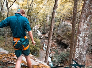
From TN 91, turn onto Panhandle Road. Follow Panhandle for 1 mile and park in the parking lot to the left.
Waterfall
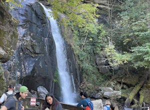
Follow the path to your right downwards until you encounter wooden stairs. The main waterfall will be to your right less than .1 mile from the parking lot. There are two other wat...
Read more
-
Johnson City, Tennessee
Gray Quarry is a perfect destination for scuba diving in TN! The quarry is about 70 feet deep with ~3 acres of clear water. They have sunk a plane, bus, truck, firetruck, boat, seedoos, and more to the bottom. There is also a large variety of aquatic animals in the quarry. This is an awesome, loc...
Read more
-
Asheville, North Carolina
Bent Creek is my favorite Mountain Biking spot in the Southeast, and epitomizes the fun and beauty to be found biking in the North Carolina mountains. Riding is open year round, but spring and fall are ideal when temperatures are still cool and colors are exploding. You can easily spend hours ...
Read more
-
Asheville, North Carolina
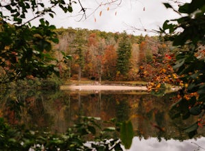
Lake Powhatan is located just minutes away from Asheville, NC and offers a number of fun activities for you, your friends, and your family. In the warm summer months, the Lake is a popular spot for swimming. The small stretch of beach along the lake is a nice place to lay out and soak in the sun....
Read more
-
Bluff City, Tennessee
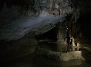
Worley’s Cave, also known as Morrill Cave, lies just outside of Boone across the Tennessee border. It is the second longest cave in the state of Tennessee at a whopping 4.4 miles in total length. It is a non-lit cavern that’s path is lit only by those who venture in its depths (i.e. headlamps, la...
Read more
-
Bluff City, Tennessee
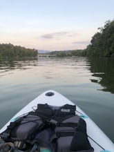
There is a mud parking area on Lakeview Drive underneath the 11E bridges with a cleared mud parking area with access to the the South Fork of the Holston River. There is a gradual drop to the water where kayaks, canoes, or SUPs can be placed in the water. To the east, the river is more narrow at ...
Read more
-
Connelly Springs, North Carolina
5.0
6.18 mi
/ 1299 ft gain
This 6.2-mile total trip will take you through the highlights of South Mountains State Park with an overnight stay in one of the drier campsites.
OPTIONAL: You can get a warm-up in by starting with a 2.5-mile loop to High Shoal Falls that you can do without packs before picking up with a 3-mile...
Read more
-
-
Connelly Springs, North Carolina
4.6
2.47 mi
/ 617 ft gain
From the Jacob Fork parking area in South Mountains State Park, it is a short 1 mile walk over the Jacob River to the High Shoals Waterfall (80'). If you choose to continue past the observation deck, High Shoals Falls Trail (blue circle) climbs up above the waterfall, crossing the river. Keep rig...
Read more
-
Connelly Springs, North Carolina
4.0
5.9 mi
/ 1115 ft gain
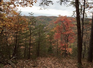
The journey begins at the Cicero Branch Parking Area along South Mountain Road, following Jacob Fork River Trail. The trail runs along the Fork before ascending Chestnut Knob. After completing the trail, you will find yourself on the highest peak of the South Mountain chain, where there are breat...
Read more
-
Elizabethton, Tennessee
5.0
2.44 mi
/ 1302 ft gain
Flint Mill Trail is an approximately 2.4 mile out-and-back trail in the Cherokee National Forrest. The trailhead is located on Flatwoods Road in Elizabethton, TN. The trail has a rather steep incline and is considered challenging. There is a 1,264 foot altitude change from the base to the top . T...
Read more
-
Del Rio, Tennessee
3.0
14.06 mi
/ 2966 ft gain
Make a weekend trip from Max Patch to Hot Springs N.C., and be sure to soak in the natural hot springs at the old inn after your hike! This is an incredible, relatively easy hike with the reward at the end being hot springs on the French Broad River. You can break this up however you like, this i...
Read more
-
Todd, North Carolina
5.0
3.8 mi
/ 1000 ft gain
There are no bathrooms at the trailhead, so if needed, drive a little past it to the park bathrooms on the left. Park at the summit trailhead and start your hike on the new gravel path. The trail gains 1000 ft in elevation in just under 2 miles so take your time if need be - and bring plenty of w...
Read more
-
Bristol, Tennessee
5.0
1.45 mi
/ 157 ft gain
The Bouton Trail Loop is an approximately 1.5 mile round trip on TVA land. There is a gravel parking lot with an information sign and trail map. Sections of the trail are gravel and sections are dirt. There are multiple places along the trail that cut off and lead down to the river for prime fish...
Read more
-
Bristol, Tennessee
5.0
2.16 mi
/ 194 ft gain
The Emmett Trail is one of the TVA South Holston Tailwater Trails. This trail began as a footpath created by anglers. The trail now has gravel, which makes for easier access for families and pets. The trailhead begins on Piney Hill Road where it the traverses down to the waters edge and leads to ...
Read more
-
Bristol, Tennessee
5.0
3.54 mi
/ 869 ft gain
Spillway Trail is an out-and-back trail that takes you by a lake located near Bristol, Tennessee.
Read more

