Corvallis, Oregon
Looking for the best hiking in Corvallis? We've got you covered with the top trails, trips, hiking, backpacking, camping and more around Corvallis. The detailed guides, photos, and reviews are all submitted by the Outbound community.
Top Hiking Spots in and near Corvallis
-
Stayton, Oregon
Shellburg Falls
3.23.7 mi / 520 ft gainThis hike is currently closed due to fire damage. Please check the Oregon.gov website or the call the Oregon Department of Forestry (503-859-4344) for updates. The hike, including the initial 1.25 mile gravel road to the trailhead, is easy to complete within 1-2 hours and only requires a modera...Read more -
Silverton, Oregon
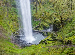
South Silver Falls
5.02.14 mi / 361 ft gainSouth Silver Falls is a loop trail that takes you by a river located near Silverton, Oregon.Read more -
Drake Crossing, Oregon
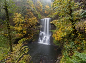
Trail of Ten Falls Loop
4.77.16 mi / 1178 ft gainThe unique feature of South Falls, Lower South Falls, and Middle North Falls are the paths that pass behind the falls providing an amazing visual and auditory experience; however, be sure to have a good bag for your equipment to avoid water damage and a decent jacket (preferably water-resistant)....Read more -
Silverton, Oregon
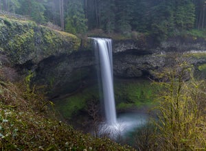
Camp in Silver Falls State Park
4.68.7 mi / 1300 ft gainIf you're thinking of hiking the Trail of Ten Falls Loop and staying overnight, there are 42 tent campsites (available from April – Oct) as well as 14 rustic cabins. With multiple beds, heat, electricity, a covered porch, and a small fridge, they provide the perfect respite after a long day of ex...Read more -
Otis, Oregon
Hike to Drift Creek Falls
4.93.5 mi / 490 ft gainThis hike down to Drift Creek Falls is more of an easy stroll. But before you reach the trail head, if coming from the north, make sure to stop at Oregon's oldest covered bridge off Bear Creek Rd.The trail head to Drift Creek Falls will be farther south on Bear Creek Rd where you will branch off ...Read more -
Eugene, Oregon
Wild Iris Ridge Loop from Summit Sky Boulevard
5.01.58 mi / 220 ft gainWild Iris Ridge Loop from Summit Sky Boulevard is a loop trail where you may see beautiful wildflowers located near Eugene, Oregon.Read more -
Cascadia, Oregon
Hike to Soda Creek Falls
5.01.5 mi / 370 ft gainSoda Creek Falls flows 150 feet down a curvy basalt rock groove at Cascadia State Park. The trail follows Soda Creek through a lush Oregon rain forest. The site was a former hotel and health spa with the mineral water from the creek as the main attraction. The park has a small campground, and pic...Read more -
Eugene, Oregon
Spencer Butte Loop
4.51.6 mi / 564 ft gainGetting There Searching Spencer Butte Trailhead Parking Lot on Google Maps will direct you to exactly where you need to go. From downtown Eugene/ UO you'll drive south on Willamette St. until you see an official park sign for Spencer Butte Park. Take a left on the gated road (will be locked duri...Read more -
Depoe Bay, Oregon
Watch the Grey Whale Migration at Depoe Bay Scenic Park
5.00.5 miIt all started when a man, in my grandad's age, initiated a conversation outside a rest stop just off the coastal highway, 101. I, then, was alone waiting for my travel companions outside the restrooms. He approached me without warning, and began asking intricate details of my travel plans and th...Read more -
Scotts Mills, Oregon
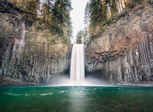
Abiqua Falls
4.90.69 mi / 115 ft gainThis trail is unmarked and a little rough and rugged. The land is privately owned by Mount Angel Abbey, but they don't appear to have problems with courteous hikers. Walking out of the parking area back up the road in the direction you came from, you’ll pass one dirt trail right at the ending of ...Read more -
Scotts Mills, Oregon
Upper Butte Creek Falls
4.00.73 mi / 308 ft gainFrom Scott Mills Follow Crooked Finger RD NE for 13.3 Miles to the Upper Butte Creek Trailhead. The last 2-3 miles or so is gravel road with some potholes but most cars shouldn't have a problem. The path down to the falls starts near the bathrooms. A short .3 mile walk on a few switchbacks and...Read more -
Yachats, Oregon
Hike the Cooks Ridge Trail at Cape Perpetua Scenic Area
5.06.5 mi / 1500 ft gainIf you've set up camp at Perpetua Campground, head out toward the Cape Perpetua Visitors Center, head east along the Cooks Ridge Trail. After 3.75 miles and 1500ft elevation gain, head south and then west along the Cummins Creek Trail, eventually ending up at the ocean along Neptune State Scenic ...Read more -
Lincoln County, Oregon
Amanda's Trail
5.06.05 mi / 1483 ft gainAmanda's Trail in Lincoln County, Oregon, is a well-known hiking route. The trail spans approximately 6.05 miles, making it a moderate hike suitable for most fitness levels. The trail is marked by a variety of natural features, including a dense forest canopy, a variety of local flora and fauna, ...Read more -
Florence, Oregon
Hike the Captain Cook Trail
5.00.75 mi / 50 ft gainThe Oregon cost is some of the most dramatic coastline in the Western United States, and the Cape Perpetua Scenic Area hosts an array of unique features arches, chasms, and blowholes like Thor's Well. The Captain Cook Trail is a quick way to take in some of the best features of the Scenic Area, a...Read more -
McMinnville, Oregon
Hike the Red Trail in Miller Woods
4.04 mi / 400 ft gainLocated three miles west of McMinnville and available for public hiking and activities, Miller Woods is owned and operated by Yamhill SWCD. You may choose different trails to take.From the parking lot the trails are marked by colors to go on the 4.0 mile loop go to the meadow and follow the red m...Read more -
McMinnville, Oregon
Miller Woods
5.03.63 mi / 735 ft gainMiller Woods Trail is a loop trail where you may see beautiful wildflowers located near McMinnville, Oregon.Read more

