Crescent, Oregon
Looking for the best photography in Crescent? We've got you covered with the top trails, trips, hiking, backpacking, camping and more around Crescent. The detailed guides, photos, and reviews are all submitted by the Outbound community.
Top Photography Spots in and near Crescent
-
Crescent, Oregon
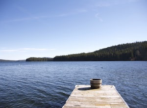
Odell Lake
5.010 mi / 65 ft gainThis spot in central Oregon is a beautiful, natural lake where you can combine a nice hike with an afternoon of fishing. There are opportunities for multiple hikes surrounding the lake that are moderately challenging hikes and also remain scenic throughout the 10 mile trek around the lake. Relax...Read more -
Crescent, Oregon
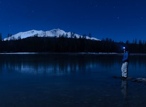
Diamond View Lake via Trapper Creek
9.88 mi / 1070 ft gainDiamond View Lake is relatively unknown compared to many of the other lakes in the Oregon Cascades, yet the views it delivers of Diamond Peak are top-notch. While it can also be done as a summer backpack, winter brings out the best aspects of the scenery - low-angle light on Diamond Peak, long n...Read more -
Bend, Oregon
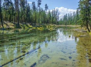
Hike the Fall River Trail
5.9 mi / 101 ft gainThe Fall River Trail follows meanders through an old growth ponderosa pine forest along the banks of the Fall River. There are several pull-out parking spots along Forest Service Road 42 but probably the easiest is to start at the Fall River Campground day-use area. The day-use area has pit toile...Read more -
Cascade Summit, Oregon
Diamond Creek Falls
5.02.92 mi / 443 ft gainThe beginning of this trail starts at the parking lot of Salt Creek Falls, right off of the 58 freeway. During the winter months, there's a gate blocking the road to the parking lot. You can park at the gate and it's a 0.6 mile walk to the beginning of the Salt Creek Falls trailhead. If you haven...Read more -
Lane County, Oregon
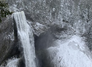
Salt Creek Falls
4.50.65 mi / 141 ft gainLocated off of the 58 Freeway, Salt Creek Falls is the second tallest waterfall in Oregon. The powerful cascade pours into a scenic canyon below, with beautiful surrounding views. You can drive almost right up to the falls, which is either great or anti-climactic, depending on your outlook. Turn...Read more -
La Pine, Oregon
Hike up Paulina Peak
5.06 mi / 1800 ft gainDistance: 6 miles, out-and-back (Can also be done as a 12 mile loop via Crater Rim Trail). Starting at Paulina Lake, just past the Visitor Center lies a marked trailhead for Paulina Peak. The trail starts close to the road and winds through the forest around the back of some lake maintenance fac...Read more -
Diamond Lake, Oregon
Clearwater Falls
4.30.15 mi / 7 ft gainThis has to be one of the most overlooked waterfalls in Oregon. It doesn't get a lot of publicity, and it's tucked away in south-central Oregon. As such, many people don't pay it much attention. That's too bad. Clearwater Falls can be found just off Highway 138, near mile marker 69. Clearwater F...Read more -
Bend, Oregon
Hike to Lucky Lake
5.02.5 mi / 405 ft gainLocated just 4.36 miles past the popular Elk Lake Day Use turnoff, the trailhead is on the right side of the highway, marked by a small 'trailhead' sign. The hike begins at the Senoj Lake Trailhead and climbs up to the lake for 1.26 miles. Once you reach the lake, you can choose to go left or rig...Read more -
Crescent, Oregon
Base of Mt. Thielsen via Mt. Thielsen Trail
4.77.26 mi / 1926 ft gainThe Trail begins at Mt. Thielsen Trailhead/Sno Park and takes you up through a vast forest of pines. As you ascend, Diamond Lake will slowly start to peak through. Continue straight at mile marker 1.6 and keep an eye out for Mt. Thielsen ahead. Just before entering Mount Thielsen Wilderness aroun...Read more -
Crescent, Oregon
Mt. Thielsen Summit
2.88.88 mi / 3291 ft gainIt may look quite intimidating from the base and surrounding areas but this hike/climb to the summit is quite straightforward and the standard route is non-technical. That being said, there are areas with some significant exposure with 2200 foot drops on its north and east faces that will definit...Read more -
Fort Rock, Oregon
Explore Fort Rock State Park
4.5There's a great beginners hike inside the rock crater itself, and if you drive on the dirt road on the south side of the rock you can get to some great vista points and photography spots.This is great during the day or night (amazing starry views on clear nights), and you can get here any time of...Read more -
Douglas County, Oregon
Mt. Bailey and Hemlock Butte Cabin
11.09 mi / 3192 ft gainThe trail starts at 5200 feet and climbs through the forest for 1.6 miles to an opening with a great view off diamond lake and the beautiful and very recognizable Mt. Thielsen. There are several small outcropping here that make a perfect spot to stop and get out the backpacking stove for some mou...Read more -
Idleyld Park, Oregon
Whitehorse Falls
3.0In June of 2015, I visited as many remote waterfall locations in Oregon as I could find. Whitehorse Falls, located along the Clearwater River in Douglas County, was one of those on my list. It's a small waterfall that is just off highway 138 (about 4.5 miles east of Toketee Falls) in Central Oreg...Read more -
Bend, Oregon
Bike or Hike The Deschutes River Trail
22 mi / 1280 ft gainThe Deschutes River Trail is a must do mountain bike ride or hike in between Sunriver and Bend, Oregon. The river varies from calm water to waterfalls. The trail follows along the river and goes through pine forests, meadows, and lava flows. Most of the single track is smooth with a few more tech...Read more -
Douglas County, Oregon
Umpqua Hot Springs
3.70.52 mi / 108 ft gainWhen you arrive at the hot springs you'll see a bathroom and large dumpster in a small gravel parking lot. From the parking lot you'll see a bridge which leads to the trail up to the springs. Its a 0.25 mile walk up to seven different pools, sitting 150ft. above the North Umpqua River. All the ho...Read more -
Bend, Oregon
Tumalo Mountain Trail
4.6There is an official trail to the summit that begins just North of the Dutchman Flat Sno-Park parking area. The trail is signed and states 1.5 miles to the summit. When there is snow on the ground, you will not see the the official trail. You will need snowshoes or skins, but you just head straig...Read more

