Government Camp, Oregon
Looking for the best camping in Government Camp? We've got you covered with the top trails, trips, hiking, backpacking, camping and more around Government Camp. The detailed guides, photos, and reviews are all submitted by the Outbound community.
Top Camping Spots in and near Government Camp
-
Cascade Locks, Oregon
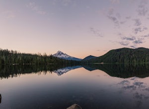
Camp at Lost Lake
4.7When the temperature starts to creep up in the summer, Lost Lake is the perfect escape. The campground provides you with everything you could want – miles of scenic hiking, a multitude of water activities, and even a general store for anything you might have forgotten at home.The lakeside tent ca...Read more -
Cascade Locks, Oregon
Tomlike Mountain
4.57.65 mi / 1198 ft gainBeginning at the Wahtum Lake trailhead, follow the Wahtum Lake Express trail down to the shore and head east (right) around the lake. At the junction with the Pacific Crest Trail, follow the Herman Creek Trail to the east (right, again). You'll begin your ascent out of the Wahtum Lake bowl and to...Read more -
Cascade Locks, Oregon
Chinidere Mountain
4.83.18 mi / 1150 ft gainThe easy version of the Chinidere Mountain hike starts Wahtum Lake Trailhead. The road to the parking lot for Wahtum Lake is paved and thus very easy to access in summer and before snowfall in autumn! The mountain sits across the lake from the parking lot and there are several trails that will ta...Read more -
Cascade Locks, Oregon
Backpack the Mark. O Hatfield Wilderness Via Eagle Creek
1.026 mi / 2300 ft gainThis is a somewhat incomplete report because we did not venture too far into the Mark O. Hatfield Wilderness. The sky had been threatening us with rain for the duration of our hike along Eagle Creek and we did not want to push our luck too far since we were hoping for an early start on our drive ...Read more -
Cascade Locks, Oregon
Ruckel Ridge Loop
5.08.08 mi / 3730 ft gainThis ridge is one of the lesser known paths from the Eagle Creek Trailhead. Instead of taking Ruckel Creek Trail, find the trail leading up Ruckel Ridge. It is a far more difficult hike of about 7 miles leading up to Benson Plateau. Along the way there are beautiful lookout points for Mount Hood,...Read more -
Cascade Locks, Oregon
North Lake via Wyeth Trail
1.012.36 mi / 4505 ft gainPark at the Wyeth Trailhead parking lot and start hiking south along the old road bed. At the junction with the Gorge-Wyeth Trail, bear left and follow the Wyeth Trail as it goes beneath several power lines. Follow the trail as it goes back into the woods and crosses Harphan Creek. Continue on an...Read more -
Cascade Locks, Oregon
Mount Defiance
3.712.55 mi / 5167 ft gainThis hike starts at the Starvation Creek Rest Area. After parking, head west back along the shoulder of the freeway, where you’ll see a wooden sign stating “Mt. Defiance Trail.” Continue heading west along the abandoned Columbia River Highway. Keep going west as you pass the junction with the Sta...Read more -
Washougal, Washington
Dougan Falls
3.5Does camping right next to an epic swimming hole sound like a pretty good way to spend a hot summer weekend? If so, you need to add Dougan Creek Campground to your list of weekend getaways. The Dougan Falls area of the Washougal River is packed with at least a dozen deep swimming holes, but the ...Read more -
National Forest Development Road 4220, Oregon
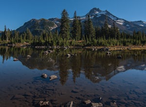
Olallie Lake North Basin Loop
12.05 mi / 2021 ft gainBegin at the Lower Lake Campground and take the Lower Lake trailhead. The best direction to hike is counter clockwise, however you can do either. Continue along Trail #717 and very shortly you come out to Lower Lake featuring Mt. Jefferson as the backdrop. From here keep hiking and you reach yo...Read more -
Stevenson, Washington
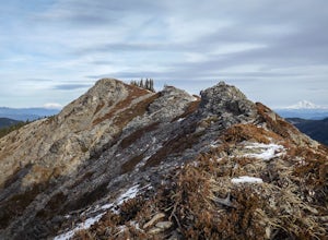
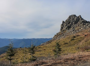
Three Corner Rock
4.03.86 mi / 1093 ft gainFrom the Rock Creek Pass Trailhead, begin the short hike to Three Corner Rock by heading south on the Pacific Crest Trail from its crossing of Road CG 2090. After a steady 1.5-mile climb of roughly 600 feet, look for a large fallen sign marking the junction to Three Corner Rock. Shortly after, an...Read more -
Marion County, Oregon
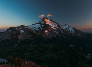
Explore Mt. Jefferson
5.0I went for a quick overnighter. The end of August is great for weather, very little bugs, and perfect time to meet and chat with PCT through hikers.The weather was absolutely perfect for night photography and lounging around camp. It's also one of the best views in Oregon if you ask me.If you're ...Read more -
Marion County, Oregon
Hike Mt. Jefferson's Park Ridge
5.07.4 mi / 1500 ft gainFrom the Breightenbush Lake PCT trailhead (5,600ft Elevation) you hike through a thick forest until you reach an old burn area. This area was burned from a forest fire and has rebirthed lush green plants and bushes to help feed all the animals in the area. After a mile of climbing through the bur...Read more -
Detroit, Oregon
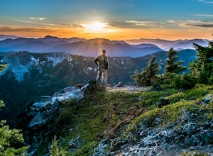
Battle Ax Mountain
5.05.09 mi / 1594 ft gainWith no officially marked trailhead, this hike begins slightly west of Elk Lake in Marion County. Take Highway 22 to Detroit, OR. East of the bridge over Breitenbush River, turn onto (FR) Forest Road 46, with signs pointing to Breitenbush River. After 4.5 miles turn left at a sign for Elk Lake, a...Read more -
Yacolt, Washington
Hike Silver Star Mountain via Grouse Vista
4.56 mi / 2000 ft gainThe Grouse Vista Trailhead is located through the town of Washougal off of highway 14 just past Camas. Once you leave the city, the road will turn to gravel and dirt though it is fairly well maintained until snow arrive and accessible by most cars so long as you're willing to get drive over loose...Read more -
Lyons, Oregon
Cedar Flat and Kopetski Trail Loop
9.62 mi / 958 ft gainOn Saturday, I slid into the backseat alongside weekend belongings crammed in the car trunk. Backpacks with patches and streaks of dust. Bags of food that could be cooked over the flames of a fire. We drove south on the 5, leaving Portland and crossing through Salem, as Lake Street Dive albums p...Read more -
Lyle, Washington
Rock Climb Horsethief Butte
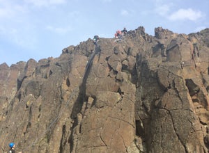
Located on the Washington side of the Columbia River Gorge heading east on highway 14 at milepost 85. Pull into the parking lot on the right hand side of the road and the trailhead is located by the restrooms. Be cautious on warm days because this is rattlesnake country. There are signs poste...Read more

