Tennessee
Looking for the best fitness in Tennessee? We've got you covered with the top trails, trips, hiking, backpacking, camping and more around Tennessee. The detailed guides, photos, and reviews are all submitted by the Outbound community.
Top Fitness Spots in and near Tennessee
-
Altamont, Tennessee
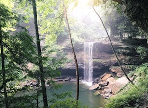
Greeter Falls and Blue Hole
4.91.79 mi / 417 ft gainAn easy, yet extremely beautiful and well marked drive leads to a pretty sizable parking lot at the trailhead. There are multiple trails to hike, depending on how much time you have or how long you want to hike. This particular trail makes for a perfect day trip from Nashville, Chattanooga or Kno...Read more -
Nashville, Tennessee
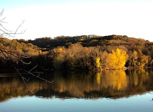
Hike around Radnor Lake
4.02.6 miIf you want a break from the city, take an early morning hike around Radnor Lake. Start this quiet trek by arriving at sunrise to snag a parking spot at the East Parking Lot. Walk down Otter Creek Road until you see the Lake Trail on the right. From there, enjoy a 1.4 mile scenic hike through the...Read more -
Mount Pleasant, Tennessee
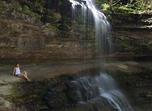
Stillhouse Falls
5.01.23 mi / 295 ft gainThis waterfall is a fun short hike that can be done quick, or a nice place to hangout for the day in your hammock to read a book! From Nashville, take I-65 south and take the Saturn Parkway toward Columbia. Turn right on Hwy 43 and proceed about 21 miles. The natural area parking area is on the ...Read more -
Chattanooga, Tennessee
Stroll Chattanooga's Walnut Street Bridge
5.0Chattanooga's Walnut Street Bridge was once almost demolished, but instead it was revitalized to be one of the longest pedestrian bridges in the world. Connecting the Downtown Arts District to Northshore's Frazier Avenue, this bridge hosts visitors and locals year round. Whether you walk, bike, o...Read more -
Sewanee, Tennessee
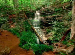
Hike to Bridal Veil Falls in Sewanee, TN
4.01.5 mi / 387 ft gainGreat short hike. Hard to find trail head, it is not marked at the parking area or where you leave the road. Put in your gps the coordinate spot tagged above off Clara Point Rd. To get to the trailhead, you have to cross the road from small parking area and go back 20 - 30 yards, where you will ...Read more -
Nashville, Tennessee
Hike the Day Loop at Long Hunter State Park
4.94 miPark at the Bakers Grove Area and take the newly wood chipped wood chip trail into the forest. Cross a small bridge, snake through a rock garden, and pass a sign indicating you are hiking the Day Loop Trail.There will be orange and white blazes. The orange blazes are for the Day Loop and the whit...Read more -
Lancing, Tennessee
Camp at OBED Wild and Scenic River Area via the Point Trail
4 miYou will want to park at the Lilly Bluff parking lot. Your GPS won't know where this is, so here are the GPS coordinates N36° 06.162', W84° 43.280'.The trailhead is located on the North side of the parking lot. All you need to do is follow the sign for Point Trail. The trail culminates at an e...Read more -
661-799 Stone Fort Drive, Tennessee
Hike Old Stone Fort Trail
5.02.9 mi / 265 ft gainThe main hiking trail at this small state park follows the wall of Old Stone Fort which was used by the Native Americans as a ceremonial gathering place. The trail threads through dramatic scenery where you can see the original entrance of the fort which was designed to face the exact spot on the...Read more -
Hampton, Tennessee
Hike to Laurel Fork Falls
4.62.6 mi / 600 ft gainFrom Hampton, Tennessee, take US-321S for about 3.5 miles. Turn right onto Dennis Cove Road and travel for 4 miles on this steep and very curvy mountain road. The trailhead is where the Appalachian Trail (AT) crosses the road at a small gravel lot on the left. Take the AT north on the trail lea...Read more -
Jamestown, Tennessee
Twin Arches Loop
1.22 mi / 177 ft gainThe trail starts at the parking lot which has some nice bathrooms and a nice small picnic area that is open year-round. From the trailhead, you will follow the signs that will lead you to a short mostly flat, 7-mile hike to the first arch. Once you get to the first arch there is a small area with...Read more -
Gruetli-Laager, Tennessee
Hike to Suter and Horsepound Falls
4.06 mi / 1794 ft gainLocated in South Cumberland State Park in the Savage Gulf section, this is a somewhat difficult 5 mile out-and-back viewing two waterfalls, cascades, creeks, rock shelters, and high bluffs. 2 miles past Suter Falls you'll come to Horsepound Falls, a unique waterfall formation with overlooks and l...Read more -
Reliance, Tennessee
Hike the Scenic Spur Trail
5.03.9 mi / 426 ft gainVery little elevation gain leads to an easy hike along a river right outside of the Ocoee river region. First .7 miles is very flat, then leads to some slight elevation gain but nothing too serious. This trail traverses through the lush forest for a short distance when you come across a small cre...Read more -
Upper Tremont Road, Tennessee
Hike to Indian Flat Falls via Middle Prong Trail
4.57.21 mi / 1140 ft gainOne of the best trails in the Smokies is the Middle Prong Trail. The trail passes three major waterfalls, in addition to numerous smaller falls, cataracts and cascades. Once you've parked, you'll start at the trail head and immediately see your first cascade. From the trailhead hikers will cro...Read more -
Chattanooga, Tennessee
Park Day at Renaissance Park
4.0Renaissance Park is a 23-acre urban wetlands park, snuggled between the Market Street Bridge and Cherokee Blvd. on Chattanooga's North Shore. This pet-friendly park features nature trails, an outdoor pavilion, public art, and more. If you're smart, you'll bring some broken down cardboard and slid...Read more -
Johnson City, Tennessee
White Rock Overlook
5.02.85 mi / 876 ft gainThe White Rock trailhead is less than a 10 minute drive from downtown Johnson City. When pulling up Highbridge Road, take a left at the fork. You will shortly encounter a vehicle gate where you will park to the side of the road (do not block the yellow vehicle gate). You have the option to walk ...Read more -
Johnson City, Tennessee
Hike to Tip Top on Buffalo Mountain
4.05.4 mi / 1388 ft gainTip Top rests on one of the highest points of Buffalo Mountain. The overlook features tree coverage perfect for hammocking and benches while providing views of Downtown Johnson City as well as the other side of the mountain range. The hike from the trailhead to Tip Top is moderately steep. The tr...Read more

