Crozet, Virginia
Top Spots in and near Crozet
-
Stanley, Virginia
Lower Hawksbill to Salamander to Appalachian Trail Loop
2.68 mi / 666 ft gainThis is one of 2 trails that will take you to the summit of Hawksbill Mountain. The other is the Upper Hawksbill Trail (which I also wrote an adventure about!). This trail is a combination of the Lower Hawksbill Trail, the AT, and the Salamander Trail. The parking are area for this hike is at mi...Read more -
Luray, Virginia
Hike Robertson Mountain in Shenandoah NP
6 mi / 1200 ft gainRobertson Mountain is often overshadowed by the nearby Old Rag Mountain, but standing 5 feet taller than Old Rag, this hike offers seclusion and gorgeous views to the south. Starting from the Limberlost Trailhead parking lot at MP 43 on the Skyline Drive, take the chained off Old Rag Fire Road. ...Read more -
Luray, Virginia
Hike Limberlost Trail in Shenandoah National Park
5.01.3 mi / 114 ft gainThe Limberlost Trail is a loop trail within Shenandoah National Park. It is classified as 'accessible' as the trail is flat and has features that would help those in a wheelchair or with other needs access the trail (boardwalk, bridge, benches). There is little-to-no elevation change and the pat...Read more -
Luray, Virginia
White Oak Canyon to Upper Falls
4.84.28 mi / 866 ft gainBetween mile 42 and 43 of Skyline Drive in Shenandoah National Park is the trailhead for WhiteOak Canyon. Begin at the trailhead from the parking lot and cross the Limberlost Trail in .3 miles. Continue on and you will cross your first footbridge shortly. After another mile you will cross the s...Read more -
Luray, Virginia
White Oak Trail to Lower Falls
5.06.68 mi / 1982 ft gainThe round trip is a total of 6.7 miles (10.8 km) from the Skyline Drive parking lot to the Whiteoak Canyon Trailhead parking lot (mile 42.6) to the final waterfall of the lower three. The elevation is moderate with a 900-foot drop to the upper falls, but an additional 1,100 feet to the lower fall...Read more -
Stanley, Virginia
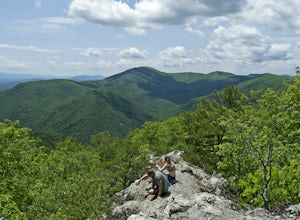
Hike the Bird Knob Trail
8.5 mi / 1300 ft gainBird Knob trail and aptly-named Emerald Pond are a not-so-well-kept secret worth sharing. Located just two hours away from Washington DC, this hike has everything: bouldering, views, and the perfect swimming hole. Even the drive to reach the hike is scenic and enjoyable with mountain views and f...Read more -
Luray, Virginia
Stony Man Trail, Shenandoah National Park
4.51.47 mi / 279 ft gainThis short, easy hike will take you to some of the best views in Shenandoah National Park. As an added bonus, it’s perfect for catching the sunset without a long walk back to your car in the dark. If you’re looking to increase the level of difficulty, there is an alternate, moderate trail option ...Read more -
Amherst, Virginia
Swim at Panther Falls
5.00.7 mi / -100 ft gainFrom Lexington or Buena Vista, Virginia, take Rt. 60 east for several miles. As soon as you pass under the Blue Ridge Parkway, look for a gravel road on your right marked Panther Falls Road. This is a fairly bumpy gravel road, so take it easy. Follow Panther Falls Road down the mountain for just ...Read more -
Luray, Virginia
Little Stony Man, Shenandoah National Park
4.71.23 mi / 433 ft gainThe parking lot for the trail is right before mile 40 on Skyline drive in Shenandoah National Park. The entire out and back is only .9 miles, so it's the perfect hike to take in a sunset after a long day, take a break from driving, or just pick a hike that is family and dog friendly as Stoney Ma...Read more -
Etlan, Virginia
Old Rag Mountain Loop
4.78.95 mi / 2510 ft gainBe prepared to deal with crowds, especially on the rock scrambles, which tend to cause a bottle neck on this trail in Shenandoah National Park. I would recommend starting out early on this loop hike, around 6 or 7 am to avoid the crowds. Definitely arrive no later than 9:30am, as the parking lot ...Read more -
Etlan, Virginia
Hike to the Summit of Mt. Robertson in Shenandoah NP
9 mi / 2500 ft gainThis hike is one of the lesser known hikes in Shenandoah. While everyone else is headed to Old Rag, hikers will find themselves on a peaceful hike to the summit of Mt. Robertson. Hikers should park in the Old Rag Parking lot and make sure to pay the daily fee ($25). If you have a yearly pass, be ...Read more -
Rockbridge Baths, Virginia
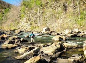
Fly Fish Goshen Pass
5.0The fly fishing on the Maury River is one of a kind through the Goshen Pass. The Pass is littered with huge boulders, which actually makes it possible to fish without waders, although it's much easier and more enjoyable with waders.From Lexington, VA, take Route 39 towards Goshen for approximatel...Read more -
Rockbridge Baths, Virginia
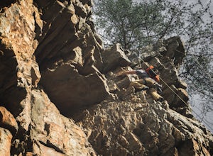
Rock Climb at Goshen Pass
5.0Goshen Pass is a beautiful area for kayaking and fishing in Bath County, Virginia near Lexington. But not as well known is the fact that there are a few places that are great for rock climbing. You'll want to park at the swinging bridge which is two miles past the picnic area on route 39 once you...Read more -
Hinton, Virginia
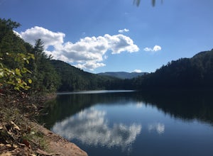
Camp at Switzer Lake
3.92 miDirectly off of Interstate 81, headed toward West Virginia on Rt 33 is a beautiful lake only known by the locals. Switzer Lake, named because Switzer Dam was placed on the Dry River years ago to aid Harrisonburg and the surrounding area with its increased need for drinking water. The lake is seld...Read more -
Hinton, Virginia
Fly Fish at Switzer Lake
Switzer Lake is a great spot outside of Harrisonburg, Virginia for fly fishing during the spring, summer, and fall. The lake is pretty decently sized, so you shouldn't have any problems finding a place along the shores to wade out and cast. Small boats are also allowed on the lake as well. Make s...Read more -
Goshen, Virginia
Hike Goshen Pass
4.35.6 mi / 1200 ft gainThe parking for the trailhead is down an unmarked gravel/dirt road about 1.5 miles upriver from the Virginia Wayside rest area on Route 39 West. You'll see the swing bridge out across the river and the road will be immediately after this on your right. The road goes back about 200 yards to the pa...Read more

